
Rachel Cook Goldsmith
| Birth | : | Sep 1773 |
| Death | : | 11 Aug 1812 Harvard, Worcester County, Massachusetts, USA |
| Burial | : | Harvard Center Cemetery, Harvard, Worcester County, USA |
| Coordinate | : | 42.4991989, -71.5847015 |
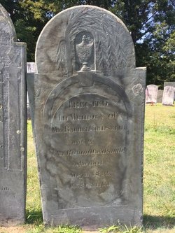
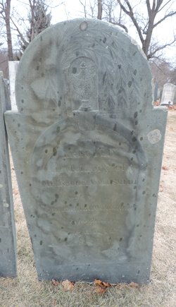
| Inscription | : | ERECTED In Memory of MRS. RACHEL GOLDSMITH wife of Mr. Richard Goldsmith who died Aug. 11, 1812 AE 38 Y & 11 Mo. |
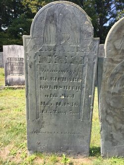
| Description | : | aged 38 years 11 months Rachel was married in Harvard, Mass on 1 July 1802 to Richard Goldsmith, the son of Richard Goldsmith and Sarah Dix. |
frequently asked questions (FAQ):
-
Where is Rachel Cook Goldsmith's memorial?
Rachel Cook Goldsmith's memorial is located at: Harvard Center Cemetery, Harvard, Worcester County, USA.
-
When did Rachel Cook Goldsmith death?
Rachel Cook Goldsmith death on 11 Aug 1812 in Harvard, Worcester County, Massachusetts, USA
-
Where are the coordinates of the Rachel Cook Goldsmith's memorial?
Latitude: 42.4991989
Longitude: -71.5847015
Family Members:
Spouse
Flowers:


Nearby Cemetories:
1. Harvard Center Cemetery
Harvard, Worcester County, USA
Coordinate: 42.4991989, -71.5847015
2. Bellevue Cemetery
Harvard, Worcester County, USA
Coordinate: 42.4958000, -71.6055984
3. Captain Benjamin Stewart Gravesite
Harvard, Worcester County, USA
Coordinate: 42.5189400, -71.5630800
4. Saint Benedict Center Cemetery
Harvard, Worcester County, USA
Coordinate: 42.4827900, -71.6231900
5. Shaker Burying Ground
Harvard, Worcester County, USA
Coordinate: 42.5309900, -71.5554600
6. Fort Devens Post Cemetery
Devens, Worcester County, USA
Coordinate: 42.5285206, -71.6220240
7. North Cemetery
Boxboro, Middlesex County, USA
Coordinate: 42.4917908, -71.5271149
8. Smallpox Cemetery
Bolton, Worcester County, USA
Coordinate: 42.4511700, -71.5832800
9. Woodlawn Cemetery
Ayer, Middlesex County, USA
Coordinate: 42.5508194, -71.5721512
10. Shirley Shaker Cemetery
Lancaster, Worcester County, USA
Coordinate: 42.5240700, -71.6514700
11. South Cemetery
Boxboro, Middlesex County, USA
Coordinate: 42.4758377, -71.5134506
12. North Burial Ground
Lancaster, Worcester County, USA
Coordinate: 42.5134048, -71.6627274
13. Saint Anthony's Cemetery
Shirley, Middlesex County, USA
Coordinate: 42.5374527, -71.6467056
14. West Burying Ground
Bolton, Worcester County, USA
Coordinate: 42.4488983, -71.6300964
15. Village Cemetery
Shirley, Middlesex County, USA
Coordinate: 42.5398026, -71.6539230
16. Saint Mary's Cemetery
Ayer, Middlesex County, USA
Coordinate: 42.5653000, -71.5958023
17. Pan Burying Ground
Bolton, Worcester County, USA
Coordinate: 42.4305992, -71.5894012
18. North Village Cemetery
Lancaster, Worcester County, USA
Coordinate: 42.4724998, -71.6778030
19. Westlawn Cemetery
Littleton, Middlesex County, USA
Coordinate: 42.5407486, -71.4979706
20. Eastwood Cemetery
Lancaster, Worcester County, USA
Coordinate: 42.4417000, -71.6528015
21. Old South Burying Ground
Bolton, Worcester County, USA
Coordinate: 42.4231000, -71.6096500
22. Old Common Burial Ground
Lancaster, Worcester County, USA
Coordinate: 42.4426700, -71.6645300
23. Old Settlers Burial Yard
Lancaster, Worcester County, USA
Coordinate: 42.4488754, -71.6742706
24. Middle Cemetery
Lancaster, Worcester County, USA
Coordinate: 42.4491997, -71.6757965