

Ralph Bernard “Taxi” Ulmer Sr.
| Birth | : | 14 Feb 1931 Elloree, Orangeburg County, South Carolina, USA |
| Death | : | 23 Apr 2009 Orangeburg, Orangeburg County, South Carolina, USA |
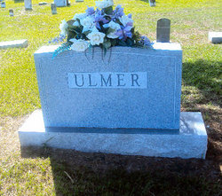
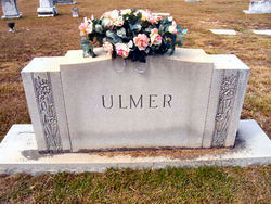
| Burial | : | Saint Marys Cemetery, Oto, Woodbury County, USA |
| Coordinate | : | 42.2955458, -95.8758426 |
| Description | : | Mr. Ulmer was born on February 14, 1931, a son of the late Edward Francis Ulmer and the late Gertrude Young Ulmer. He was a life-long member of Trinity Lutheran Church, where he served in many capacities. Mr. Ulmer was a retired civil engineer with South Carolina Department of Transportation. He attended Clemson University and he was a member of the Elloree Charity Lodge No. 62, AFM, where he served as Worshipful Master. Mr Ulmer was the Elloree Fire Chief for 25 years and was also a volunteer fireman. He was also a life long member of the Community Hunting Club... Read More |
frequently asked questions (FAQ):
-
Where is Ralph Bernard “Taxi” Ulmer Sr.'s memorial?
Ralph Bernard “Taxi” Ulmer Sr.'s memorial is located at: Saint Marys Cemetery, Oto, Woodbury County, USA.
-
When did Ralph Bernard “Taxi” Ulmer Sr. death?
Ralph Bernard “Taxi” Ulmer Sr. death on 23 Apr 2009 in Orangeburg, Orangeburg County, South Carolina, USA
-
Where are the coordinates of the Ralph Bernard “Taxi” Ulmer Sr.'s memorial?
Latitude: 42.2955458
Longitude: -95.8758426
Family Members:
Parent


Spouse

Siblings
Children

Flowers:


Nearby Cemetories:
1. Saint Marys Cemetery
Oto, Woodbury County, USA
Coordinate: 42.2955458, -95.8758426
2. Oto Cemetery
Oto, Woodbury County, USA
Coordinate: 42.2764015, -95.9032974
3. Wellington Cemetery
Smithland, Woodbury County, USA
Coordinate: 42.2220000, -95.8993000
4. Hollister Cemetery
Smithland, Woodbury County, USA
Coordinate: 42.2219009, -95.8989029
5. Little Sioux Township Cemetery
Smithland, Woodbury County, USA
Coordinate: 42.2233009, -95.9313965
6. Peiro-Bethel Cemetery
Woodbury County, USA
Coordinate: 42.3355103, -95.9762115
7. Mount Saint Joseph Cemetery
Anthon, Woodbury County, USA
Coordinate: 42.3812510, -95.8818340
8. Lucky Valley Cemetery
Anthon, Woodbury County, USA
Coordinate: 42.3816986, -95.9417038
9. Oak Hill Cemetery
Anthon, Woodbury County, USA
Coordinate: 42.3953018, -95.8731003
10. Wolf Creek Township Cemetery
Anthon, Woodbury County, USA
Coordinate: 42.4033700, -95.9411600
11. Grant Township Cemetery
Rodney, Monona County, USA
Coordinate: 42.1767006, -95.9218979
12. Saint Mary's Cemetery
Danbury, Woodbury County, USA
Coordinate: 42.2498660, -95.7189930
13. Saint Patrick's Cemetery
Danbury, Woodbury County, USA
Coordinate: 42.2498660, -95.7189930
14. Liston Township Cemetery
Danbury, Woodbury County, USA
Coordinate: 42.2468987, -95.7182999
15. Reynolds Cemetery
Monona County, USA
Coordinate: 42.1695949, -95.8921463
16. Pleasant Hill Baptist Cemetery
Anthon, Woodbury County, USA
Coordinate: 42.4148300, -95.9420000
17. German City Cemetery
Holly Springs, Woodbury County, USA
Coordinate: 42.2695000, -96.0479000
18. Saint Paul Lutheran Cemetery
Midway, Woodbury County, USA
Coordinate: 42.3667500, -95.7281500
19. Willow Cemetery
Holly Springs, Woodbury County, USA
Coordinate: 42.2705994, -96.0588989
20. Heisler Cemetery
Mapleton, Monona County, USA
Coordinate: 42.1817017, -95.7683029
21. Mount Hope Cemetery
Mapleton, Monona County, USA
Coordinate: 42.1571999, -95.7814026
22. Westfork Township Cemetery
Climbing Hill, Woodbury County, USA
Coordinate: 42.3399990, -96.0773130
23. Saint Marys Catholic Cemetery
Mapleton, Monona County, USA
Coordinate: 42.1556015, -95.7814026
24. Rock Cemetery
Woodbury County, USA
Coordinate: 42.4132996, -95.7288971