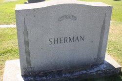
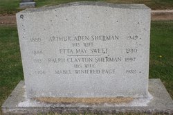
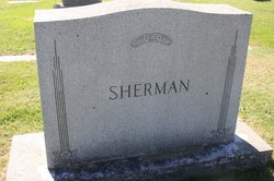
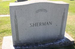
Ralph Clayton Sherman
| Birth | : | 1913 Foster, Providence County, Rhode Island, USA |
| Death | : | 2 Sep 1997 Scituate, Providence County, Rhode Island, USA |
| Burial | : | Acotes Hill Cemetery, Glocester, Providence County, USA |
| Coordinate | : | 41.9088249, -71.6643753 |
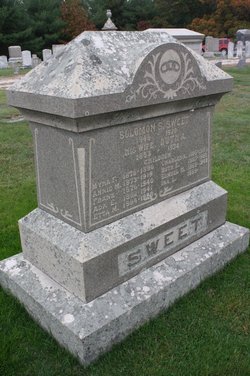
| Description | : | partial obituary: RALPH C. SHERMAN, 84, of Danielson Pike, died yesterday at Oak Crest Manor in Scituate. He was the husband of the late Mabel W. (Page) Sherman. Born in Foster, a son of the late Arthur A. and Etta M. (Sweet) Sherman, he had lived in Scituate for most of his life. After graduating from the Providence Technical High School, he worked the family farm and store located on Chopmist Hill. He also owned and operated his own trucking business. A active Democrat, he was the first Democrat to be elected to the Scituate Town Council in 70 years, serving from 1965... Read More |
frequently asked questions (FAQ):
-
Where is Ralph Clayton Sherman's memorial?
Ralph Clayton Sherman's memorial is located at: Acotes Hill Cemetery, Glocester, Providence County, USA.
-
When did Ralph Clayton Sherman death?
Ralph Clayton Sherman death on 2 Sep 1997 in Scituate, Providence County, Rhode Island, USA
-
Where are the coordinates of the Ralph Clayton Sherman's memorial?
Latitude: 41.9088249
Longitude: -71.6643753
Family Members:
Parent
Spouse
Flowers:
Nearby Cemetories:
1. Acotes Hill Cemetery
Glocester, Providence County, USA
Coordinate: 41.9088249, -71.6643753
2. Clovis Bowen Children Monuments
Glocester, Providence County, USA
Coordinate: 41.9116110, -71.6668330
3. James Martin Lot
Glocester, Providence County, USA
Coordinate: 41.9056970, -71.6573710
4. Place-Keach Lot
Glocester, Providence County, USA
Coordinate: 41.9029083, -71.6683884
5. Potter Lot
Glocester, Providence County, USA
Coordinate: 41.9047490, -71.6469720
6. Mowry Smith Lot
Glocester, Providence County, USA
Coordinate: 41.9163910, -71.6805910
7. Owen-Evans Cemetery
Glocester, Providence County, USA
Coordinate: 41.9248060, -71.6699750
8. Jonathan Vallet Lot
Glocester, Providence County, USA
Coordinate: 41.8924170, -71.6682220
9. Public Cemetery
Glocester, Providence County, USA
Coordinate: 41.9249990, -71.6698900
10. Page Lot
Glocester, Providence County, USA
Coordinate: 41.8909720, -71.6555000
11. Potter Lot
Glocester, Providence County, USA
Coordinate: 41.9246110, -71.6788060
12. Paine Lot
Glocester, Providence County, USA
Coordinate: 41.8926000, -71.6498000
13. Gorry-Britton-Barnes Lot
Glocester, Providence County, USA
Coordinate: 41.9260400, -71.6773800
14. Brown-Newton Lot
Glocester, Providence County, USA
Coordinate: 41.8987460, -71.6889320
15. Armstrong - Smith Lot
Glocester, Providence County, USA
Coordinate: 41.9082720, -71.6937560
16. Deacon Joshua Winsor Lot
Glocester, Providence County, USA
Coordinate: 41.9029997, -71.6354914
17. Jesse Brown Lot
Glocester, Providence County, USA
Coordinate: 41.8923670, -71.6878810
18. Brown-Burrill-Hall Lot
Glocester, Providence County, USA
Coordinate: 41.8914720, -71.6887800
19. John Sprague Lot
Glocester, Providence County, USA
Coordinate: 41.9031940, -71.6987780
20. Captain Stephen Keech Lot
Glocester, Providence County, USA
Coordinate: 41.8847750, -71.6802670
21. Rhode Island Historical Cemetery Glocester #117
Glocester, Providence County, USA
Coordinate: 41.9157760, -71.7007040
22. Asa Hicks Lot
Glocester, Providence County, USA
Coordinate: 41.8887500, -71.6376940
23. Crossman Lot
Glocester, Providence County, USA
Coordinate: 41.9270560, -71.6336960
24. Baker Lot
Glocester, Providence County, USA
Coordinate: 41.9242780, -71.6284400

