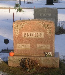
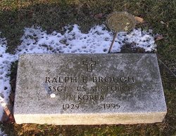
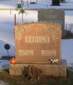
Ralph Edward Brough
| Birth | : | 25 Mar 1929 Rutland, Rutland County, Vermont, USA |
| Death | : | 29 Jun 1995 Bloomfield, Hartford County, Connecticut, USA |
| Burial | : | Hillside Cemetery, Castleton, Rutland County, USA |
| Coordinate | : | 43.6133003, -73.1864014 |
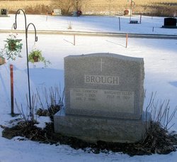
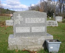
| Inscription | : | SSGT, US AIR FORCE, KOREA |
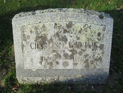
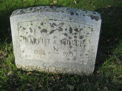
| Description | : | Ralph E. Brough June 30, 1995 BROUGH. Ralph E. Brough, 66, of 16 Norman Dr., Bloomfield, died suddenly Thursday (June 29) at his home. He was born in Castleton, Vt., March 25, 1929, son of Charles E. and Harriet (McCarthy) Brough. A veteran of the Korean Conflict, Mr. Brough served four years in the United States Air Force with the 20th Bomber Wing, Strategic Air Command. He was stationed in Weathersfield, England. Mr. Brough was a member and past Commander of the American Legion Post 50, Castleton, Vt. Mr. Brough graduated from Castleton State College, and later earned a Masters degree... Read More |
frequently asked questions (FAQ):
-
Where is Ralph Edward Brough's memorial?
Ralph Edward Brough's memorial is located at: Hillside Cemetery, Castleton, Rutland County, USA.
-
When did Ralph Edward Brough death?
Ralph Edward Brough death on 29 Jun 1995 in Bloomfield, Hartford County, Connecticut, USA
-
Where are the coordinates of the Ralph Edward Brough's memorial?
Latitude: 43.6133003
Longitude: -73.1864014
Family Members:
Parent
Spouse
Siblings
Flowers:
Nearby Cemetories:
1. Hillside Cemetery
Castleton, Rutland County, USA
Coordinate: 43.6133003, -73.1864014
2. Congregational Cemetery
Castleton, Rutland County, USA
Coordinate: 43.6127396, -73.1755524
3. Gates Cemetery
Castleton Corners, Rutland County, USA
Coordinate: 43.5938988, -73.2080994
4. Hydeville Cemetery
Hydeville, Rutland County, USA
Coordinate: 43.6027600, -73.2278000
5. Blissville Cemetery
Blissville, Rutland County, USA
Coordinate: 43.5923000, -73.2292000
6. Culver Cemetery
Blissville, Rutland County, USA
Coordinate: 43.5867004, -73.2268982
7. Fifield Cemetery
Poultney, Rutland County, USA
Coordinate: 43.5750008, -73.2181015
8. Crystal Beach Cemetery
Bomoseen, Rutland County, USA
Coordinate: 43.6603433, -73.1903886
9. Ames Cemetery
Poultney, Rutland County, USA
Coordinate: 43.5864830, -73.1311798
10. Ward Cemetery
Poultney, Rutland County, USA
Coordinate: 43.5581017, -73.1710968
11. Hosford Crossing Cemetery
Poultney, Rutland County, USA
Coordinate: 43.5621600, -73.2252200
12. West Street Cemetery
Fair Haven, Rutland County, USA
Coordinate: 43.5950900, -73.2708500
13. Old Burial Ground
Fair Haven, Rutland County, USA
Coordinate: 43.6011800, -73.2740400
14. Saint Marys Cemetery
Fair Haven, Rutland County, USA
Coordinate: 43.5968500, -73.2728800
15. Lincoln Cemetery
Castleton, Rutland County, USA
Coordinate: 43.6707000, -73.1392300
16. Cedar Grove Cemetery
Fair Haven, Rutland County, USA
Coordinate: 43.5824200, -73.2689000
17. Hampton Flats Cemetery
Hampton, Washington County, USA
Coordinate: 43.5550003, -73.2574997
18. Carvers Falls Cemetery
West Haven, Rutland County, USA
Coordinate: 43.6264000, -73.3007965
19. William Miller Cemetery
Low Hampton, Washington County, USA
Coordinate: 43.5950600, -73.2997200
20. East Poultney Jewish Cemetery
East Poultney, Rutland County, USA
Coordinate: 43.5275002, -73.2009964
21. East Poultney Cemetery
East Poultney, Rutland County, USA
Coordinate: 43.5270004, -73.2009964
22. Saint Johns Episcopal Church Cemetery
East Poultney, Rutland County, USA
Coordinate: 43.5261330, -73.2072670
23. East Hubbardton Cemetery
East Hubbardton, Rutland County, USA
Coordinate: 43.6986008, -73.1430969
24. Saint Stanislaus Kostka Cemetery
West Rutland, Rutland County, USA
Coordinate: 43.5963402, -73.0555115

