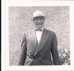
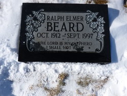
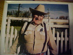
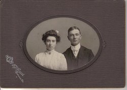
Ralph Elmer Beard
| Birth | : | 22 Oct 1912 Milk River, Lethbridge Census Division, Alberta, Canada |
| Death | : | Sep 1997 Milk River, Lethbridge Census Division, Alberta, Canada |
| Burial | : | Milk River Cemetery, Milk River, Lethbridge Census Division, Canada |
| Coordinate | : | 49.1442000, -112.0658700 |
| Inscription | : | The Lord is my shepherd I shall not want. |
| Description | : | Son of Henry Fred Beard and Ora Mae (Cheesman) Beard. He was raised in Milk River, moved to Newberg, Ore c.1918, graduated from High School in Newberg, Ore, USA as an honor student. He later took several short courses in various fields. He returned to Milk River and worked for several different farmers in order to accumulate enough machinery to farm on his own. He took over management of the Beard Homestead (farm) in 1940 plus adding several parcels of land to the "farm". Ralph was very civic minded and served as Mayor of Milk River for two... Read More |
frequently asked questions (FAQ):
-
Where is Ralph Elmer Beard's memorial?
Ralph Elmer Beard's memorial is located at: Milk River Cemetery, Milk River, Lethbridge Census Division, Canada.
-
When did Ralph Elmer Beard death?
Ralph Elmer Beard death on Sep 1997 in Milk River, Lethbridge Census Division, Alberta, Canada
-
Where are the coordinates of the Ralph Elmer Beard's memorial?
Latitude: 49.1442000
Longitude: -112.0658700
Family Members:
Parent
Spouse
Siblings
Flowers:
Ralph, you were my hero--I enjoyed your company and working for you when I was young. May you rest in peace.
Left by Anonymous on 20 Feb 2012
UNCLE RALPHWhen this century was twelve years young(1900)The life of Ralph had just begunHe was the anemic son of farmer FredWhen he misbehaved,Fred banged his headHe grew up tough and he grew up leanHis breath was hard as keroseneIn depression times he ate the dustBut showed his grit and didn't go bustWhen times improved for this visionaryHe farmed more land and married MaryHe read books of poems and animal husbandryBut it took ten years to produce Ruth MarieHe took a stint at politicsWhere he used his mouth and he used his fistsWhen the days were long and the grain was goldThere was many a young person he helped to moldYear after year from far and wideEach summer they came and worked by his sideThey learned about mechanics and they learned about soilThey learned human relations and they learned how to toilThey swam in the river and fished in the lakesHe took them exploring when nature gave him a breakWell finally you've reached the age of four scoreOne door may be closing but you'll open one moreSo pull off your boots and sit in the sunHappy Birthday RalphYou're our number one!Composed by Gerry for Ralph's 80th birthday in 1992. Read less
Left by Anonymous on 18 Feb 2013
Nearby Cemetories:
1. Milk River Cemetery
Milk River, Lethbridge Census Division, Canada
Coordinate: 49.1442000, -112.0658700
2. Sweet Grass Cemetery
Sweet Grass, Toole County, USA
Coordinate: 48.9972120, -111.9966140
3. Holy Angels Cemetery Community
Coutts, Lethbridge Census Division, Canada
Coordinate: 48.9989440, -111.9649050
4. Coutts Cemetery
Coutts, Lethbridge Census Division, Canada
Coordinate: 48.9989690, -111.9647810
5. Hillside Hutterite Colony Cemetery
Toole County, USA
Coordinate: 48.9788000, -112.0740000
6. Warner Memorial Cemetery
Warner, Lethbridge Census Division, Canada
Coordinate: 49.2914900, -112.2246800
7. Allerston Cemetery
Milk River, Lethbridge Census Division, Canada
Coordinate: 49.1451500, -111.7664000
8. Rimrock Colony Cemetery
Toole County, USA
Coordinate: 48.8985000, -112.0980000
9. Masinasin Cemetery
Milk River, Lethbridge Census Division, Canada
Coordinate: 49.1302328, -111.6527199
10. Sunburst Cemetery
Sunburst, Toole County, USA
Coordinate: 48.8847800, -111.8743800
11. Glacier Colony Cemetery
Glacier Colony, Glacier County, USA
Coordinate: 48.8313000, -112.2154000
12. Zenith Colony Cemetery
Cut Bank, Glacier County, USA
Coordinate: 48.8678000, -112.3442000
13. Nutter Ranch Cemetery
Sunburst, Toole County, USA
Coordinate: 48.9668200, -111.6365320
14. New Dayton Community Cemetery
New Dayton, Lethbridge Census Division, Canada
Coordinate: 49.4254300, -112.3601800
15. Prairie Round Cemetery
Lucky Strike, Lethbridge Census Division, Canada
Coordinate: 49.2249600, -111.5523800
16. Wrentham Cemetery
Wrentham, Lethbridge Census Division, Canada
Coordinate: 49.5231200, -112.1574800
17. Prairie Home Hutterite Colony Cemetery
Wrentham, Lethbridge Census Division, Canada
Coordinate: 49.5291670, -111.9608330
18. Dahlen Family Homestead Cemetery
Kevin, Toole County, USA
Coordinate: 48.7504200, -112.1016200
19. Wolf Creek Hutterite Colony Cemetery
Stirling, Lethbridge Census Division, Canada
Coordinate: 49.4119142, -112.5163705
20. East Raymond Hutterite Colony Cemetery
Raymond, Lethbridge Census Division, Canada
Coordinate: 49.4185305, -112.5791329
21. Glendale Colony Cemetery
Glendale Colony, Glacier County, USA
Coordinate: 48.8380000, -112.5457000
22. Horizon Colony Cemetery
Cut Bank, Glacier County, USA
Coordinate: 48.7156000, -112.2290000
23. Stirling Mennonite Church Cemetery
Stirling, Lethbridge Census Division, Canada
Coordinate: 49.4607570, -112.5387970
24. Stirling Cemetery
Stirling, Lethbridge Census Division, Canada
Coordinate: 49.5093400, -112.5380000

