
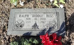
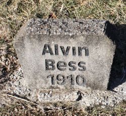
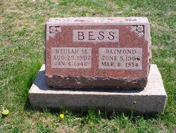
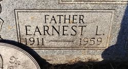
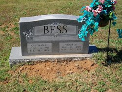
Ralph Elwood “Diddle” Bess
| Birth | : | 10 Nov 1930 Bonne Terre, St. Francois County, Missouri, USA |
| Death | : | 9 Jan 2012 St. Francois County, Missouri, USA |
| Burial | : | Adams-Hillcrest Cemetery, Bonne Terre, St. Francois County, USA |
| Coordinate | : | 37.9735985, -90.5436020 |
| Description | : | Ralph Elwood "Diddle" Bess 81, of Bonne Terre passed away January 9, 2012 at St. Joe Manor. He was born November 10, 1930 in Bonne Terre. He was a 40 year member and Past Master of Samaritan Lodge #424. He loved to ride motorcycles and toured both the United States and Canada. He was one of the original members of the Gold Wing Motorcycle Road Riders Association. He was known for his excavation work. Diddle did lots of work to help others out for little or nothing. He enjoyed relaxing by his pond and fishing with his dog, Ozzie. He... Read More |
frequently asked questions (FAQ):
-
Where is Ralph Elwood “Diddle” Bess's memorial?
Ralph Elwood “Diddle” Bess's memorial is located at: Adams-Hillcrest Cemetery, Bonne Terre, St. Francois County, USA.
-
When did Ralph Elwood “Diddle” Bess death?
Ralph Elwood “Diddle” Bess death on 9 Jan 2012 in St. Francois County, Missouri, USA
-
Where are the coordinates of the Ralph Elwood “Diddle” Bess's memorial?
Latitude: 37.9735985
Longitude: -90.5436020
Family Members:
Parent
Siblings

Children
Flowers:


Nearby Cemetories:
1. Adams-Hillcrest Cemetery
Bonne Terre, St. Francois County, USA
Coordinate: 37.9735985, -90.5436020
2. Primrose Cemetery
St. Francois County, USA
Coordinate: 37.9910000, -90.5638000
3. Appleberry Cemetery
St. Francois County, USA
Coordinate: 37.9893990, -90.5119019
4. Wheelehon Cemetery
St. Francois County, USA
Coordinate: 37.9399790, -90.5412120
5. Saint Joseph Cemetery
Bonne Terre, St. Francois County, USA
Coordinate: 37.9282990, -90.5441971
6. Settle Cemetery
St. Francois County, USA
Coordinate: 37.9519005, -90.5967026
7. Perret Cemetery
St. Francois County, USA
Coordinate: 37.9667015, -90.4768982
8. Moontown Cemetery
Jefferson County, USA
Coordinate: 38.0186005, -90.5828018
9. Bonne Terre Cemetery
Bonne Terre, St. Francois County, USA
Coordinate: 37.9173000, -90.5393000
10. Hill Cemetery
Bonne Terre, St. Francois County, USA
Coordinate: 37.9185104, -90.5278091
11. Hamman Cemetery
Jefferson County, USA
Coordinate: 38.0318985, -90.5742035
12. Cole Cemetery
St. Francois County, USA
Coordinate: 38.0028000, -90.6166992
13. Robert's Gravesite
St. Francois County, USA
Coordinate: 38.0087260, -90.6172080
14. Ashburn Cemetery
East Bonne Terre, St. Francois County, USA
Coordinate: 37.9338500, -90.4727000
15. Germania Cemetery
Bonne Terre, St. Francois County, USA
Coordinate: 37.9211006, -90.6141968
16. Richardson Cemetery
Bonne Terre, St. Francois County, USA
Coordinate: 37.9525330, -90.4501500
17. Rouggly Cemetery
St. Francois County, USA
Coordinate: 38.0097008, -90.4546967
18. Baker Cemetery
Desloge, St. Francois County, USA
Coordinate: 37.8963280, -90.5206528
19. Byington Cemetery
Bonne Terre, St. Francois County, USA
Coordinate: 37.9519005, -90.4456024
20. Mostiller Cemetery
St. Francois County, USA
Coordinate: 37.9672012, -90.4403000
21. Marvin Chapel Cemetery
Bonne Terre, St. Francois County, USA
Coordinate: 37.9299000, -90.4530000
22. Saint Francois Memorial Park
Bonne Terre, St. Francois County, USA
Coordinate: 37.8931000, -90.5136000
23. Avoca Cemetery
De Soto, Jefferson County, USA
Coordinate: 38.0545807, -90.5121536
24. Smallpox Cemetery
St. Francois County, USA
Coordinate: 37.8891983, -90.5306015