

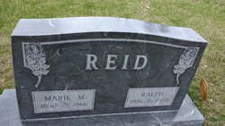
Ralph Reid
| Birth | : | 20 Oct 1886 Elmo, Nodaway County, Missouri, USA |
| Death | : | 2 Feb 1970 Omaha, Douglas County, Nebraska, USA |
| Burial | : | Rose Hill Cemetery, Albion, Boone County, USA |
| Coordinate | : | 41.6762000, -98.0003900 |
| Description | : | Son of William Mathew Reid and Mary Celia (Gates) Reid. Ralph's father William (12/8/1857 to 4/25/1922) spent his later years traveling the west and was a tourist guide in Mesa Verde National Park for a time. William Reid suffered a stroke in Arizona in 1922. His son Ralph brought him to Albion, Nebraska where he died a few weeks later. His obituary states his remains were to be taken to Blanchard, Iowa for interment. According to William's obituary, Mary (Gates) Reid died in Boone County, Nebraska about 1895. She was born about 1863 in... Read More |
frequently asked questions (FAQ):
-
Where is Ralph Reid's memorial?
Ralph Reid's memorial is located at: Rose Hill Cemetery, Albion, Boone County, USA.
-
When did Ralph Reid death?
Ralph Reid death on 2 Feb 1970 in Omaha, Douglas County, Nebraska, USA
-
Where are the coordinates of the Ralph Reid's memorial?
Latitude: 41.6762000
Longitude: -98.0003900
Family Members:
Spouse
Flowers:


Nearby Cemetories:
1. Rose Hill Cemetery
Albion, Boone County, USA
Coordinate: 41.6762000, -98.0003900
2. Saint Michael's Cemetery
Albion, Boone County, USA
Coordinate: 41.6991997, -97.9764023
3. Boone Cemetery
Boone County, USA
Coordinate: 41.6272011, -97.9332962
4. Orford Pioneer Cemetery
Loretto, Boone County, USA
Coordinate: 41.7953000, -98.0864300
5. Dennison Cemetery
Albion, Boone County, USA
Coordinate: 41.7182999, -98.1753006
6. Sunrise Cemetery
Cedar Rapids, Boone County, USA
Coordinate: 41.5760994, -98.1278000
7. Salem Lutheran Cemetery
Woodville Township, Platte County, USA
Coordinate: 41.6525800, -97.8084000
8. Naomi Cemetery
Saint Edward, Boone County, USA
Coordinate: 41.5245200, -97.9907000
9. Saint Edward Catholic Cemetery
Saint Edward, Boone County, USA
Coordinate: 41.5684800, -97.8424800
10. Immanuel Zion South Branch Cemetery
Albion, Boone County, USA
Coordinate: 41.8135000, -97.8906000
11. Evergreen Cemetery
Saint Edward, Boone County, USA
Coordinate: 41.5677986, -97.8411026
12. Sunset Cemetery
Cedar Rapids, Boone County, USA
Coordinate: 41.5611000, -98.1605988
13. Saint Anthony Cemetery
Cedar Rapids, Boone County, USA
Coordinate: 41.5607986, -98.1616974
14. Trinity Cemetery
Newman Grove, Madison County, USA
Coordinate: 41.7574997, -97.8035965
15. Looking Glass Cemetery
Rosenborg, Platte County, USA
Coordinate: 41.6571000, -97.7617000
16. Hope Cemetery
Platte County, USA
Coordinate: 41.7383003, -97.7742004
17. Main Cemetery
Belgrade, Nance County, USA
Coordinate: 41.4947014, -98.0425034
18. Saint Ansgar Cemetery
Rosenborg, Platte County, USA
Coordinate: 41.6334000, -97.7539000
19. Dahlsborg Cemetery
Closter, Boone County, USA
Coordinate: 41.8212300, -97.8360000
20. Dublin Cemetery
Primrose, Boone County, USA
Coordinate: 41.6463000, -98.2529900
21. Saint Marys Catholic Cemetery
Primrose, Boone County, USA
Coordinate: 41.6465900, -98.2532600
22. Skeedee Cemetery
Nance County, USA
Coordinate: 41.5038986, -97.8850021
23. Mount Pleasant Cemetery
Petersburg, Boone County, USA
Coordinate: 41.8568993, -98.0924988
24. Saint Johns Cemetery
Petersburg, Boone County, USA
Coordinate: 41.8581009, -98.0939026