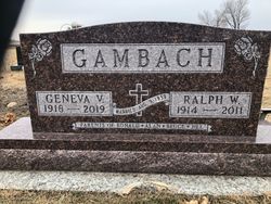
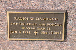
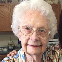
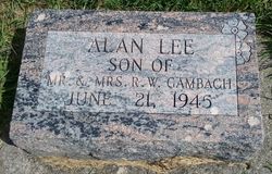
Ralph Waldo Gambach
| Birth | : | 4 Jun 1914 Lohrville, Calhoun County, Iowa, USA |
| Death | : | 13 Feb 2011 Mount Pleasant, Henry County, Iowa, USA |
| Burial | : | Laurens Cemetery, Laurens, Pocahontas County, USA |
| Coordinate | : | 42.8438988, -94.8330994 |
| Plot | : | Sec. E, Block 1, Lot 27, 1 |
| Description | : | Mt Pleasant (Ia.) Mt Pleasant News Ralph Waldo Gambach June 4, 1914 - Feb 13, 2011 Ralph Waldo Gambach , 96, of Mt. Pleasant, formerly of Fairfield, Tipton and Lohrville, died Sunday, Feb. 13, 2011, at the Park Place Long Term Care Unit in Mt. Pleasant. A memorial funeral service will be held at 11 a.m. Saturday, Feb. 19 at the First United Methodist Church in Mt. Pleasant. The Rev. Herbert G. Shafer will officiate. A military flag presentation service will be conducted by Iowa Military Funeral Honors at the church. Burial will be on Tuesday, Feb. 22 at the Laurens Cemetery... Read More |
frequently asked questions (FAQ):
-
Where is Ralph Waldo Gambach's memorial?
Ralph Waldo Gambach's memorial is located at: Laurens Cemetery, Laurens, Pocahontas County, USA.
-
When did Ralph Waldo Gambach death?
Ralph Waldo Gambach death on 13 Feb 2011 in Mount Pleasant, Henry County, Iowa, USA
-
Where are the coordinates of the Ralph Waldo Gambach's memorial?
Latitude: 42.8438988
Longitude: -94.8330994
Family Members:
Parent
Spouse
Children
Flowers:
Nearby Cemetories:
1. Laurens Cemetery
Laurens, Pocahontas County, USA
Coordinate: 42.8438988, -94.8330994
2. Calvary Cemetery
Laurens, Pocahontas County, USA
Coordinate: 42.8403015, -94.8368988
3. Swan Lake Cemetery
Laurens, Pocahontas County, USA
Coordinate: 42.8511009, -94.8925018
4. Garton Family Cemetery
Marathon, Buena Vista County, USA
Coordinate: 42.8297000, -94.9334500
5. Washington Cemetery
Havelock, Pocahontas County, USA
Coordinate: 42.8363250, -94.7091440
6. Marshall Cemetery
Pocahontas County, USA
Coordinate: 42.7633018, -94.8930969
7. Poland Township Cemetery
Marathon, Buena Vista County, USA
Coordinate: 42.8610992, -94.9916992
8. Fairfield Cemetery
Albert City, Buena Vista County, USA
Coordinate: 42.7783012, -94.9692001
9. Smith Cemetery
Albert City, Buena Vista County, USA
Coordinate: 42.8142014, -94.9925003
10. Rush Lake Cemetery
Rush Lake Township, Palo Alto County, USA
Coordinate: 42.9497185, -94.7383270
11. Garfield Township Cemetery
Webb, Clay County, USA
Coordinate: 42.9538994, -94.9392014
12. Saint Mary's Cemetery
Rush Lake Township, Palo Alto County, USA
Coordinate: 42.9560000, -94.6980000
13. Dover Township Cemetery
Varina, Pocahontas County, USA
Coordinate: 42.6896100, -94.8524200
14. Calvary Cemetery
Pocahontas, Pocahontas County, USA
Coordinate: 42.7335000, -94.6597000
15. Summit Hill Cemetery
Pocahontas, Pocahontas County, USA
Coordinate: 42.7315000, -94.6595000
16. Saint John's Lutheran Cemetery
Albert City, Buena Vista County, USA
Coordinate: 42.7200920, -94.9947630
17. Ellington Cemetery
Ellington Township, Palo Alto County, USA
Coordinate: 42.9377000, -94.6240400
18. Powhatan Cemetery
Plover, Pocahontas County, USA
Coordinate: 42.8557396, -94.5801773
19. Osborn Cemetery
Webb, Clay County, USA
Coordinate: 42.9346918, -95.0608244
20. Silver Lake Cemetery
Silver Lake Township, Palo Alto County, USA
Coordinate: 43.0386009, -94.8597031
21. Calvary Cemetery
Silver Lake Township, Palo Alto County, USA
Coordinate: 43.0386009, -94.8613968
22. Saint Columbkilles Cemetery
Varina, Pocahontas County, USA
Coordinate: 42.6467018, -94.8443985
23. Saint Johns Church Of Christ Cemetery
Storm Lake, Buena Vista County, USA
Coordinate: 42.7108002, -95.0428009
24. Varina Cemetery
Newell Township, Buena Vista County, USA
Coordinate: 42.6539993, -94.9339981

