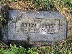
Randy Harrison Johns
| Birth | : | 11 Dec 1944 Washington, USA |
| Death | : | 24 Dec 1944 Omak, Okanogan County, Washington, USA |
| Burial | : | Mount Olivet Cemetery, Leavenworth, Leavenworth County, USA |
| Coordinate | : | 39.2811012, -94.9036026 |
| Description | : | Washington Death Certificate Name Rand Harrison Johns Death date 24 Dec 1944 Death place Omak, Okanogan, Washington Gender Male Age at death 13 days Estimated birth year 1944 Father name Claude Johns Film number 2024173 Digital GS number 4224962 Image number 1725 Reference number 204 |
frequently asked questions (FAQ):
-
Where is Randy Harrison Johns's memorial?
Randy Harrison Johns's memorial is located at: Mount Olivet Cemetery, Leavenworth, Leavenworth County, USA.
-
When did Randy Harrison Johns death?
Randy Harrison Johns death on 24 Dec 1944 in Omak, Okanogan County, Washington, USA
-
Where are the coordinates of the Randy Harrison Johns's memorial?
Latitude: 39.2811012
Longitude: -94.9036026
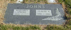
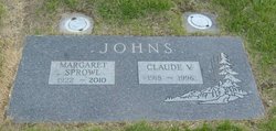
Family Members:
Parent
Flowers:
Nearby Cemetories:
1. Mount Olivet Cemetery
Leavenworth, Leavenworth County, USA
Coordinate: 39.2811012, -94.9036026
2. Leavenworth National Cemetery
Leavenworth, Leavenworth County, USA
Coordinate: 39.2770996, -94.8874435
3. Mount Muncie Cemetery
Lansing, Leavenworth County, USA
Coordinate: 39.2694016, -94.8889008
4. Mount Calvary Cemetery
Leavenworth, Leavenworth County, USA
Coordinate: 39.2653008, -94.9214020
5. Leavenworth High School Killed/Missing In Action
Leavenworth, Leavenworth County, USA
Coordinate: 39.2955685, -94.9307293
6. Greenwood Cemetery
Leavenworth, Leavenworth County, USA
Coordinate: 39.2881012, -94.9385986
7. Mount Aurora Cemetery (Defunct)
Leavenworth, Leavenworth County, USA
Coordinate: 39.2971800, -94.9364600
8. Cemetery of the Good Thief
Leavenworth County, USA
Coordinate: 39.2497700, -94.8962700
9. Delaware Cemetery
Lansing, Leavenworth County, USA
Coordinate: 39.2489600, -94.8774400
10. Saint Paul Episcopal Church Columbarium
Leavenworth, Leavenworth County, USA
Coordinate: 39.3196400, -94.9185300
11. Green Cemetery
Stillings, Platte County, USA
Coordinate: 39.3017006, -94.8447037
12. Starns Cemetery
Lansing, Leavenworth County, USA
Coordinate: 39.2435989, -94.9488983
13. Sunset Memory Gardens
Leavenworth, Leavenworth County, USA
Coordinate: 39.2999992, -94.9653015
14. Charles Cox Grave
Farley, Platte County, USA
Coordinate: 39.2831900, -94.8344300
15. Farley Cemetery
Farley, Platte County, USA
Coordinate: 39.2821000, -94.8342700
16. Sully Family Cemetery
Leavenworth, Leavenworth County, USA
Coordinate: 39.3226790, -94.9571080
17. Mary Perry Gravesite
Lansing, Leavenworth County, USA
Coordinate: 39.2211700, -94.9016700
18. United States Penitentiary Cemetery
Leavenworth, Leavenworth County, USA
Coordinate: 39.3311996, -94.9511566
19. Little Stranger Cemetery
Leavenworth County, USA
Coordinate: 39.2453003, -94.9741974
20. Buffalo Soldier Monument
Fort Leavenworth, Leavenworth County, USA
Coordinate: 39.3459396, -94.9191589
21. Isaac Gruber Gravesite
Kickapoo Township, Leavenworth County, USA
Coordinate: 39.3349400, -94.9585400
22. Fort Leavenworth National Cemetery
Fort Leavenworth, Leavenworth County, USA
Coordinate: 39.3496323, -94.9304657
23. Sons of Truth Cemetery
Leavenworth, Leavenworth County, USA
Coordinate: 39.3302994, -94.9775009
24. Hymer Cemetery
Platte County, USA
Coordinate: 39.2637600, -94.8032600


