Randy Wayne Davis
| Birth | : | 23 Feb 1951 Saint Charles, St. Charles County, Missouri, USA |
| Death | : | 23 Feb 1951 Saint Charles, St. Charles County, Missouri, USA |
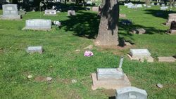
| Burial | : | Leavenworth National Cemetery, Leavenworth, Leavenworth County, USA |
| Coordinate | : | 39.2770996, -94.8874435 |
| Plot | : | Block 06, Baby Row/No Headstone Rotation 109 |
| Description | : | Infant son of William Walter Davis & Grace Maxey. Cod: Heart defect |
frequently asked questions (FAQ):
-
Where is Randy Wayne Davis's memorial?
Randy Wayne Davis's memorial is located at: Leavenworth National Cemetery, Leavenworth, Leavenworth County, USA.
-
When did Randy Wayne Davis death?
Randy Wayne Davis death on 23 Feb 1951 in Saint Charles, St. Charles County, Missouri, USA
-
Where are the coordinates of the Randy Wayne Davis's memorial?
Latitude: 39.2770996
Longitude: -94.8874435
Family Members:
Parent
Siblings
Flowers:
Nearby Cemetories:
1. Leavenworth National Cemetery
Leavenworth, Leavenworth County, USA
Coordinate: 39.2770996, -94.8874435
2. Mount Muncie Cemetery
Lansing, Leavenworth County, USA
Coordinate: 39.2694016, -94.8889008
3. Mount Olivet Cemetery
Leavenworth, Leavenworth County, USA
Coordinate: 39.2811012, -94.9036026
4. Cemetery of the Good Thief
Leavenworth County, USA
Coordinate: 39.2497700, -94.8962700
5. Mount Calvary Cemetery
Leavenworth, Leavenworth County, USA
Coordinate: 39.2653008, -94.9214020
6. Delaware Cemetery
Lansing, Leavenworth County, USA
Coordinate: 39.2489600, -94.8774400
7. Leavenworth High School Killed/Missing In Action
Leavenworth, Leavenworth County, USA
Coordinate: 39.2955685, -94.9307293
8. Greenwood Cemetery
Leavenworth, Leavenworth County, USA
Coordinate: 39.2881012, -94.9385986
9. Green Cemetery
Stillings, Platte County, USA
Coordinate: 39.3017006, -94.8447037
10. Farley Cemetery
Farley, Platte County, USA
Coordinate: 39.2821000, -94.8342700
11. Charles Cox Grave
Farley, Platte County, USA
Coordinate: 39.2831900, -94.8344300
12. Mount Aurora Cemetery (Defunct)
Leavenworth, Leavenworth County, USA
Coordinate: 39.2971800, -94.9364600
13. Saint Paul Episcopal Church Columbarium
Leavenworth, Leavenworth County, USA
Coordinate: 39.3196400, -94.9185300
14. Mary Perry Gravesite
Lansing, Leavenworth County, USA
Coordinate: 39.2211700, -94.9016700
15. Starns Cemetery
Lansing, Leavenworth County, USA
Coordinate: 39.2435989, -94.9488983
16. Sunset Memory Gardens
Leavenworth, Leavenworth County, USA
Coordinate: 39.2999992, -94.9653015
17. Hymer Cemetery
Platte County, USA
Coordinate: 39.2637600, -94.8032600
18. Fouts Cemetery
Waldron, Platte County, USA
Coordinate: 39.2627900, -94.8000100
19. Sully Family Cemetery
Leavenworth, Leavenworth County, USA
Coordinate: 39.3226790, -94.9571080
20. Peters Cemetery
Platte County, USA
Coordinate: 39.2705600, -94.7941400
21. Buffalo Soldier Monument
Fort Leavenworth, Leavenworth County, USA
Coordinate: 39.3459396, -94.9191589
22. United States Penitentiary Cemetery
Leavenworth, Leavenworth County, USA
Coordinate: 39.3311996, -94.9511566
23. Moore Cemetery
Waldron, Platte County, USA
Coordinate: 39.2541900, -94.7962900
24. Little Stranger Cemetery
Leavenworth County, USA
Coordinate: 39.2453003, -94.9741974

