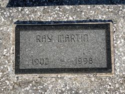
Ray Carl Martin
| Birth | : | 21 Oct 1902 Pittsburg, Crawford County, Kansas, USA |
| Death | : | 13 Dec 1998 Frontenac, Crawford County, Kansas, USA |
| Burial | : | Harrison Township Cemetery, South Bloomfield, Pickaway County, USA |
| Coordinate | : | 39.7100029, -82.9895859 |
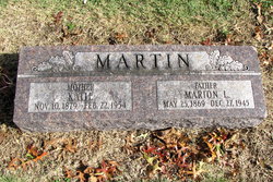
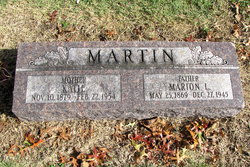
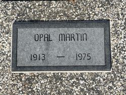
| Description | : | The son of Marion L. & Katie Hunter Martin. He married Opal West 10 May 1938 in Lamar, Mo. He was of the Protestant faith. Survivors include step-son Calvin Hoenshell, brothers William & Glen Martin. |
frequently asked questions (FAQ):
-
Where is Ray Carl Martin's memorial?
Ray Carl Martin's memorial is located at: Harrison Township Cemetery, South Bloomfield, Pickaway County, USA.
-
When did Ray Carl Martin death?
Ray Carl Martin death on 13 Dec 1998 in Frontenac, Crawford County, Kansas, USA
-
Where are the coordinates of the Ray Carl Martin's memorial?
Latitude: 39.7100029
Longitude: -82.9895859
Family Members:
Parent
Spouse
Siblings
Flowers:
Nearby Cemetories:
1. Harrison Township Cemetery
South Bloomfield, Pickaway County, USA
Coordinate: 39.7100029, -82.9895859
2. Frye Farm Cemetery
South Bloomfield, Pickaway County, USA
Coordinate: 39.6971110, -83.0047600
3. Conner Family Farm Cemetery
Ashville, Pickaway County, USA
Coordinate: 39.7097700, -82.9625420
4. Floral Hills Memory Gardens
Circleville, Pickaway County, USA
Coordinate: 39.6775000, -82.9687000
5. Ashville Cemetery
Ashville, Pickaway County, USA
Coordinate: 39.7150440, -82.9425720
6. James Borror Farm Cemetery
Pickaway County, USA
Coordinate: 39.7519690, -83.0144500
7. Stage Cemetery (Defunct)
Walnut Township, Pickaway County, USA
Coordinate: 39.6810750, -82.9403970
8. Caldwell Farm Cemetery
Commercial Point, Pickaway County, USA
Coordinate: 39.7539518, -83.0168503
9. Hoover Hill Cemetery
Ashville, Pickaway County, USA
Coordinate: 39.7098530, -82.9213610
10. Mount Herman Cemetery
Ashville, Pickaway County, USA
Coordinate: 39.7010994, -82.9214020
11. Press Peters Farm Cemetery
Commercial Point, Pickaway County, USA
Coordinate: 39.7496470, -83.0378710
12. Ira Hoover Cemetery
Walnut Township, Pickaway County, USA
Coordinate: 39.7294565, -82.9190150
13. Hott Farm Cemetery
Matville, Pickaway County, USA
Coordinate: 39.7198200, -83.0653970
14. Jackson Township Cemetery
Pickaway County, USA
Coordinate: 39.6508942, -83.0090714
15. A R Duvall Cemetery
Ashville, Pickaway County, USA
Coordinate: 39.7447850, -82.9235130
16. Bowsher Cemetery
Circleville, Pickaway County, USA
Coordinate: 39.6458959, -82.9643476
17. Old Herrenstine Cemetery
Circleville, Pickaway County, USA
Coordinate: 39.6536734, -83.0376842
18. McLaine Cemetery
Circleville, Pickaway County, USA
Coordinate: 39.6450980, -83.0168030
19. Presbyterian Cemetery
Commercial Point, Pickaway County, USA
Coordinate: 39.7609000, -83.0504600
20. Clayton Weaver Cemetery (Defunct)
Walnut Township, Pickaway County, USA
Coordinate: 39.7090320, -82.8993170
21. W C Morrison Farm Cemetery (Defunct)
Walnut Township, Pickaway County, USA
Coordinate: 39.6683030, -82.9159340
22. Burnley Family Cemetery
Commercial Point, Pickaway County, USA
Coordinate: 39.7692650, -83.0558040
23. Dry Run Cemetery
Ashville, Pickaway County, USA
Coordinate: 39.6680984, -82.9036026
24. C F Brinker Farm Cemetery (Defunct)
Walnut Township, Pickaway County, USA
Coordinate: 39.6675060, -82.9038640

