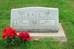
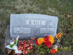
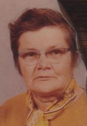
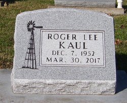
Ray Gene Kaul
| Birth | : | 20 Feb 1930 Holton, Jackson County, Kansas, USA |
| Death | : | 12 Nov 2006 Holton, Jackson County, Kansas, USA |
| Burial | : | Highmore Cemetery, Highmore, Hyde County, USA |
| Coordinate | : | 44.5074997, -99.4197006 |
| Plot | : | Section A (west) |
frequently asked questions (FAQ):
-
Where is Ray Gene Kaul's memorial?
Ray Gene Kaul's memorial is located at: Highmore Cemetery, Highmore, Hyde County, USA.
-
When did Ray Gene Kaul death?
Ray Gene Kaul death on 12 Nov 2006 in Holton, Jackson County, Kansas, USA
-
Where are the coordinates of the Ray Gene Kaul's memorial?
Latitude: 44.5074997
Longitude: -99.4197006
Family Members:
Parent
Spouse
Siblings
Children
Flowers:
Nearby Cemetories:
1. Highmore Cemetery
Highmore, Hyde County, USA
Coordinate: 44.5074997, -99.4197006
2. Saint Marys Catholic Cemetery
Highmore, Hyde County, USA
Coordinate: 44.5063800, -99.4214900
3. Morningside Cemetery
Ree Heights, Hand County, USA
Coordinate: 44.5147018, -99.1903000
4. Saint John Catholic Cemetery
Harrold, Hughes County, USA
Coordinate: 44.5127983, -99.7335968
5. Medicine Hill Cemetery
Harrold, Hughes County, USA
Coordinate: 44.5116997, -99.7453003
6. Pleasant View Cemetery
Highmore, Hyde County, USA
Coordinate: 44.7358017, -99.4910965
7. Immaculate Conception Mission Cemetery
Stephan, Hyde County, USA
Coordinate: 44.2447100, -99.4566500
8. Cedar Cemetery
Hand County, USA
Coordinate: 44.2775002, -99.2238998
9. Alden Cemetery
Hand County, USA
Coordinate: 44.6775017, -99.1203003
10. Bohemian National Cemetery
Highmore, Hyde County, USA
Coordinate: 44.7933006, -99.3319016
11. Hillcrest Cemetery
Miller, Hand County, USA
Coordinate: 44.5207000, -99.0006100
12. Pleasant Cemetery
Sully County, USA
Coordinate: 44.6927986, -99.7568970
13. Spring Lake Cemetery
Hyde County, USA
Coordinate: 44.7942009, -99.5610962
14. G A R Cemetery
Miller, Hand County, USA
Coordinate: 44.5078011, -98.9858017
15. Saint John the Baptist Catholic Cemetery
Onaka, Faulk County, USA
Coordinate: 44.1951100, -99.4703500
16. Saint Ann's Cemetery
Miller, Hand County, USA
Coordinate: 44.5222015, -98.9732971
17. Saint Lawrence Cemetery
Saint Lawrence, Hand County, USA
Coordinate: 44.5292015, -98.9321976
18. Mount Calvary Cemetery
Polo, Hand County, USA
Coordinate: 44.7827988, -99.1097031
19. Mondamin Cemetery
Hand County, USA
Coordinate: 44.2158012, -99.1238022
20. Elm Creek Cemetery
Buffalo County, USA
Coordinate: 44.1649290, -99.2261748
21. Chapelle Cemetery
Hughes County, USA
Coordinate: 44.3025017, -99.8653030
22. Saint Michaels Cemetery
Hand County, USA
Coordinate: 44.8302994, -99.1106033
23. Saint Catherines Cemetery
Harrold, Hughes County, USA
Coordinate: 44.2091100, -99.7868200
24. Howell Cemetery
Miller, Hand County, USA
Coordinate: 44.7757988, -98.9766998

