
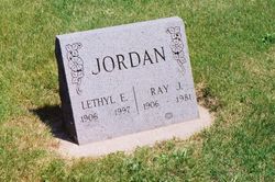
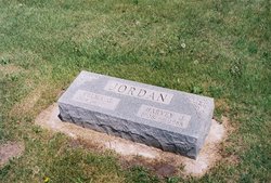
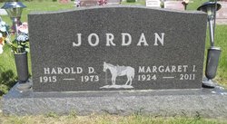
Ray John Jordan
| Birth | : | 22 Oct 1906 Miner County, South Dakota, USA |
| Death | : | Feb 1981 Jefferson, Greene County, Iowa, USA |
| Burial | : | Dillavou Cemetery, Kendrick Township, Greene County, USA |
| Coordinate | : | 42.0802994, -94.6138992 |
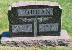
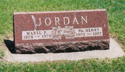
| Description | : | Ray was born 22 Oct 1906 in Miner, South Dakota. He was the son of William M Jordan and Anise M Dillavon. He lived with his parents in South Dakota and Iowa. Lethyl E Turner and Ray John Jordan were married 24 Nov 1941 in Richmond, Ray, Missouri. He died in Feb 1981 and is buried in Dillavou Cemetery, Ralston, Greene County, Iowa. United States Social Security Death Index," database, FamilySearch (https://familysearch.org/ark:/61903/1:1:J1P6-46N : 19 May 2014), Ray Jordan, Feb 1981; citing U.S. Social Security Administration, Death Master File, database (Alexandria, Virginia: National Technical Information Service, ongoing). %Contributor: Melinda... Read More |
frequently asked questions (FAQ):
-
Where is Ray John Jordan's memorial?
Ray John Jordan's memorial is located at: Dillavou Cemetery, Kendrick Township, Greene County, USA.
-
When did Ray John Jordan death?
Ray John Jordan death on Feb 1981 in Jefferson, Greene County, Iowa, USA
-
Where are the coordinates of the Ray John Jordan's memorial?
Latitude: 42.0802994
Longitude: -94.6138992
Family Members:
Parent
Spouse

Siblings

Flowers:


Nearby Cemetories:
1. Dillavou Cemetery
Kendrick Township, Greene County, USA
Coordinate: 42.0802994, -94.6138992
2. Scranton Township Cemetery
Scranton, Greene County, USA
Coordinate: 42.0306015, -94.5783005
3. North Coon Cemetery
Carroll County, USA
Coordinate: 42.1260986, -94.6716995
4. Dickson Cemetery
Glidden Township, Carroll County, USA
Coordinate: 42.1074982, -94.6939011
5. Saint Patricks Cemetery
Churdan, Greene County, USA
Coordinate: 42.1605988, -94.5511017
6. Gibson-Fleck-Thompson Cemetery
Scranton, Greene County, USA
Coordinate: 42.0428870, -94.4988800
7. West Lawn Cemetery
Glidden, Carroll County, USA
Coordinate: 42.0649986, -94.7406006
8. Old Cedar Cemetery
Adaza, Greene County, USA
Coordinate: 42.1874821, -94.5419194
9. Highland Township Cemetery
Churdan, Greene County, USA
Coordinate: 42.1518310, -94.4699120
10. Lanesboro Cemetery
Lanesboro, Carroll County, USA
Coordinate: 42.1810989, -94.7230988
11. Holy Family Cemetery
Lidderdale, Carroll County, USA
Coordinate: 42.1178017, -94.7839966
12. Fair Oaks Cemetery
Scranton, Greene County, USA
Coordinate: 42.0355988, -94.4460983
13. Wright Cemetery
Jefferson, Greene County, USA
Coordinate: 42.0228004, -94.4477997
14. East Liberty Cemetery
Lidderdale, Carroll County, USA
Coordinate: 42.1591988, -94.7636032
15. Bishop Cemetery
Calhoun Township, Calhoun County, USA
Coordinate: 42.2230400, -94.6453190
16. Immanuel Cemetery
Lidderdale, Carroll County, USA
Coordinate: 42.1389008, -94.8022003
17. Headley Cemetery
Jefferson, Greene County, USA
Coordinate: 42.0041504, -94.4335815
18. Willow Cemetery
Greene County, USA
Coordinate: 41.9067001, -94.5730972
19. McCurdy Cemetery
Carroll County, USA
Coordinate: 41.9403000, -94.7649994
20. Saint Joseph Cemetery
Jefferson, Greene County, USA
Coordinate: 42.0289001, -94.3818970
21. Evergreen Cemetery
Lohrville, Calhoun County, USA
Coordinate: 42.2505989, -94.5330963
22. Old Carrollton Cemetery
Carrollton, Carroll County, USA
Coordinate: 41.9233017, -94.7403030
23. Carroll City Cemetery
Carroll, Carroll County, USA
Coordinate: 42.0560963, -94.8599856
24. Mount Olivet Cemetery
Carroll, Carroll County, USA
Coordinate: 42.0536340, -94.8595510