| Description |
: |
~~~ ✈ Raymond Edward Magee ~~~ ✈
(April 30, 1922 ~ November 14, 2001)
30 April 1922 – 14 November 2001
[Estimated Age at Death: 79 years, 6 months, 15 days]
***
Raymond Edward Magee, 79, Fort Scott, died Wednesday, Nov. 14, 2001, at a Kansas City, Kan., hospital.
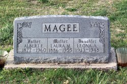
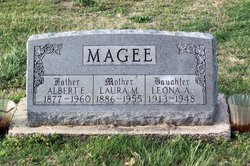
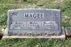
He was born April 30, 1922, near Mulberry, the son of Albert and Laura Magee. He graduated from Mulberry High School in 1939. He attended Pittsburg State University and obtained a civil engineering degree from the Penn State International Correspondence School.
Mr. Magee was...
Read More
|
~~~ ✈ Raymond Edward Magee ~~~ ✈
(April 30, 1922 ~ November 14, 2001)
30 April 1922 – 14 November 2001
[Estimated Age at Death: 79 years, 6 months, 15 days]
***
Raymond Edward Magee, 79, Fort Scott, died Wednesday, Nov. 14, 2001, at a Kansas City, Kan., hospital.
He was born April 30, 1922, near Mulberry, the son of Albert and Laura Magee. He graduated from Mulberry High School in 1939. He attended Pittsburg State University and obtained a civil engineering degree from the Penn State International Correspondence School.
Mr. Magee was a civil engineer and retired as area engineer for the Kansas Department of Transportation in 1986 after 39 years. He was involved in the US-69 highway Buck Run Route and served on state highway commission jobs in Girard, Pittsburg and Ottawa.
He was a captain in the Army 8th Air Corps during World War II and completed 58 missions piloting a P-51 Thunderbolt in the European theater. He was decorated with the Air Medal with five oak leaf clusters.
Mr. Magee was a member of Mary Queen of Angels Catholic Church, a fourth degree member of the Knights of Columbus and was past president of the Southeast Chapter of the Kansas Engineering Society.
He married Violet Nardelli on June 20, 1948, in Mulberry. She survives.
Other survivors include a daughter, Sharon Magee-Minor, Baldwin City; four sons, Dr. Raymond Daniel Magee and Dr. Shawn Michael Magee, both of Topeka, Dr. Lawrence Marion Magee, Lawrence, and Mark Edward Magee, DeSoto; a sister, Sybel Kittle, Martinez, Calif.; and 10 grandchildren.
Mass of Christian Burial will be celebrated at 10 a.m. today at Mary Queen of Angels Catholic Church in Fort Scott. Burial will be in Pittsburg Garden of Memories Cemetery in Pittsburg.
Memorial contributions may be made to the Department of Civil, Environmental ad Architectural Engineering, in care of The University of Kansas Endowment Association, P.O. Box 928, Lawrence, Kan., 66044, or sent in care of the Cheney Witt Memorial Funeral Chapel in Fort Scott.
Topeka Capital-Journal, The (KS) - Page: B4.
Saturday, November 17, 2001
Deceased Name: Raymond Magee
~*~
*~*
Raymond Edward Magee
Mass of Christian Burial for Raymond Edward Magee, 79, Fort Scott, will be at 10 a.m. Saturday at Mary Queen of Angels Catholic Church, Fort Scott. Burial will be in Pittsburg Garden of Memories Cemetery.
Mr. Magee died Wednesday, Nov. 14, 2001, at Kansas University Medical Center, Kansas City, Kan.
He was born April 30, 1922, near Mulberry, the son of Albert and Laura Magee. He graduated from Mulberry High School in 1939. He attended Pittsburg State University and obtained his civil engineering degree from Pennsylvania State University International Correspondence School.
Mr. Magee was a captain in the United States 8th Army Air Forces during World War II and was stationed in East Wretham, England.
He completed 58 missions as a pilot flying a P-51 Thunderbolt. He was awarded the Air Medal with Five Oak Leaf Clusters for his participation on the European Theatre.
He was a licensed professional engineer and retired March 3, 1986, as area engineer for the Kansas Department of Transportation after 39 years of service.
Before coming to Fort Scott, he held state highway commission jobs in Girard, Pittsburg and Ottawa.
Mr. Magee was a member of Mary Queen of Angels Catholic Church, a 4th degree member of the Knights of Columbus and past president and member of the Southeast Chapter of the Kansas Engineering Society.
He married Violet Nardelli of Arcadia June 20, 1948, in Mulberry. She survives of the home.
Other survivors include a daughter, Sharon Magee-Minor, Baldwin; four sons, Raymond, Topeka, Lawrence, Lawrence, Mark, DeSoto, and Shawn, Topeka; a sister, Sybel Kittle, Martinez, Calif.; and 10 grandchildren.
The rosary will be recited at 7 p.m. Friday at Cheney Witt Memorial Chapel, Fort Scott, where the family will receive friends after the service.
The family suggests memorials in his name to the Kansas University's department of civil, environmental and architectural engineering. Contributions to the department may be sent in care of the Kansas University Endowment Association or to the chapel, 201 S. Main St., Fort Scott, KS 66701.
Lawrence Journal-World (KS) - Friday, November 16, 2001
Deceased Name: Raymond Edward Magee
~*~
*~*
Social Security Death Index
Name: Raymond E. Magee
State of Issue: Kansas
Date of Birth: Sunday April 30, 1922
Date of Death: Wednesday November 14, 2001
Est. Age at Death: 79 years, 6 months, 15 days
Confirmation: Verified
Last known residence:
City: Fort Scott; Devon; Hiattville
County: Bourbon
State: Kansas
ZIP Code: 66701
Latitude: 37.8381
Longitude: -94.7210
~*~
*~*
HUSBAND OF:
Violet Marie Nardelli Magee
PHOTO: Black and White.
Violet Marie (Nardelli) Magee, age 97, passed peacefully, surrounded by family and caregivers, at her home, in Baldwin, Kansas, on Jan. 11, 2022.
Violet was born in Gross, Kansas to Mario Nardelli and Johanna (Zanona) Nardelli, Oct., 6, 1924.
She graduated from Arcadia High School in 1941, completed her teaching certificate at Kansas State Teachers College of Pittsburg and began her first job in a one room schoolhouse at St. Paul, Kansas, on the "island."
She was married to Raymond Edward Magee on June 20, 1948, at St. Gabriel's Catholic Church in Mulberry, Kansas, during a rainstorm. A tornado followed the ceremony, so the reception was held in the family basement by the light of church candles.
Violet was a friend, a neighbor, a teacher, and a mentor. Most importantly, she was a wife, a mother to 5 children, a grandmother to 14 grandchildren, a great-grandmother to 6 great-grandchildren, and a loving dog owner to her loyal O'Riley.
Music was a large part of her life, and she was thankful for the opportunity, but most importantly she credited God for her talent.
Violet was preceded in death by her husband, Raymond.
Survivors include one daughter, Sharon Magee-Minor and husband, James, of Baldwin, Kansas; four sons, Dr. Raymond Daniel Magee, and wife Connie, Topeka, Kansas, Dr. Lawrence Marion Magee and wife,
Michelle, Lawrence, Kansas, Mark Edward Magee, and wife Cabrina, DeSoto, Kansas, and Dr. Shawn Michael Magee, and wife Shirley Dawn, Topeka, Kansas.
What a wonderful difference she made in the lives of many. "Always in our Hearts."
Because the Funeral Mass is for family only, friends and neighbors may view Violet Wednesday, Jan. 19 through Friday, Jan. 21, 2022, from 8 a.m. to 7 p.m. at Konantz-Cheney Funeral Home, Fort Scott, Kansas.
A private family service will be held at Mary Queen of Angels Catholic Church, on Jan. 22, 2022, where she was the organist for 50 years. A private family graveside service will follow at Garden of Memories, Pittsburg, Kansas.
Expressions of sympathy in memory of Violet may be made to Mary Queen of Angels Music Ministry or Engineering Scholarship at Kansas University, Raymond and Violet Magee.
Memorials may be left in care of Konantz-Cheney Funeral Home, 15 W. Wall, Fort Scott, KS 66701.
Condolences may be submitted to the online guestbook at konantz-cheney.com.
~*~
*~*
Violet M. Magee
October 6, 1924 ~ January 11, 2022
PHOTO: Colored.
Service Date: January 22, 2022
Cemetery Garden of Memories Cemetery
Church Mary Queen of Angels Catholic Church
Private Family Services
Violet Marie (Nardelli) Magee, age 97, passed peacefully, surrounded by family and caregivers, at her home, in Baldwin, Kansas, on January 11, 2022. Violet was born in Gross, Kansas to Mario Nardelli and Johanna (Zanona) Nardelli, October 6, 1924. She graduated from Arcadia High School in 1941, completed her teaching certificate at Kansas State Teachers College of Pittsburg, and began her first job in a one-room schoolhouse at St. Paul, Kansas, on the "island".
Violet's life spoke music, like a tapestry. It was woven through her journey and defined her being. Using voice lessons to learn the English dialect, it was discovered that she was blessed with being a quick learner. Violet was most notably a talented pianist who could embellish music and teach others, piano and voice. So gifted, her instructor accompanied her to Chicago for a debut of her talent and a musical tour. Earlier, she had rekindled a friendship with a schoolmate; a pilot returning from World War II, so she came home for her true love. She was married to Raymond Edward Magee on June 20, 1948, at St. Gabriel's Catholic Church in Mulberry, Kansas, during a rainstorm. A tornado followed the ceremony, so the reception was held in the family basement by the light of church candles.
Violet and Raymond celebrated 52 years of marriage and "were proud and grateful for five children and were honored that God had entrusted them to be their parents." They spoke of goodness and their actions showed care and kindness. Their home was filled with cappellettis, cinnamon rolls, pies, meatballs, and handmade breads that were available to family and anyone that needed a place for the holidays. There were piano students of all ages, often 30 a week, along with scout meetings, homemade dance costumes, student recitals, voice lessons, and choir practice for mass and weddings.
Music made the moment, making every occasion better, as Violet played at graduations, civic symphony, community choir, school plays, as well as participating and judging piano and voice competitions. She volunteered her time at St. Mary's as a music teacher. As the organist at Mary Queen of Angel Catholic Church for fifty years, generations remember Midnight Mass and Easter. She played at many weddings as well as funerals. Hundreds of thank you cards lined her scrapbooks, recalling her contribution to their ceremonies. Music was a large part of her life, and she was thankful for the opportunity, but most importantly she credited God for her talent.
Violet was a friend, a neighbor, a teacher, and a mentor. Most importantly, she was a wife, a mother to 5 children, a grandmother to 14 grandchildren, a great-grandmother to 6 great-grandchildren, and a loving dog owner to her loyal O'Riley.
Violet was preceded in death by her husband, Raymond. Survivor's include one daughter, Sharon Magee-Minor and husband, James, of Baldwin, Kansas; four sons, Dr. Raymond Daniel Magee, and wife Connie, Topeka, Kansas, Dr. Lawrence Marion Magee and wife, Michelle, Lawrence, Kansas, Mark Edward Magee, and wife Cabrina, DeSoto, Kansas, and Dr. Shawn Michael Magee, and wife Shirley Dawn, Topeka, Kansas.
What a wonderful difference she made in the lives of many. The family would like to thank all of Violet's friends for being such an important part of her life. "Always in our Hearts"
Because the Funeral Mass is for family only, friends and neighbors may view Violet Wednesday, January 19th thru Friday, January 21st, from 8:00 am until 7:00 pm at Konantz-Cheney Funeral Home, Fort Scott, Kansas. A private family service will be held at Mary Queen of Angels Catholic Church, on January 22nd, 2022, where she was the organist for 50 years. A private family graveside service will follow at Garden of Memories, Pittsburg, Kansas. Expressions of sympathy in memory of Violet may be made to Mary Queen of Angels Music Ministry or Engineering Scholarship at Kansas University, Raymond and Violet Magee. Memorials may be left in care of Konantz-Cheney Funeral Home, 15 West Wall, Fort Scott, Kansas, 66701. Condolences may be submitted to the online guestbook at konantz-cheney.com.
https://konantz-cheney.com/obituaries/violet-m-magee/338/
~*~
*~* |


