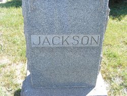
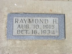
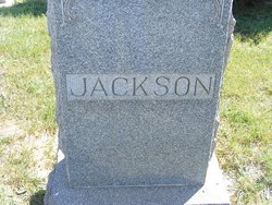
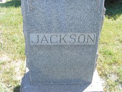
Raymond H. Jackson
| Birth | : | 10 Aug 1915 Hill County, Montana, USA |
| Death | : | 16 Oct 1934 Havre, Hill County, Montana, USA |
| Burial | : | Penola Cemetery, Penola, Wattle Range Council, Australia |
| Coordinate | : | -37.4009210, 140.8362800 |
| Description | : | DAILY INTER LAKE, Kalispell, MT, 17 Oct 1934 Burns Suffered in Blast Fatal to Havre Man Havre, Oct 17 - Raymond Jackson, 19, Hingham, died at a hospital here late yesterday of burns he suffered in an explosion of a distillate he was using to start a fire in the Jackson ranch home. The house was destroyed in the flames following the blast. Jackson and a brother had been staying at the farm home alone while their parents, Mr. and Mr. Thomas Jackson, were away |
frequently asked questions (FAQ):
-
Where is Raymond H. Jackson's memorial?
Raymond H. Jackson's memorial is located at: Penola Cemetery, Penola, Wattle Range Council, Australia.
-
When did Raymond H. Jackson death?
Raymond H. Jackson death on 16 Oct 1934 in Havre, Hill County, Montana, USA
-
Where are the coordinates of the Raymond H. Jackson's memorial?
Latitude: -37.4009210
Longitude: 140.8362800
Family Members:
Parent
Siblings
Flowers:
Nearby Cemetories:
1. Penola Cemetery
Penola, Wattle Range Council, Australia
Coordinate: -37.4009210, 140.8362800
2. Penola Old Cemetery
Penola, Wattle Range Council, Australia
Coordinate: -37.3670740, 140.8412400
3. Kalangadoo Cemetery
Kalangadoo, Wattle Range Council, Australia
Coordinate: -37.5694190, 140.7045780
4. Heathfield Cemetery
Lake Mundi, Glenelg Shire, Australia
Coordinate: -37.5713233, 141.1436213
5. Dergholm Cemetery
Dergholm, West Wimmera Shire, Australia
Coordinate: -37.3717520, 141.2253000
6. Moyhall Homestead
Naracoorte Lucindale Council, Australia
Coordinate: -37.0585750, 140.6699470
7. Strathdownie Cemetery
Strathdownie, Glenelg Shire, Australia
Coordinate: -37.7174000, 141.1676280
8. Millicent Cemetery
Millicent, Wattle Range Council, Australia
Coordinate: -37.6184335, 140.3770980
9. Pioneer Park
Mount Gambier, Mount Gambier City, Australia
Coordinate: -37.8348290, 140.7840010
10. Mieschel Park
Mount Gambier, Mount Gambier City, Australia
Coordinate: -37.8374980, 140.7855890
11. Carinya Gardens
Mount Gambier, Mount Gambier City, Australia
Coordinate: -37.8370330, 140.7494970
12. Lake Terrace Cemetery
Mount Gambier, Mount Gambier City, Australia
Coordinate: -37.8425950, 140.7854720
13. Chetwynd Cemetery
Chetwynd, West Wimmera Shire, Australia
Coordinate: -37.2791510, 141.3951660
14. Hynam Cemetery
Naracoorte Lucindale Council, Australia
Coordinate: -36.9393410, 140.8490120
15. Naracoorte Cemetery
Naracoorte, Naracoorte Lucindale Council, Australia
Coordinate: -36.9460270, 140.7302250
16. Casterton Old Cemetery
Casterton, Glenelg Shire, Australia
Coordinate: -37.5948850, 141.3700380
17. Apsley Cemetery
Apsley, West Wimmera Shire, Australia
Coordinate: -36.9589380, 141.0837570
18. Casterton Cemetery
Casterton, Glenelg Shire, Australia
Coordinate: -37.5992440, 141.4088270
19. Edenhope Cemetery
Edenhope, West Wimmera Shire, Australia
Coordinate: -37.0421400, 141.3039580
20. Kybybolite Cemetery
Kybybolite, Naracoorte Lucindale Council, Australia
Coordinate: -36.8815610, 140.9291740
21. Sandford Cemetery
Sandford, Glenelg Shire, Australia
Coordinate: -37.6290998, 141.4562576
22. Lucindale Cemetery
Lucindale, Naracoorte Lucindale Council, Australia
Coordinate: -36.9696190, 140.3797090
23. Tarrayoukyan Cemetery
Tarrayoukyan, Southern Grampians Shire, Australia
Coordinate: -37.3253840, 141.5809310
24. Dartmoor Cemetery
Dartmoor, Glenelg Shire, Australia
Coordinate: -37.9148220, 141.2491380

