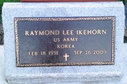
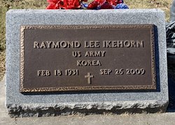
Raymond Lee Ikehorn
| Birth | : | 18 Feb 1931 Chanute, Neosho County, Kansas, USA |
| Death | : | 26 Sep 2009 Olathe, Johnson County, Kansas, USA |
| Burial | : | Elmwood Cemetery, Toppenish, Yakima County, USA |
| Coordinate | : | 46.3673830, -120.3334530 |
| Plot | : | Sec 200 Blk 8 Lot 54 Sp 3 |
| Inscription | : | US ARMY KOREA |
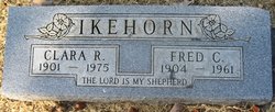
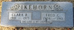
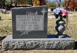
| Description | : | ***************************** Published Sept. 28, 2009 - Chanute, KS Raymond Lee Ikehorn, 78, of Olathe, Kansas, passed away Saturday, September 26, 2009 at the Evergreen Community in Olathe, Kansas. Raymond was born in Chanute, Kansas on February 18, 1931, the son of Charles Frederick and Clara Rose (Squires) Ikehorn. He graduated from Chanute High School in the Class of 1949. He spent all of his life in Chanute. He was married to Shirley Fyrne Stover. She preceded him in death. Raymond worked for the Wax Plant, the State of Kansas, and he also farmed. He is survived by a daughter, Sharon Phillips and husband Steven, of Olathe,... Read More |
frequently asked questions (FAQ):
-
Where is Raymond Lee Ikehorn's memorial?
Raymond Lee Ikehorn's memorial is located at: Elmwood Cemetery, Toppenish, Yakima County, USA.
-
When did Raymond Lee Ikehorn death?
Raymond Lee Ikehorn death on 26 Sep 2009 in Olathe, Johnson County, Kansas, USA
-
Where are the coordinates of the Raymond Lee Ikehorn's memorial?
Latitude: 46.3673830
Longitude: -120.3334530
Family Members:
Parent
Spouse
Siblings
Flowers:
Nearby Cemetories:
1. Elmwood Cemetery
Toppenish, Yakima County, USA
Coordinate: 46.3673830, -120.3334530
2. Winnier Cemetery
Toppenish, Yakima County, USA
Coordinate: 46.3590060, -120.3192450
3. McCoy Cemetery
Toppenish, Yakima County, USA
Coordinate: 46.3835983, -120.2755966
4. Zillah Cemetery
Zillah, Yakima County, USA
Coordinate: 46.4055202, -120.2726072
5. Zillah German Baptist Cemetery
Zillah, Yakima County, USA
Coordinate: 46.4128550, -120.2506400
6. Smohalla Cemetery
Toppenish, Yakima County, USA
Coordinate: 46.3009660, -120.2186250
7. Smina Cemetery
Yakima County, USA
Coordinate: 46.2372017, -120.4269028
8. Reservation Community Memorial Park
Wapato, Yakima County, USA
Coordinate: 46.4484291, -120.5375519
9. Outlook Cemetery
Yakima, Yakima County, USA
Coordinate: 46.3208008, -120.0811005
10. Union Gap Cemetery
Yakima County, USA
Coordinate: 46.5209084, -120.4850998
11. Holy Rosary Cemetery
Moxee City, Yakima County, USA
Coordinate: 46.5531006, -120.3585968
12. Meninick Cemetery
Yakima County, USA
Coordinate: 46.1981010, -120.4741974
13. Lewis Family Cemetery
Yakima, Yakima County, USA
Coordinate: 46.5390013, -120.5052581
14. Pioneer Cemetery
Union Gap, Yakima County, USA
Coordinate: 46.5578003, -120.4697037
15. Holland Cemetery
Moxee City, Yakima County, USA
Coordinate: 46.5766983, -120.3861008
16. Toweatmy Cemetery
Toppenish, Yakima County, USA
Coordinate: 46.1794014, -120.5056000
17. Lower Valley Memorial Gardens
Sunnyside, Yakima County, USA
Coordinate: 46.3450012, -120.0117035
18. Holy Trinity Episcopal Close
Sunnyside, Yakima County, USA
Coordinate: 46.3235000, -120.0158500
19. Shaker Cemetery
White Swan, Yakima County, USA
Coordinate: 46.3891907, -120.6621399
20. Yemowat Cemetery
Yakima County, USA
Coordinate: 46.5475006, -120.5730972
21. Tahoma Cemetery
Yakima, Yakima County, USA
Coordinate: 46.5753610, -120.5332320
22. Terrace Heights Memorial Park
Yakima, Yakima County, USA
Coordinate: 46.6068600, -120.4598900
23. Calvary Cemetery
Yakima, Yakima County, USA
Coordinate: 46.5790740, -120.5407420
24. Beaver Cemetery
Yakima County, USA
Coordinate: 46.0993996, -120.2866974

