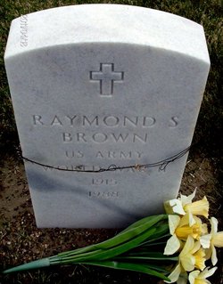
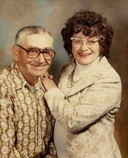
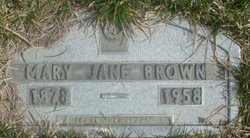
Raymond Sylvester “Brownie” Brown
| Birth | : | 19 Aug 1915 Rosebud County, Montana, USA |
| Death | : | 24 Oct 1988 Forsyth, Rosebud County, Montana, USA |
| Burial | : | Mann Creek Cemetery, Weiser, Washington County, USA |
| Coordinate | : | 44.3669014, -116.8688965 |
| Plot | : | Veterans Section Row 17 Lot 6 |
| Inscription | : | US ARMY WORLD WAR II |
| Description | : | SOURCE: Death Certificate: '''''''''''''''''''''''' The Billings Gazette, MT. 10/26/1988 Wednesday Page 13 Raymond "Brownie" Brown FORSYTH, MT. ---- Raymond "Brownie" Brown and his wife lived on the homestead at Lee, MT. and he drove school bus for Colstrip, MT. In 1957 they moved to Forsyth, and he operated the South Country mail route. He retired in 1980 and operated the Forsyth Secondhand Store with his wife. Mr. Brown, 73, died Monday in Miles City Veterans Medical of natural causes. He was born in Lee, MT., a son of Clarence and Mary DeHaven Brown. He spent his... Read More |
frequently asked questions (FAQ):
-
Where is Raymond Sylvester “Brownie” Brown's memorial?
Raymond Sylvester “Brownie” Brown's memorial is located at: Mann Creek Cemetery, Weiser, Washington County, USA.
-
When did Raymond Sylvester “Brownie” Brown death?
Raymond Sylvester “Brownie” Brown death on 24 Oct 1988 in Forsyth, Rosebud County, Montana, USA
-
Where are the coordinates of the Raymond Sylvester “Brownie” Brown's memorial?
Latitude: 44.3669014
Longitude: -116.8688965
Family Members:
Parent
Spouse
Flowers:
Nearby Cemetories:
1. Mann Creek Cemetery
Weiser, Washington County, USA
Coordinate: 44.3669014, -116.8688965
2. Keithley Creek Cemetery
Midvale, Washington County, USA
Coordinate: 44.4769096, -116.7839813
3. Hillcrest Cemetery
Weiser, Washington County, USA
Coordinate: 44.2585983, -116.9638290
4. Galloway Cemetery
Weiser, Washington County, USA
Coordinate: 44.2372017, -116.8869019
5. Eastside Cemetery
Midvale, Washington County, USA
Coordinate: 44.4713554, -116.6847610
6. Fairview Cemetery
Ontario, Malheur County, USA
Coordinate: 44.2181015, -116.9847031
7. Applegate Cemetery
Malheur County, USA
Coordinate: 44.1266600, -116.9298100
8. Mineral Cemetery
Mineral, Washington County, USA
Coordinate: 44.5642000, -117.0763000
9. Cambridge Cemetery
Cambridge, Washington County, USA
Coordinate: 44.5789833, -116.6774521
10. Salubria Cemetery
Cambridge, Washington County, USA
Coordinate: 44.5730000, -116.6250000
11. Van Ornum Massacre Site
Baker County, USA
Coordinate: 44.3339330, -117.2456320
12. Hibbard Creek Cemetery
Baker County, USA
Coordinate: 44.4999890, -117.2003590
13. Old Oregon Trail Cemetery
Huntington, Baker County, USA
Coordinate: 44.3439200, -117.2529000
14. Riverside Cemetery
Payette, Payette County, USA
Coordinate: 44.0952988, -116.9349976
15. Rosedale Memorial Gardens
Payette, Payette County, USA
Coordinate: 44.0902820, -116.9116120
16. Pioneer Cemetery
Huntington, Baker County, USA
Coordinate: 44.3480500, -117.2695900
17. Beckmon Burial
Payette County, USA
Coordinate: 44.0565928, -116.9159265
18. Newbold Family Cemetery
Cambridge, Washington County, USA
Coordinate: 44.6492800, -116.6806800
19. Lime-Dixie Cemetery
Baker County, USA
Coordinate: 44.4235992, -117.3013992
20. Washoe Cemetery
Payette County, USA
Coordinate: 44.0503006, -116.9471970
21. Walker Cemetery
Midvale, Washington County, USA
Coordinate: 44.2998700, -116.4104140
22. Corpus Christi Catholic Church Columbarium
Fruitland, Payette County, USA
Coordinate: 44.0170500, -116.9281260
23. Sunset Cemetery
Ontario, Malheur County, USA
Coordinate: 44.0225080, -116.9887300
24. Evergreen Cemetery
Ontario, Malheur County, USA
Coordinate: 44.0167007, -116.9757996


