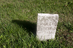
Reuben Lundy Roberts
| Birth | : | 1 Jul 1806 Northumberland County, Pennsylvania, USA |
| Death | : | 13 Feb 1875 Cherokee County, Kansas, USA |
| Burial | : | Maple Leaf Cemetery, Oak Harbor, Island County, USA |
| Coordinate | : | 48.3111000, -122.6307983 |
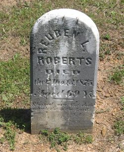
| Inscription | : | DIED the 2Mo.13.1875 Aged 69 Ys. Blessed are the dead which die in the Lord. |
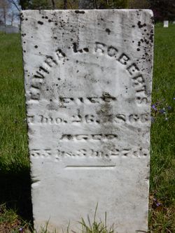
| Description | : | Reuben Lundy Roberts 01 July 1806 ~ 13 February 1875 *** Reuben Roberts Sent by: Merideth Hmura (#47399453) Aug 27, 2017 10:11 AM Father: Aaron Roberts (1775 - 1854) Mother: Elizabeth Lundy Roberts (1771 - 1870) ~*~ *~* Thanks to Jason Townsend (#47064954) for names and links to his wives and other info. ------------------------- His first wife: Elvira L Roberts 86116378 Married: 1833 Second wife: Rebecca Roberts 31300673 Married abt: 1868 ------------------------- 1868-1871, Indian agent appointed by President Grant for the Shawnees at Olathe, Kansas. ------------------------- ~*~ |
frequently asked questions (FAQ):
-
Where is Reuben Lundy Roberts's memorial?
Reuben Lundy Roberts's memorial is located at: Maple Leaf Cemetery, Oak Harbor, Island County, USA.
-
When did Reuben Lundy Roberts death?
Reuben Lundy Roberts death on 13 Feb 1875 in Cherokee County, Kansas, USA
-
Where are the coordinates of the Reuben Lundy Roberts's memorial?
Latitude: 48.3111000
Longitude: -122.6307983
Family Members:
Parent
Spouse
Siblings
Children
Flowers:
Nearby Cemetories:
1. Maple Leaf Cemetery
Oak Harbor, Island County, USA
Coordinate: 48.3111000, -122.6307983
2. Saint Stephens Episcopal Church Columbarium
Island County, USA
Coordinate: 48.2941500, -122.6362000
3. Fircrest Cemetery
Oak Harbor, Island County, USA
Coordinate: 48.3047030, -122.6589630
4. Pioneer Burial Park
Oak Harbor, Island County, USA
Coordinate: 48.3010000, -122.6597000
5. Snarling Cemetery
Coupeville, Island County, USA
Coordinate: 48.2200012, -122.6849976
6. Swinomish Cemetery
Skagit County, USA
Coordinate: 48.3893750, -122.5042530
7. Sunnyside Cemetery
Coupeville, Island County, USA
Coordinate: 48.2060350, -122.7049150
8. Camano Island Lutheran Cemetery
Camano, Island County, USA
Coordinate: 48.2341670, -122.4630560
9. Camano Island Pioneer Cemetery
Camano, Island County, USA
Coordinate: 48.2449989, -122.4505997
10. Pleasant Ridge Cemetery
La Conner, Skagit County, USA
Coordinate: 48.3925018, -122.4480972
11. Fern Hill Cemetery
Anacortes, Skagit County, USA
Coordinate: 48.4580994, -122.5830994
12. Camp Casey Conference Center Memorial Garden
Coupeville, Island County, USA
Coordinate: 48.1622600, -122.6819070
13. Saint Aidans Episcopal Church Columbarium
Camano, Island County, USA
Coordinate: 48.2386500, -122.4108000
14. Grand View Cemetery
Anacortes, Skagit County, USA
Coordinate: 48.4886017, -122.6027985
15. Stanwood Pioneer Cemetery
Stanwood, Snohomish County, USA
Coordinate: 48.2628120, -122.3653660
16. Skagit City Cemetery
Skagit City, Skagit County, USA
Coordinate: 48.3454900, -122.3573970
17. Havekost Grave
Anacortes, Skagit County, USA
Coordinate: 48.4922670, -122.6911170
18. Fir-Conway Lutheran Cemetery
Mount Vernon, Skagit County, USA
Coordinate: 48.3084030, -122.3340960
19. Scandinavian Cemetery
Milltown, Skagit County, USA
Coordinate: 48.2988000, -122.3295000
20. Fort Worden Military Cemetery
Port Townsend, Jefferson County, USA
Coordinate: 48.1333000, -122.7736000
21. Saint Marys Catholic Cemetery
Port Townsend, Jefferson County, USA
Coordinate: 48.1300250, -122.7778980
22. Our Saviours Lutheran Church Cemetery
Stanwood, Snohomish County, USA
Coordinate: 48.2350760, -122.3416000
23. Cedarhome Cemetery
Stanwood, Snohomish County, USA
Coordinate: 48.2613970, -122.3262700
24. Anderson Cemetery
East Stanwood, Snohomish County, USA
Coordinate: 48.2335710, -122.3362570

