
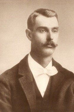
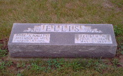


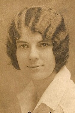
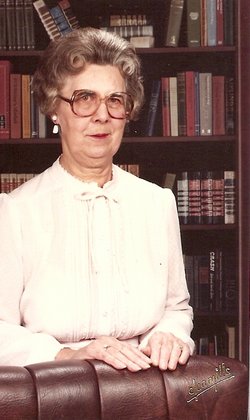
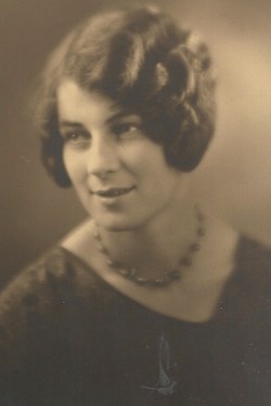
Reuben Wade Ellis
| Birth | : | 23 Jun 1867 |
| Death | : | 5 May 1959 |
| Burial | : | Torhamns kyrkogård, Torhamn, Karlskrona kommun, Sweden |
| Coordinate | : | 56.0952220, 15.8329000 |
| Description | : | REUBEN WADE ELLIS, Tippecanoe farmer, who has successfully specialized in live stock and in seed corn, represents one of the oldest families of Lauramie Township. He was born on the farm where he now resides, in 1867. The Ellis family has been in America since Colonial times. His great-grandparents were Rowland and Frances (Breadwater) Ellis. Rowland Ellis was born in Virginia and served as a soldier in the American Revolution. For his military service he was granted a tract of land at Guilford Court House, North Carolina, but sold it without occupying it. He lived out... Read More |
frequently asked questions (FAQ):
-
Where is Reuben Wade Ellis's memorial?
Reuben Wade Ellis's memorial is located at: Torhamns kyrkogård, Torhamn, Karlskrona kommun, Sweden.
-
When did Reuben Wade Ellis death?
Reuben Wade Ellis death on 5 May 1959 in
-
Where are the coordinates of the Reuben Wade Ellis's memorial?
Latitude: 56.0952220
Longitude: 15.8329000
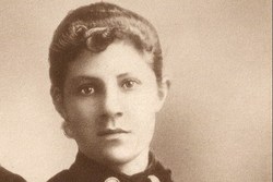
Family Members:
Parent
Spouse
Siblings
Children

Flowers:


Nearby Cemetories:
1. Torhamns kyrkogård
Torhamn, Karlskrona kommun, Sweden
Coordinate: 56.0952220, 15.8329000
2. Sturkö Kyrkogård
Sturko, Karlskrona kommun, Sweden
Coordinate: 56.0886899, 15.6963390
3. Jämjö kyrkogård
Jamjo, Karlskrona kommun, Sweden
Coordinate: 56.1921200, 15.8318400
4. Lösens kyrka
Lyckeby, Karlskrona kommun, Sweden
Coordinate: 56.1965965, 15.6882357
5. Wämö
Karlskrona, Karlskrona kommun, Sweden
Coordinate: 56.1804250, 15.6017650
6. Aspö kyrkogård
Aspo, Karlskrona kommun, Sweden
Coordinate: 56.1135337, 15.5192664
7. Fridlevstads Kyrkogård
Fridlevstad, Karlskrona kommun, Sweden
Coordinate: 56.2696868, 15.5388697
8. Listerby Cemetery
Listerby, Ronneby kommun, Sweden
Coordinate: 56.1953366, 15.4065383
9. Hjortsberga kyrkogård
Johannishus, Ronneby kommun, Sweden
Coordinate: 56.2255649, 15.4078853
10. Tvings Kyrkogård
Tving, Karlskrona kommun, Sweden
Coordinate: 56.3092001, 15.4655756
11. Gullabo kyrkogård
Gullabo, Torsås kommun, Sweden
Coordinate: 56.4636883, 15.8071821
12. Sophia Magdalena
Soderakra, Torsås kommun, Sweden
Coordinate: 56.4457031, 16.0717222
13. Aaryd Kyrkogård
Aryd, Karlshamns kommun, Sweden
Coordinate: 56.2073510, 15.0095260
14. Karlslunda churchyard
Paryd, Kalmar kommun, Sweden
Coordinate: 56.5685926, 15.9182519
15. Kastlösa Kyrkogård
Kastlosa, Mörbylånga kommun, Sweden
Coordinate: 56.4585433, 16.4293813
16. Arby kyrka
Arby, Hjo kommun, Sweden
Coordinate: 56.5666670, 16.1227780
17. Hällaryd Kyrkogård
Hallaryd, Karlshamns kommun, Sweden
Coordinate: 56.2062400, 14.9474500
18. Mörbylånga Kyrkogård
Mörbylånga, Mörbylånga kommun, Sweden
Coordinate: 56.5197335, 16.3979088
19. Långasjö kyrkogård
Langasjo, Emmaboda kommun, Sweden
Coordinate: 56.5789481, 15.4445904
20. Hulterstad Kyrkogård
Hulterstad, Mörbylånga kommun, Sweden
Coordinate: 56.4494100, 16.5675470
21. Hvilans Kyrkogård
Karlshamn, Karlshamns kommun, Sweden
Coordinate: 56.1801190, 14.8573860
22. Resmo kyrkogård
Resmo, Mörbylånga kommun, Sweden
Coordinate: 56.5415446, 16.4438174
23. Södra Sandsjö Kyrkogård
Tingsryds kommun, Sweden
Coordinate: 56.5142500, 15.1544400
24. Asarum Kyrkogård
Asarum, Karlshamns kommun, Sweden
Coordinate: 56.2054400, 14.8328400