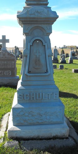
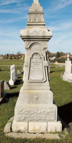
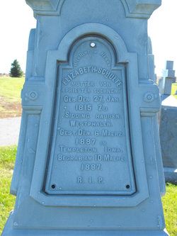
Rev Fr Bernard Albert “Al” Schulte
| Birth | : | 19 Feb 1856 New Vienna, Dubuque County, Iowa, USA |
| Death | : | 28 Apr 1913 Iowa, USA |
| Burial | : | Sacred Heart Cemetery, Templeton, Carroll County, USA |
| Coordinate | : | 41.9138746, -94.9460994 |
| Description | : | Excerpt from the 1982 Templeton Centennial Book pg. 199. Rev. Schulte was a son of Anton and Elizabeth Schulte. He had three brothers who were also priests: Revs. Frank X. Schulte, Joseph Schulte and Conrad Schulte. Father Schulte attended St. John's at Collegeville, MN and pursued seminary studies at St. Francis Seminary at Milwaukee, WI. He was ordained in June 1879. He was appointed pastor at St. Joseph's Church at State Center, IA following his ordination. He took care of Haverhill, Templeton, Dedham and Coon Rapids, which were missions of State Center. In 1882 (Headstone notes 1882 while the Centennial Book says 1884) he... Read More |
frequently asked questions (FAQ):
-
Where is Rev Fr Bernard Albert “Al” Schulte's memorial?
Rev Fr Bernard Albert “Al” Schulte's memorial is located at: Sacred Heart Cemetery, Templeton, Carroll County, USA.
-
When did Rev Fr Bernard Albert “Al” Schulte death?
Rev Fr Bernard Albert “Al” Schulte death on 28 Apr 1913 in Iowa, USA
-
Where are the coordinates of the Rev Fr Bernard Albert “Al” Schulte's memorial?
Latitude: 41.9138746
Longitude: -94.9460994
Family Members:
Parent
Siblings
Flowers:
Nearby Cemetories:
1. Sacred Heart Cemetery
Templeton, Carroll County, USA
Coordinate: 41.9138746, -94.9460994
2. Elba Cemetery
Templeton, Carroll County, USA
Coordinate: 41.9068985, -94.9131012
3. Sacred Heart Cemetery
Manning, Carroll County, USA
Coordinate: 41.9132500, -95.0540000
4. Gray Cemetery
Gray, Audubon County, USA
Coordinate: 41.8414001, -94.9946976
5. Manning Cemetery
Manning, Carroll County, USA
Coordinate: 41.8990000, -95.0620000
6. Holy Angels Cemetery
Carroll County, USA
Coordinate: 42.0014000, -94.9141998
7. Cameron Cemetery
Audubon County, USA
Coordinate: 41.8236008, -94.9167023
8. Dedham Cemetery
Dedham, Carroll County, USA
Coordinate: 41.8993988, -94.8225021
9. Saint Josephs Cemetery
Dedham, Carroll County, USA
Coordinate: 41.8993988, -94.8210983
10. Saint Augustine Cemetery
Halbur, Carroll County, USA
Coordinate: 42.0066986, -94.9744034
11. Lincoln Township Cemetery
Gray, Audubon County, USA
Coordinate: 41.8198130, -95.0154970
12. Saint Marys Catholic Cemetery
Willey, Carroll County, USA
Coordinate: 41.9783363, -94.8212204
13. Iowa Township Cemetery
Aspinwall, Crawford County, USA
Coordinate: 41.9216995, -95.1113968
14. McCurdy Cemetery
Carroll County, USA
Coordinate: 41.9403000, -94.7649994
15. Viola Center Cemetery
Viola Center, Audubon County, USA
Coordinate: 41.8236008, -94.8016968
16. Old Carrollton Cemetery
Carrollton, Carroll County, USA
Coordinate: 41.9233017, -94.7403030
17. Mount Olivet Cemetery
Carroll, Carroll County, USA
Coordinate: 42.0536340, -94.8595510
18. Carroll City Cemetery
Carroll, Carroll County, USA
Coordinate: 42.0560963, -94.8599856
19. Hayes Township Cemetery
Westside, Crawford County, USA
Coordinate: 42.0083199, -95.1216583
20. Luccocks Grove Cemetery
Audubon County, USA
Coordinate: 41.7619019, -94.8653030
21. Douglas Township Cemetery
Audubon County, USA
Coordinate: 41.7611008, -95.0282974
22. Oak Hill Cemetery
Coon Rapids, Carroll County, USA
Coordinate: 41.9053001, -94.7200012
23. Westside Cemetery
Westside, Crawford County, USA
Coordinate: 42.0602989, -95.0922012
24. Saint Francis Cemetery
Maple River, Carroll County, USA
Coordinate: 42.0969009, -94.9372025


