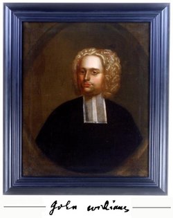
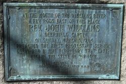
Rev John Williams
| Birth | : | 10 Dec 1664 Roxbury, Suffolk County, Massachusetts, USA |
| Death | : | 12 Jun 1729 Deerfield, Franklin County, Massachusetts, USA |
| Burial | : | Burke Cemetery, Holder, Citrus County, USA |
| Coordinate | : | 28.9699993, -82.4100037 |
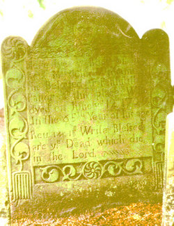
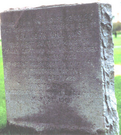
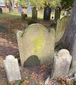
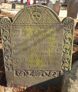
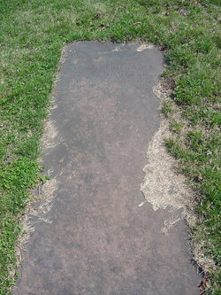
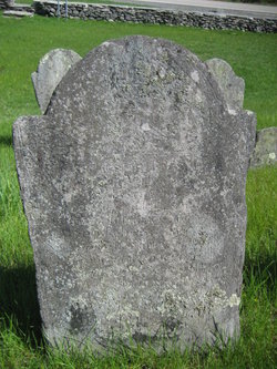
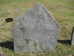
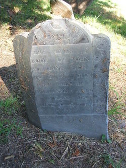
| Inscription | : | Here lyes ye Body of the Rev. Mr. John Williams The Beloved & Faithfull Pastor of this place: Who dyed on June ye 12th 1729 In the 65th Year of his age. Rev.14:13 Write Blessed are ye Dead, which die i |
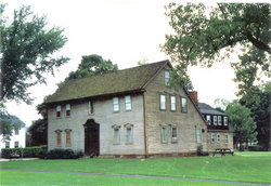
| Description | : | Clergyman and author, was born in Roxbury, Mass., the fifth child and second son of Deacon Samuel and Theoda (Park) Williams and a grandson of Robert Williams who was admitted freeman of Roxbury in 1638. John was prepared in the Roxbury Latin School and graduated B.A. from Harvard College in 1683. For two years he taught school in Dorchester. He prophesied as a candidate in the frontier settlement of Deerfield and when some time later a church was gathered there, he was formally ordained its first pastor, Oct. 17, 1688. In the meantime, on July 21,... Read More |
frequently asked questions (FAQ):
-
Where is Rev John Williams's memorial?
Rev John Williams's memorial is located at: Burke Cemetery, Holder, Citrus County, USA.
-
When did Rev John Williams death?
Rev John Williams death on 12 Jun 1729 in Deerfield, Franklin County, Massachusetts, USA
-
Where are the coordinates of the Rev John Williams's memorial?
Latitude: 28.9699993
Longitude: -82.4100037
Family Members:
Parent
Spouse
Siblings
Children
Flowers:
Nearby Cemetories:
1. Burke Cemetery
Holder, Citrus County, USA
Coordinate: 28.9699993, -82.4100037
2. Holder Cemetery
Holder, Citrus County, USA
Coordinate: 28.9655991, -82.4189529
3. Nature Coast Unitarian Universalist Fellowship Mem
Citrus Springs, Citrus County, USA
Coordinate: 28.9751010, -82.4244630
4. Saint Paul Lutheran Memorial Garden
Beverly Hills, Citrus County, USA
Coordinate: 28.9540876, -82.4412583
5. Number 32 Cemetery
Hernando, Citrus County, USA
Coordinate: 28.9099691, -82.3773631
6. Fero Memorial Gardens Cemetery
Beverly Hills, Citrus County, USA
Coordinate: 28.9207993, -82.4610977
7. Cedar Grove Cemetery
Marion County, USA
Coordinate: 29.0097000, -82.3440960
8. Hernando Community Cemetery
Hernando, Citrus County, USA
Coordinate: 28.9036522, -82.3788140
9. Hernando Cemetery
Hernando, Citrus County, USA
Coordinate: 28.9001617, -82.3774185
10. Holy Faith Episcopal Church Memory Garden
Dunnellon, Marion County, USA
Coordinate: 29.0509320, -82.4501090
11. Blue Run Cemetery
Dunnellon, Marion County, USA
Coordinate: 29.0579426, -82.4357847
12. Dunnellon Presbyterian Church Memorial Garden
Dunnellon, Marion County, USA
Coordinate: 29.0519450, -82.4626490
13. Shepherd of the Hills Episcopal Church Columbarium
Lecanto, Citrus County, USA
Coordinate: 28.8920810, -82.4763060
14. Jester Family Cemetery
Dunnellon, Marion County, USA
Coordinate: 29.0636330, -82.3652130
15. Dunnellon Community Cemetery
Marion County, USA
Coordinate: 29.0612900, -82.4717000
16. Dunnellon Memorial Gardens
Dunnellon, Marion County, USA
Coordinate: 29.0648030, -82.4696870
17. Van Ness Cemetery
Inverness, Citrus County, USA
Coordinate: 28.8707850, -82.3586800
18. Rockwell Cemetery
Dunnellon, Marion County, USA
Coordinate: 29.0677240, -82.4710070
19. Living Water Wesleyan Church Memorial Garden
Dunnellon, Marion County, USA
Coordinate: 29.0527220, -82.3052400
20. Episcopal Church of the Advent Memorial Garden
Dunnellon, Marion County, USA
Coordinate: 29.0542580, -82.3058370
21. Magnolia Cemetery
Lecanto, Citrus County, USA
Coordinate: 28.8525160, -82.4855340
22. Citronelle Baptist Church Cemetery
Citronelle, Citrus County, USA
Coordinate: 28.9789770, -82.5656500
23. Juliette Cemetery
Dunnellon, Marion County, USA
Coordinate: 29.1054530, -82.4361060
24. John Joseph Pastuch Memorial Site
Lecanto, Citrus County, USA
Coordinate: 28.8540980, -82.4980350

