

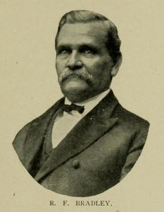

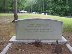
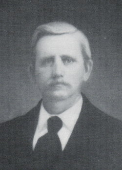
Rev Robert Foster Bradley
| Birth | : | 22 Sep 1846 Abbeville County, South Carolina, USA |
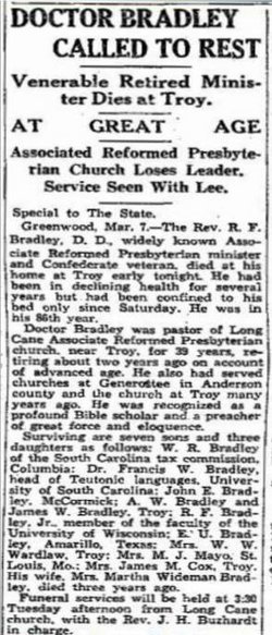
| Death | : | 7 Mar 1931 Troy, Greenwood County, South Carolina, USA |
| Burial | : | Spider Hill Cemetery, Wells County, USA |
| Coordinate | : | 40.7705994, -85.3186035 |
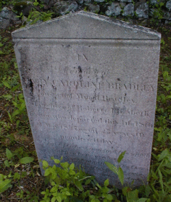
| Inscription | : | Robert Foster Bradley CW marker CIVIL WAR VETERAN b. Sept. 22, 1846 d. Mar. 7, 1931 |
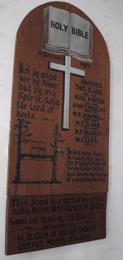
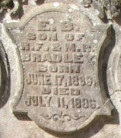
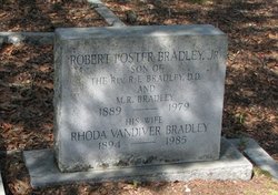
| Description | : | Robert Foster Bradley was born in Abbeville Co., Sept. 22nd. 1846. In early life he had the advantage of neighboring schools, and the High Schools taught by Rev. E. L. Patton, near Long Cane, and was graduated from Erskine, 1869, and from Erskine Seminary in 1872. He was licensed by the Second Presbytery the same year at its fall meeting, Cannon's Creek, Newberry, South Carolina. Mr. Bradley was ordained and installed pastor of Generostee and Concord, South Carolina, Sept. 5th, 1873, and demitted this work in the fall of 1883. He was also installed the first pastor of Troy South Carolina,... Read More |
frequently asked questions (FAQ):
-
Where is Rev Robert Foster Bradley's memorial?
Rev Robert Foster Bradley's memorial is located at: Spider Hill Cemetery, Wells County, USA.
-
When did Rev Robert Foster Bradley death?
Rev Robert Foster Bradley death on 7 Mar 1931 in Troy, Greenwood County, South Carolina, USA
-
Where are the coordinates of the Rev Robert Foster Bradley's memorial?
Latitude: 40.7705994
Longitude: -85.3186035
Family Members:
Parent
Spouse
Siblings

Children
Flowers:


Nearby Cemetories:
1. Spider Hill Cemetery
Wells County, USA
Coordinate: 40.7705994, -85.3186035
2. Emmanuel Cemetery
Rockford, Wells County, USA
Coordinate: 40.7730331, -85.3177872
3. Redding Cemetery
Markle, Wells County, USA
Coordinate: 40.7824097, -85.3178864
4. Rockford Cemetery
Rockford, Wells County, USA
Coordinate: 40.7587471, -85.3086472
5. Sparks Cemetery
Wells County, USA
Coordinate: 40.7872009, -85.3347015
6. Mossburg Cemetery
Liberty Center, Wells County, USA
Coordinate: 40.7225266, -85.3272247
7. Old Rock Creek Cemetery
Murray, Wells County, USA
Coordinate: 40.7855492, -85.2558365
8. Saint Paul Cemetery
Uniondale, Wells County, USA
Coordinate: 40.7862625, -85.2535172
9. Yankeetown Cemetery
Huntington, Huntington County, USA
Coordinate: 40.7564011, -85.3889008
10. Markle Cemetery
Markle, Huntington County, USA
Coordinate: 40.8270187, -85.3465195
11. Horeb Cemetery
Uniondale, Wells County, USA
Coordinate: 40.8271523, -85.2765503
12. Thompson Home Cemetery
Warren, Huntington County, USA
Coordinate: 40.7085991, -85.3531036
13. Barnes Chapel Cemetery
Browns Corner, Huntington County, USA
Coordinate: 40.8242836, -85.4112320
14. Star of Hope Cemetery
Huntington, Huntington County, USA
Coordinate: 40.8272018, -85.4124985
15. Murray Cemetery
Murray, Wells County, USA
Coordinate: 40.8003006, -85.1956024
16. West Union Cemetery
Huntington, Huntington County, USA
Coordinate: 40.7416992, -85.4439011
17. Kocher Cemetery
Huntington, Huntington County, USA
Coordinate: 40.8299370, -85.4307580
18. Rees Cemetery
Majenica, Huntington County, USA
Coordinate: 40.7780991, -85.4552994
19. Old Bluffton Cemetery
Bluffton, Wells County, USA
Coordinate: 40.7456017, -85.1757965
20. McFarren Cemetery
Bluffton, Wells County, USA
Coordinate: 40.6730830, -85.2468790
21. Loon Creek Cemetery
Huntington County, USA
Coordinate: 40.8133011, -85.4567032
22. Woodlawn Cemetery
Warren, Huntington County, USA
Coordinate: 40.6822014, -85.4131012
23. Pet Rest Gardens
Ossian, Wells County, USA
Coordinate: 40.8299070, -85.1902010
24. Tower Park
Warren, Huntington County, USA
Coordinate: 40.6818410, -85.4184460