
| Birth | : | 22 Nov 1914 Loleta, Humboldt County, California, USA |
| Death | : | 15 May 1930 Loleta, Humboldt County, California, USA |
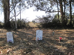
| Burial | : | Ceres Memorial Park, Ceres, Stanislaus County, USA |
| Coordinate | : | 37.5958214, -120.9634399 |
| Description | : | Blue Lake Advocate, Volume 43, Number 2, 17 May 1930 FORTUNA, May 15.—Death today claimed Rex Brenard, 15-year-old son of Mr. and Mrs. Smith Brenard, at his home near Loleta, following an illness of several months. The deceased was one of the most popular members of the freshman class of the Fortuna high school. He is survived by his parents, and two brothers and three sisters. Funeral services will be held Saturday at 2 p. m. from the Hunter-Wise funeral chapel in Fortuna with the Rev. Lars Henry Bennett officiating. Interment will be in the Table Bluff cemetery. |
frequently asked questions (FAQ):
-
Where is Rex Brenard's memorial?
Rex Brenard's memorial is located at: Ceres Memorial Park, Ceres, Stanislaus County, USA.
-
When did Rex Brenard death?
Rex Brenard death on 15 May 1930 in Loleta, Humboldt County, California, USA
-
Where are the coordinates of the Rex Brenard's memorial?
Latitude: 37.5958214
Longitude: -120.9634399
Family Members:
Parent

Siblings
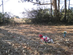


Flowers:


Nearby Cemetories:
1. Ceres Memorial Park
Ceres, Stanislaus County, USA
Coordinate: 37.5958214, -120.9634399
2. Saint Stanislaus Catholic Cemetery
Modesto, Stanislaus County, USA
Coordinate: 37.6473610, -120.9808440
3. Modesto Pioneer Cemetery
Modesto, Stanislaus County, USA
Coordinate: 37.6473350, -120.9829040
4. Modesto Citizens Cemetery
Modesto, Stanislaus County, USA
Coordinate: 37.6472930, -120.9845570
5. Acacia Memorial Park
Modesto, Stanislaus County, USA
Coordinate: 37.6481080, -120.9836610
6. Modesto County Cemetery
Modesto, Stanislaus County, USA
Coordinate: 37.6492400, -120.9813800
7. Lakewood Memorial Park
Hughson, Stanislaus County, USA
Coordinate: 37.6199760, -120.8975983
8. Good Shepherd Catholic Cemetery
Modesto, Stanislaus County, USA
Coordinate: 37.6853130, -121.0672890
9. Wood Colony Cemetery
Salida, Stanislaus County, USA
Coordinate: 37.6893730, -121.0682144
10. Turlock Memorial Park
Turlock, Stanislaus County, USA
Coordinate: 37.4937592, -120.8659821
11. Denair Cemetery
Denair, Stanislaus County, USA
Coordinate: 37.5293999, -120.8199997
12. Saint Francis Episcopal Church Columbarium
Turlock, Stanislaus County, USA
Coordinate: 37.5014300, -120.8368400
13. Burwood Cemetery
Escalon, San Joaquin County, USA
Coordinate: 37.7616997, -120.9593964
14. Langworth Cemetery
Oakdale, Stanislaus County, USA
Coordinate: 37.7580986, -120.8957977
15. Grayson Cemetery
Grayson, Stanislaus County, USA
Coordinate: 37.5594559, -121.1802826
16. Martin Cemetery
Waterford, Stanislaus County, USA
Coordinate: 37.6684360, -120.7582160
17. Patterson District Cemetery
Patterson, Stanislaus County, USA
Coordinate: 37.5268135, -121.1728287
18. North Hilmar Cemetery
Hilmar, Merced County, USA
Coordinate: 37.4146614, -120.8864288
19. Oakdale Citizens Cemetery
Oakdale, Stanislaus County, USA
Coordinate: 37.7624600, -120.8388800
20. Ripon Cemetery
Ripon, San Joaquin County, USA
Coordinate: 37.7420311, -121.1238708
21. Oaklawn Memorial Park
Oakdale, Stanislaus County, USA
Coordinate: 37.7711945, -120.8486862
22. Saint John's Catholic Cemetery
Escalon, San Joaquin County, USA
Coordinate: 37.7994537, -121.0705185
23. South Hilmar Cemetery
Hilmar, Merced County, USA
Coordinate: 37.3802681, -120.8868408
24. Valley Home Memorial Park
Oakdale, Stanislaus County, USA
Coordinate: 37.8275528, -120.9333267