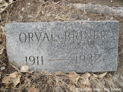
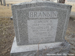
Richard Orval Briner
| Birth | : | 17 Apr 1911 Peru, Miami County, Indiana, USA |
| Death | : | 5 Nov 1932 Sweet Grass County, Montana, USA |
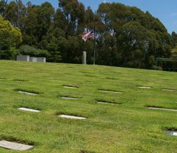
| Burial | : | Rossville Cemetery, Rossville, Vermilion County, USA |
| Coordinate | : | 40.3738708, -87.6730728 |
| Plot | : | Section 1 Block 38 Lot 4 Grave 2 |
| Description | : | Big Timber Pioneer, November 10, 1932 Sweet Grass county had its second hunting fatality of the season on Saturday afternoon when Orville Briner was the victim of a bullet fired by Ora Ostenson at what he supposed was a deer. The two boys were hunting on Porcupine butte near Melville and had separated to track their game. The Briner boy switched his course from the two had at first mapped out, and when the other youth saw a movement in the bushes he fired the bullet striking his friend in the back. Doing what he could for the injured lad,... Read More |
frequently asked questions (FAQ):
-
Where is Richard Orval Briner's memorial?
Richard Orval Briner's memorial is located at: Rossville Cemetery, Rossville, Vermilion County, USA.
-
When did Richard Orval Briner death?
Richard Orval Briner death on 5 Nov 1932 in Sweet Grass County, Montana, USA
-
Where are the coordinates of the Richard Orval Briner's memorial?
Latitude: 40.3738708
Longitude: -87.6730728
Family Members:
Parent
Siblings
Nearby Cemetories:
1. Rossville Cemetery
Rossville, Vermilion County, USA
Coordinate: 40.3738708, -87.6730728
2. Manns Family Plot
Rossville, Vermilion County, USA
Coordinate: 40.3397598, -87.6641235
3. Mann's Chapel Cemetery
Rossville, Vermilion County, USA
Coordinate: 40.3316994, -87.6592026
4. Miller Cemetery
Rossville, Vermilion County, USA
Coordinate: 40.3675003, -87.6082993
5. Red Top Cemetery
Hoopeston, Vermilion County, USA
Coordinate: 40.4255981, -87.6866989
6. Bethel Cemetery
Alvin, Vermilion County, USA
Coordinate: 40.3305550, -87.6202774
7. Kight Cemetery
Alvin, Vermilion County, USA
Coordinate: 40.3509500, -87.6005300
8. Prairie Chapel Cemetery
Rossville, Vermilion County, USA
Coordinate: 40.3793983, -87.7596970
9. Suche Cemetery
Suche, okres Michalovce, Slovakia
Coordinate: 40.4346700, -87.6099600
10. Peddicord Family Cemetery
Hebbville, Baltimore County, USA
Coordinate: 40.4346700, -87.6099600
11. Anglican Cathedral Cemetery
Mazowe District, Zimbabwe
Coordinate: 40.4346700, -87.6099600
12. Friedhof Altenkessel
Altenkessel, Regionalverband Saarbrücken, Germany
Coordinate: 40.4346700, -87.6099600
13. Chateau Herqueville
Herqueville, Departement de l'Eure, France
Coordinate: 40.4346700, -87.6099600
14. Cimitero comunale
Brembate, Provincia di Bergamo, Italy
Coordinate: 40.4346700, -87.6099600
15. Cementerio de Rocha
Rocha Amarela, Loulé Municipality, Portugal
Coordinate: 40.4346700, -87.6099600
16. Wards Memorial Cemetery
Marion Station, Somerset County, USA
Coordinate: 40.4346700, -87.6099600
17. St. Peter's Churchyard
Satterleigh, North Devon District, England
Coordinate: 40.4346700, -87.6099600
18. Agios Georgios
Vlasaiika, Regional unit of Messenia, Greece
Coordinate: 40.4346700, -87.6099600
19. Cimitero Comunale
Zogno, Provincia di Bergamo, Italy
Coordinate: 40.4346700, -87.6099600
20. Cimetero di Fanna
Fanna, Provincia di Pordenone, Italy
Coordinate: 40.4364429, -87.6098716
21. Pigeon Creek Cemetery
Dunningsville, Washington County, USA
Coordinate: 40.4422478, -87.6092734
22. Gundy Cemetery
Bismarck, Vermilion County, USA
Coordinate: 40.2708015, -87.6425018
23. Ingersol Cemetery
Potomac, Vermilion County, USA
Coordinate: 40.3396988, -87.8142014
24. Potomac Cemetery
Potomac, Vermilion County, USA
Coordinate: 40.3016663, -87.7891693


