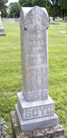
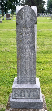
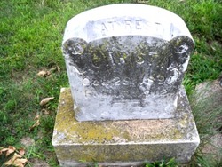
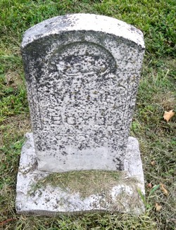
Robert C. “Robie” Boyd
| Birth | : | 17 Nov 1886 |
| Death | : | 2 Aug 1888 Columbus, Platte County, Nebraska, USA |
| Burial | : | Hillcrest Memorial Park, Hurffville, Gloucester County, USA |
| Coordinate | : | 39.7491989, -75.1110992 |
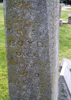
| Inscription | : | 1 year, 8 months, 27 days |
| Description | : | From the web site: http://www.usgennet.org/usa/ne/county/platte/vitals/vitals1888b.html The Columbus Journal, August 8, 1888 Thursday, August 2, 1888, of cholera infantum, after an illness of four days, Robie, son of Robert and Sarah Boyd, aged 20 months and 15 days. The funeral took place from the residence. Rev. H. L. Powers officiating. Robie was a bright little boy whose childish prattle had gladdened the hearts of his parents, brothers and sisters, but the angel of death came and took him, and his childish words will be heard no more. We look at Robie, but scarcely realize that it can be so, yet... Read More |
frequently asked questions (FAQ):
-
Where is Robert C. “Robie” Boyd's memorial?
Robert C. “Robie” Boyd's memorial is located at: Hillcrest Memorial Park, Hurffville, Gloucester County, USA.
-
When did Robert C. “Robie” Boyd death?
Robert C. “Robie” Boyd death on 2 Aug 1888 in Columbus, Platte County, Nebraska, USA
-
Where are the coordinates of the Robert C. “Robie” Boyd's memorial?
Latitude: 39.7491989
Longitude: -75.1110992
Family Members:
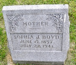
Parent
Siblings
Flowers:
Nearby Cemetories:
1. Hillcrest Memorial Park
Hurffville, Gloucester County, USA
Coordinate: 39.7491989, -75.1110992
2. Bethel Methodist Church Cemetery
Hurffville, Gloucester County, USA
Coordinate: 39.7571983, -75.1110992
3. Bunker Hill Presbyterian Church Cemetery
Gloucester County, USA
Coordinate: 39.7451600, -75.0849200
4. Cost Family Cemetery
Pitman, Gloucester County, USA
Coordinate: 39.7307100, -75.1332310
5. Bunker Hill Presbyterian Church Cemetery
Sewell, Gloucester County, USA
Coordinate: 39.7767514, -75.0931293
6. Manahath Cemetery
Glassboro, Gloucester County, USA
Coordinate: 39.7154236, -75.1141129
7. Driver Cemetery
Barnsboro, Gloucester County, USA
Coordinate: 39.7631000, -75.1554900
8. Jesse Chew Cemetery
Gloucester County, USA
Coordinate: 39.7736800, -75.1498250
9. Mount Zion Methodist Church Cemetery
Barnsboro, Gloucester County, USA
Coordinate: 39.7547540, -75.1629530
10. Saint Thomas Episcopal Church Cemetery
Glassboro, Gloucester County, USA
Coordinate: 39.7079200, -75.1101500
11. First United Methodist Church Cemetery
Glassboro, Gloucester County, USA
Coordinate: 39.7068900, -75.1081300
12. Alms House Cemetery
Lakeland, Camden County, USA
Coordinate: 39.7878700, -75.0823500
13. Saint Bridgets Cemetery
Glassboro, Gloucester County, USA
Coordinate: 39.7023300, -75.1159000
14. Trinity Bible Cemetery
Glassboro, Gloucester County, USA
Coordinate: 39.7003610, -75.1133800
15. Saint Johns United Methodist Cemetery
Turnersville, Gloucester County, USA
Coordinate: 39.7598300, -75.0487100
16. Grenloch First Presbyterian Church Memorial Garden
Grenloch Terrace, Gloucester County, USA
Coordinate: 39.7806000, -75.0587000
17. Grenloch First Presbyterian Church Memory Garden
Camden County, USA
Coordinate: 39.7806000, -75.0587000
18. Richwood United Methodist Church Cemetery
Richwood, Gloucester County, USA
Coordinate: 39.7211100, -75.1667700
19. Holy Trinity Memorial Garden
Wenonah, Gloucester County, USA
Coordinate: 39.7922200, -75.1514700
20. Buffalo Soldiers Cemetery
Franklinville, Gloucester County, USA
Coordinate: 39.8010180, -75.0899580
21. Wenonah Cemetery
Wenonah, Gloucester County, USA
Coordinate: 39.7893982, -75.1622009
22. Mantua Methodist Cemetery
Mantua, Gloucester County, USA
Coordinate: 39.7883160, -75.1663420
23. Blackwood Baptist Cemetery
Blackwood, Camden County, USA
Coordinate: 39.8010521, -75.0709305
24. Mantua Union Graveyard
Mantua, Gloucester County, USA
Coordinate: 39.7902460, -75.1707610

