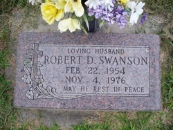
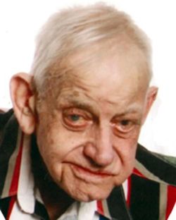
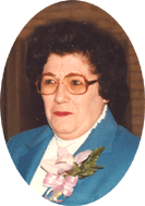
Robert D. Swanson
| Birth | : | 22 Feb 1954 Fullerton, Nance County, Nebraska, USA |
| Death | : | 4 Nov 1976 Duncan, Platte County, Nebraska, USA |
| Burial | : | Our Saviour Cemetery, Callender, Webster County, USA |
| Coordinate | : | 42.3396988, -94.3153000 |
| Description | : | Thanks to contributor #48317562 Robert D. Swanson was killed November 4, 1976, while operating a forklift truck at Farr Better Feeds located near Duncan. Robert was born Feb 22, 1954 at Fullerton, the son of Dolend and Phyllis (Medinger) Swanson. He attended rural school and Monroe High School, was a member of the Monroe Fire Department and St. Isidore Church. On August 14, 1976 at St. Isidore Church, he married Bonnie Lynn Cook, who survives. Also surviving are his parents and brother, Kenneth of Monroe. Services were held at St. Isidore Catholic Church with burial... Read More |
frequently asked questions (FAQ):
-
Where is Robert D. Swanson's memorial?
Robert D. Swanson's memorial is located at: Our Saviour Cemetery, Callender, Webster County, USA.
-
When did Robert D. Swanson death?
Robert D. Swanson death on 4 Nov 1976 in Duncan, Platte County, Nebraska, USA
-
Where are the coordinates of the Robert D. Swanson's memorial?
Latitude: 42.3396988
Longitude: -94.3153000
Family Members:
Parent
Flowers:
Nearby Cemetories:
1. Our Saviour Cemetery
Callender, Webster County, USA
Coordinate: 42.3396988, -94.3153000
2. Vinje Cemetery
Callender, Webster County, USA
Coordinate: 42.3693237, -94.2797775
3. Callender Cemetery
Callender, Webster County, USA
Coordinate: 42.3693237, -94.2793427
4. Saron Lutheran Cemetery
Callender, Webster County, USA
Coordinate: 42.3690720, -94.2780609
5. Roland Township Cemetery
Slifer, Webster County, USA
Coordinate: 42.3685989, -94.3685989
6. Gowrie Township Cemetery
Gowrie, Webster County, USA
Coordinate: 42.2813988, -94.3043976
7. Mizpah Cemetery
Webster County, USA
Coordinate: 42.3835983, -94.3707962
8. Fulton Township Cemetery
Moorland, Webster County, USA
Coordinate: 42.4272000, -94.3159000
9. Fulton Lutheran Cemetery
Roelyn, Webster County, USA
Coordinate: 42.4263992, -94.3688965
10. Lost Grove Cemetery
Harcourt, Webster County, USA
Coordinate: 42.2583008, -94.2331009
11. Our Lady of Good Counsel Cemetery
Moorland, Webster County, USA
Coordinate: 42.4427986, -94.3043976
12. Elkhorn Township Cemetery
Fort Dodge, Webster County, USA
Coordinate: 42.4276120, -94.2329690
13. Elkhorn Cemetery
Webster County, USA
Coordinate: 42.4277992, -94.2328033
14. Cedar Cemetery
Rinard, Calhoun County, USA
Coordinate: 42.3456001, -94.4644012
15. Graceland Cemetery
Elkhorn Township, Webster County, USA
Coordinate: 42.4275017, -94.2127991
16. Reading Cemetery
Farnhamville, Calhoun County, USA
Coordinate: 42.2593994, -94.4325027
17. Webster County Home Cemetery
Fort Dodge, Webster County, USA
Coordinate: 42.4563710, -94.2181420
18. Calvary Presbyterian Cemetery
Barnum, Webster County, USA
Coordinate: 42.4742810, -94.3835020
19. Greenfield Cemetery
Knierim, Calhoun County, USA
Coordinate: 42.4495000, -94.4565000
20. Otho Cemetery
Otho, Webster County, USA
Coordinate: 42.4025002, -94.1153030
21. Logan Township Cemetery
Logan Township, Calhoun County, USA
Coordinate: 42.3539009, -94.5330963
22. Saint Joseph Cemetery
Lohrville, Calhoun County, USA
Coordinate: 42.2569008, -94.5119019
23. Trinity Cemetery
Calhoun County, USA
Coordinate: 42.4747200, -94.4555588
24. Dawson Cemetery
Paton, Greene County, USA
Coordinate: 42.1655998, -94.3283005


