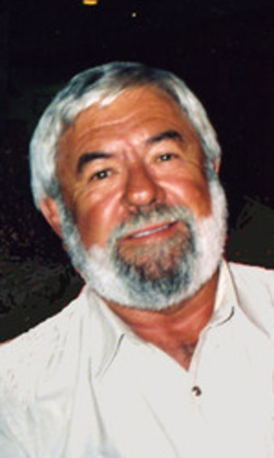
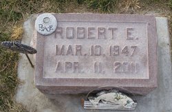
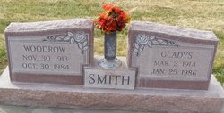
Robert E. “Bob” Smith
| Birth | : | 10 Mar 1947 Lexington, Dawson County, Nebraska, USA |
| Death | : | 11 Apr 2011 Kansas City, Jackson County, Missouri, USA |
| Burial | : | Ormans Cemetery, Benton County, USA |
| Coordinate | : | 34.7999992, -89.1016998 |
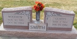
| Description | : | Robert E. "Bob" Smith, 64, of Olathe, Kan., died Monday, April 11, 2011, at KC Hospice House in Kansas City. Bob was born March 10, 1947, in Lexington, Neb., to Woodrow and Gladys (Miller) Smith. On June 20, 1977, he married Suzanne Akers in Olathe. Survivors include his wife; sister, Sherry Brennan of Overton; brother, Tim Smith of Overton; and many nephews and nieces. Bob grew up in Overton but spent the last 26 years in Olathe. Bob served in the U.S. Navy. He was employed by Contract Trucking. He was a member of First Christian Church of Olathe. Bob was an... Read More |
frequently asked questions (FAQ):
-
Where is Robert E. “Bob” Smith's memorial?
Robert E. “Bob” Smith's memorial is located at: Ormans Cemetery, Benton County, USA.
-
When did Robert E. “Bob” Smith death?
Robert E. “Bob” Smith death on 11 Apr 2011 in Kansas City, Jackson County, Missouri, USA
-
Where are the coordinates of the Robert E. “Bob” Smith's memorial?
Latitude: 34.7999992
Longitude: -89.1016998
Family Members:
Parent
Siblings
Flowers:
Nearby Cemetories:
1. Ormans Cemetery
Benton County, USA
Coordinate: 34.7999992, -89.1016998
2. Babbs Cemetery
Alamo, Crockett County, USA
Coordinate: 34.8043170, -89.0901190
3. Old Boone Noris Cemetery
Ripley, Tippah County, USA
Coordinate: 34.8141100, -89.0788400
4. Friendship Cemetery
Benton County, USA
Coordinate: 34.8241997, -89.1110992
5. Whittentown Baptist Church Cemetery
Whitten Town, Tippah County, USA
Coordinate: 34.7780991, -89.0789032
6. Rainey Cemetery
Ashland, Benton County, USA
Coordinate: 34.7700100, -89.1041100
7. Shelby Creek Cemetery
Tippah County, USA
Coordinate: 34.7710991, -89.0877991
8. Curtis Creek Cemetery
Benton County, USA
Coordinate: 34.7682991, -89.1066971
9. Jones Cemetery
Whitten Town, Tippah County, USA
Coordinate: 34.7793312, -89.0611496
10. Simpson Cemetery
Ashland, Benton County, USA
Coordinate: 34.7640495, -89.1311569
11. Pleasant Hill Cemetery
Ashland, Benton County, USA
Coordinate: 34.7844009, -89.1577988
12. Beech Hill Church of Christ Cemetery
Ashland, Benton County, USA
Coordinate: 34.7503014, -89.0947037
13. Vaughan-Pettypool Cemetery
Ashland, Benton County, USA
Coordinate: 34.8230610, -89.1594920
14. Old Beech Hill Church of Christ Cemetery
Benton County, USA
Coordinate: 34.7459717, -89.0966034
15. Hopkins Cemetery
Ashland, Benton County, USA
Coordinate: 34.8210983, -89.0355988
16. New Hope Cemetery
Ashland, Benton County, USA
Coordinate: 34.8588982, -89.0922012
17. Tate Cemetery
Benton County, USA
Coordinate: 34.8619003, -89.1033020
18. Shady Grove Baptist Church Cemetery
Ripley, Tippah County, USA
Coordinate: 34.7505989, -89.0522003
19. Brown Cemetery
Benton County, USA
Coordinate: 34.8421400, -89.1618200
20. Ashland Church of Christ Cemetery
Benton County, USA
Coordinate: 34.8331800, -89.1704700
21. McDonald Cemetery #3
Benton County, USA
Coordinate: 34.7646200, -89.1698670
22. Mount Zion Cemetery
Benton County, USA
Coordinate: 34.8630981, -89.0689011
23. Duncan Cemetery
Benton County, USA
Coordinate: 34.7308311, -89.1072235
24. Ashland Cemetery
Ashland, Benton County, USA
Coordinate: 34.8372002, -89.1733017

