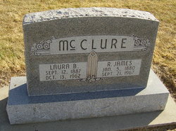
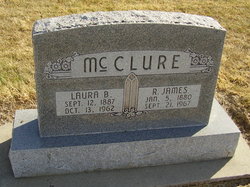
Robert James McClure
| Birth | : | 5 Jan 1880 McLean County, Illinois, USA |
| Death | : | 21 Sep 1967 Blue Hill, Webster County, Nebraska, USA |
| Burial | : | Assumption Catholic Cemetery, Mississauga, Peel Regional Municipality, Canada |
| Coordinate | : | 43.6644287, -79.6821289 |
| Plot | : | SW section Lot 25 |
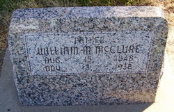
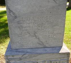
| Description | : | R. James McClure Obituary Robert James McClure, son of William M. and Lida Rose Heagler McClure, was born on January 5, 1880, in McLean County, Ill. He came with his father to Nebraska in 1884 and they lived on the family farm three miles west and one half mile south of Blue Hill. His early schooling was secured in the Cloverton School, and he later attended the Grand Island Business School. He was married to Luara Belle Burroughs on September 23, 1908. He and his bride moved onto a farm near Gibbon immediately after their marriage, and in 1914 moved to a farm... Read More |
frequently asked questions (FAQ):
-
Where is Robert James McClure's memorial?
Robert James McClure's memorial is located at: Assumption Catholic Cemetery, Mississauga, Peel Regional Municipality, Canada.
-
When did Robert James McClure death?
Robert James McClure death on 21 Sep 1967 in Blue Hill, Webster County, Nebraska, USA
-
Where are the coordinates of the Robert James McClure's memorial?
Latitude: 43.6644287
Longitude: -79.6821289
Family Members:
Parent
Spouse
Children
Flowers:
Nearby Cemetories:
1. Assumption Catholic Cemetery
Mississauga, Peel Regional Municipality, Canada
Coordinate: 43.6644287, -79.6821289
2. King's Cemetery
Mississauga, Peel Regional Municipality, Canada
Coordinate: 43.6770600, -79.6766900
3. Moore's Cemetery
Mississauga, Peel Regional Municipality, Canada
Coordinate: 43.6855100, -79.6622300
4. Derry West Cemetery
Mississauga, Peel Regional Municipality, Canada
Coordinate: 43.6456560, -79.7072320
5. Trinity Wesleyan Methodist Cemetery
Hanlan, Peel Regional Municipality, Canada
Coordinate: 43.6558490, -79.6467698
6. Cheyne Cemetery
Brampton, Peel Regional Municipality, Canada
Coordinate: 43.6580520, -79.7219820
7. Britannia United Church Cemetery
Mississauga, Peel Regional Municipality, Canada
Coordinate: 43.6259995, -79.6787033
8. Meadowvale Cemetery
Brampton, Peel Regional Municipality, Canada
Coordinate: 43.6415300, -79.7474000
9. Old Grahamsville Cemetery
Brampton, Peel Regional Municipality, Canada
Coordinate: 43.7184900, -79.6854700
10. Brampton Cemetery
Brampton, Peel Regional Municipality, Canada
Coordinate: 43.6928400, -79.7546800
11. Churchville Cemetery
Churchville, Peel Regional Municipality, Canada
Coordinate: 43.6390900, -79.7601800
12. Brampton Pioneer Cemetery
Brampton, Peel Regional Municipality, Canada
Coordinate: 43.6940300, -79.7706100
13. Burnhamthorpe Cemetery
Mississauga, Peel Regional Municipality, Canada
Coordinate: 43.6221201, -79.6024919
14. Sharon United Church Cemetery
Etobicoke, Toronto Municipality, Canada
Coordinate: 43.7205401, -79.6080869
15. Richview Cemetery
Etobicoke, Toronto Municipality, Canada
Coordinate: 43.6704270, -79.5750900
16. Eventide Cemetery
Brampton, Peel Regional Municipality, Canada
Coordinate: 43.7000500, -79.7825500
17. Renforth Baptist Church Cemetery
Toronto, Toronto Municipality, Canada
Coordinate: 43.6435432, -79.5728149
18. Mount Olivet Cemetery
Brampton, Peel Regional Municipality, Canada
Coordinate: 43.7304020, -79.7491950
19. Lundy Burying Ground
Brampton, Peel Regional Municipality, Canada
Coordinate: 43.7306800, -79.7496900
20. Trinity Anglican Church Cemetery
Mississauga, Peel Regional Municipality, Canada
Coordinate: 43.5846809, -79.7178698
21. St. Joseph's Cemetery
Mississauga, Peel Regional Municipality, Canada
Coordinate: 43.5812300, -79.7019050
22. Streetsville Public Cemetery
Mississauga, Peel Regional Municipality, Canada
Coordinate: 43.5802626, -79.7035682
23. Stonehouse Burying Grounds
Etobicoke, Toronto Municipality, Canada
Coordinate: 43.6807365, -79.5655746
24. Mount Peace Cemetery
Mississauga, Peel Regional Municipality, Canada
Coordinate: 43.5984500, -79.6058900

