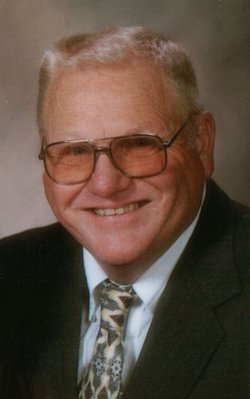
Robert William “Red” Lane Sr.
| Birth | : | 23 Mar 1936 Davenport, Scott County, Iowa, USA |
| Death | : | 1 Sep 2012 Dubuque, Dubuque County, Iowa, USA |
| Burial | : | Mount Hope Cemetery, Maquoketa, Jackson County, USA |
| Coordinate | : | 42.0615616, -90.6619720 |
| Description | : | ROBERT W. LANE, Sr. Mar. 23, 1936 ~ Sept. 1, 2012 Robert W. "Red" Lane, 76, of Maquoketa, Iowa, died on Saturday evening, September 1, 2012, at Mercy Hospital in Dubuque, Iowa. A celebration of Robert's life will be held at 10:30 A.M., Wednesday, September 5, 2012, from the Carson Celebration of Life Center in Maquoketa, Iowa. Visitation will be held from 4 to 7 P.M. on Tuesday, September 4, 2012 from the Carson Celebration of Life Center in Maquoketa, Iowa. Burial will be at the Mount Hope Cemetery, Maquoketa, Iowa. Robert W. "Red" Lane was born on March 23, 1936 in... Read More |
frequently asked questions (FAQ):
-
Where is Robert William “Red” Lane Sr.'s memorial?
Robert William “Red” Lane Sr.'s memorial is located at: Mount Hope Cemetery, Maquoketa, Jackson County, USA.
-
When did Robert William “Red” Lane Sr. death?
Robert William “Red” Lane Sr. death on 1 Sep 2012 in Dubuque, Dubuque County, Iowa, USA
-
Where are the coordinates of the Robert William “Red” Lane Sr.'s memorial?
Latitude: 42.0615616
Longitude: -90.6619720
Family Members:
Spouse
Flowers:
Nearby Cemetories:
1. Mount Hope Cemetery
Maquoketa, Jackson County, USA
Coordinate: 42.0615616, -90.6619720
2. Sacred Heart Cemetery
Maquoketa, Jackson County, USA
Coordinate: 42.0583496, -90.6617966
3. Bridgeport Cemetery
Maquoketa, Jackson County, USA
Coordinate: 42.0906000, -90.6267000
4. Union Cemetery
Brookfield Township, Clinton County, USA
Coordinate: 42.0182991, -90.6694031
5. Goddard Cemetery
Maquoketa, Jackson County, USA
Coordinate: 42.0391998, -90.7335968
6. Codfish Hollow Cemetery
Maquoketa, Jackson County, USA
Coordinate: 42.0727997, -90.5793991
7. Tilton Cemetery
Jackson County, USA
Coordinate: 42.1236000, -90.6798000
8. Buckhorn Waterford Cemetery
Buckhorn, Jackson County, USA
Coordinate: 42.0607986, -90.7517014
9. Saint Patrick's Cemetery
Delmar, Clinton County, USA
Coordinate: 42.0036011, -90.6149979
10. Esgate Cemetery
Maquoketa, Jackson County, USA
Coordinate: 42.1292000, -90.7142029
11. Rathbun Cemetery
Maquoketa, Jackson County, USA
Coordinate: 42.0402000, -90.5570000
12. Evergreen Cemetery
Delmar, Clinton County, USA
Coordinate: 41.9897003, -90.6057968
13. Elwood Cemetery
Elwood, Clinton County, USA
Coordinate: 41.9935989, -90.7307968
14. Risinger Cemetery
Andrew, Jackson County, USA
Coordinate: 42.1241787, -90.5548475
15. Union Center Cemetery
Maquoketa, Jackson County, USA
Coordinate: 42.0546989, -90.5246964
16. Saint Johns Catholic Cemetery
Andrew, Jackson County, USA
Coordinate: 42.1509760, -90.5888680
17. Andrew Cemetery
Andrew, Jackson County, USA
Coordinate: 42.1519430, -90.5895330
18. Busch Cemetery
Clinton County, USA
Coordinate: 41.9996986, -90.7818985
19. Pence Cemetery
Baldwin, Jackson County, USA
Coordinate: 42.0746994, -90.8106003
20. East Iron Hill Cemetery
Farmers Creek Township, Jackson County, USA
Coordinate: 42.1465797, -90.7591019
21. Sutton Cemetery
Fulton, Jackson County, USA
Coordinate: 42.1677000, -90.7143000
22. West Iron Hill Cemetery
Jackson County, USA
Coordinate: 42.1460000, -90.7686000
23. Bloomfield Cemetery
Clinton County, USA
Coordinate: 41.9458008, -90.6194000
24. Springbrook Amish-Mennonite Cemetery
Bellevue, Jackson County, USA
Coordinate: 42.1570340, -90.5515440


