
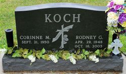
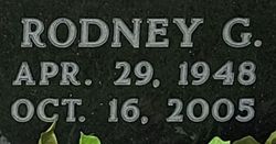
Rodney Gene Koch
| Birth | : | 29 Apr 1948 Beatrice, Gage County, Nebraska, USA |
| Death | : | 16 Oct 2005 Beatrice, Gage County, Nebraska, USA |
| Burial | : | Renjoji-temple, Fujieda-shi, Japan |
| Coordinate | : | 34.8730740, 138.2592090 |
| Description | : | Rodney G. Koch, 57, Beatrice, died Sunday night, Oct. 16, 2005, after a four-year battle with non-Hodgkin's Lymphoma. He was born April 29, 1948, in Beatrice, and was raised on a farm west of Clatonia. He was a 1966 graduate of Wilber-Clatonia High School and a 1971 graduate of the University of Nebraska-Lincoln with a Bachelors degree in finance. He lived in the Clatonia and Beatrice areas most of his life, moving to Beatrice in 1977. He and Corinne Wood were married on May 14, 1971, in Wilber. He was a member of the U.S. Army Reserves for seven years;... Read More |
frequently asked questions (FAQ):
-
Where is Rodney Gene Koch's memorial?
Rodney Gene Koch's memorial is located at: Renjoji-temple, Fujieda-shi, Japan.
-
When did Rodney Gene Koch death?
Rodney Gene Koch death on 16 Oct 2005 in Beatrice, Gage County, Nebraska, USA
-
Where are the coordinates of the Rodney Gene Koch's memorial?
Latitude: 34.8730740
Longitude: 138.2592090
Family Members:
Parent

Flowers:


Nearby Cemetories:
1. Renjoji-temple
Fujieda-shi, Japan
Coordinate: 34.8730740, 138.2592090
2. Daikeiji-temple
Fujieda-shi, Japan
Coordinate: 34.8698810, 138.2540760
3. Seiganji-temple
Shizuoka-shi, Japan
Coordinate: 34.9479080, 138.3268560
4. Saifukuji-temple
Shizuoka-shi, Japan
Coordinate: 34.9720840, 138.3751420
5. Kenkoin-temple
Shizuoka-shi, Japan
Coordinate: 34.9761290, 138.3751280
6. Zozenji-temple
Shizuoka-shi, Japan
Coordinate: 35.0011510, 138.3447830
7. Hotaiji-temple
Shizuoka-shi, Japan
Coordinate: 34.9743620, 138.3892700
8. Keyoin-temple
Shizuoka-shi, Japan
Coordinate: 34.9766720, 138.3909460
9. Rinzaiji-temple
Shizuoka-shi, Japan
Coordinate: 34.9928660, 138.3757530
10. Kutsunoya Cemetery
Shizuoka-shi, Japan
Coordinate: 34.9841310, 138.3974430
11. Shizuoka Army Cemetery
Shizuoka-shi, Japan
Coordinate: 34.9885000, 138.4003890
12. Atago Cemetery
Shizuoka-shi, Japan
Coordinate: 34.9928020, 138.4104730
13. Kunōzan Tōshō-gū
Shizuoka-shi, Japan
Coordinate: 34.9647420, 138.4676420
14. Kozutsumiyama Park
Makinohara-shi, Japan
Coordinate: 34.6803120, 138.1952820
15. Shinnyoji-temple
Kakegawa-shi, Japan
Coordinate: 34.7754490, 138.0205350
16. Tesshuji-temple
Shizuoka-shi, Japan
Coordinate: 34.9926840, 138.4830530
17. Tennen-ji Temple Cemetery
Kakegawa-shi, Japan
Coordinate: 34.7742580, 138.0181340
18. Ryuminji-temple
Kakegawa-shi, Japan
Coordinate: 34.6849190, 137.9859120
19. Kasuisai-temple
Fukuroi-shi, Japan
Coordinate: 34.7749500, 137.9200190
20. Hongenji-temple
Kakegawa-shi, Japan
Coordinate: 34.6876280, 137.9786040
21. Senyoji-temple
Kakegawa-shi, Japan
Coordinate: 34.6878660, 137.9676490
22. Kaizoji-temple
Fukuroi-shi, Japan
Coordinate: 34.7585740, 137.9106860
23. Sairaiin-temple
Hamamatsu-shi, Japan
Coordinate: 34.7133790, 137.7162730
24. Ryotanji-temple
Hamamatsu-shi, Japan
Coordinate: 34.8283840, 137.6681170