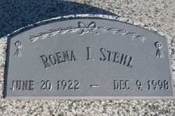
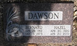
Roena Isadora Dawson Stehl
| Birth | : | 20 Jun 1922 |
| Death | : | 9 Dec 1998 |
| Burial | : | Hope Lutheran Cemetery, Smithfield, Gosper County, USA |
| Coordinate | : | 40.5667500, -99.6800000 |
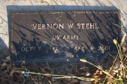
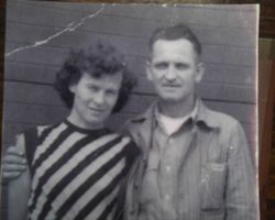
| Description | : | Married to Arlie Reiter he was killed in action in late 1944 during World War II. Married 1956 Vernon Stehl they then reside on a farm south of Hope Lutheran Church in Gosper County, Nebraska. |
frequently asked questions (FAQ):
-
Where is Roena Isadora Dawson Stehl's memorial?
Roena Isadora Dawson Stehl's memorial is located at: Hope Lutheran Cemetery, Smithfield, Gosper County, USA.
-
When did Roena Isadora Dawson Stehl death?
Roena Isadora Dawson Stehl death on 9 Dec 1998 in
-
Where are the coordinates of the Roena Isadora Dawson Stehl's memorial?
Latitude: 40.5667500
Longitude: -99.6800000
Family Members:
Parent
Spouse
Siblings
Children
Flowers:
Nearby Cemetories:
1. Hope Lutheran Cemetery
Smithfield, Gosper County, USA
Coordinate: 40.5667500, -99.6800000
2. Keely Cemetery
Smithfield, Gosper County, USA
Coordinate: 40.5727500, -99.6563500
3. Immanuel Cemetery
Bertrand, Phelps County, USA
Coordinate: 40.5682983, -99.6283035
4. Highland Cemetery
Bertrand, Phelps County, USA
Coordinate: 40.5194016, -99.6430969
5. Yoder Cemetery
Smithfield, Gosper County, USA
Coordinate: 40.4957000, -99.6845500
6. Sandstrom Cemetery
Phelps County, USA
Coordinate: 40.5983009, -99.5661011
7. Adullam Cemetery
Bertrand, Phelps County, USA
Coordinate: 40.6265000, -99.5856000
8. Robb Cemetery
Smithfield, Gosper County, USA
Coordinate: 40.6710691, -99.6996001
9. Quakerville Cemetery
Gosper County, USA
Coordinate: 40.6189003, -99.8097000
10. Fairfield Cemetery
Gosper County, USA
Coordinate: 40.4672012, -99.7549973
11. Plum Creek Massacre Cemetery
Phelps County, USA
Coordinate: 40.6726840, -99.6058220
12. Elwood Cemetery
Elwood, Gosper County, USA
Coordinate: 40.5999300, -99.8397300
13. Loomis Cemetery
Loomis, Phelps County, USA
Coordinate: 40.4801860, -99.5128300
14. Platte Valley Cemetery
Phelps County, USA
Coordinate: 40.6425018, -99.5028000
15. Shaw Cemetery
Phelps County, USA
Coordinate: 40.4303017, -99.5781021
16. Zion Cemetery
Gosper County, USA
Coordinate: 40.4085999, -99.7005997
17. Homerville Cemetery
Gosper County, USA
Coordinate: 40.4668999, -99.8593979
18. Williamsburg Cemetery
Phelps County, USA
Coordinate: 40.6490290, -99.4543150
19. McGuire Cemetery
Gosper County, USA
Coordinate: 40.4380989, -99.8664017
20. Moses Hill Cemetery
Loomis, Phelps County, USA
Coordinate: 40.5104490, -99.4388600
21. Evergreen Cemetery
Lexington, Dawson County, USA
Coordinate: 40.7639008, -99.6791992
22. Overton Cemetery
Overton, Dawson County, USA
Coordinate: 40.7317009, -99.5222015
23. Immanuel Lutheran Cemetery
Elwood, Gosper County, USA
Coordinate: 40.4206500, -99.8672000
24. Pleasant Grove Cemetery
Gosper County, USA
Coordinate: 40.4664001, -99.9250031


