
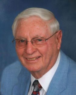
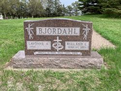
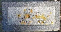
Rolland LeRoy “Ronnie” Bjordahl
| Birth | : | 23 Dec 1930 Kingsbury County, South Dakota, USA |
| Death | : | 13 Dec 2021 Milbank, Grant County, South Dakota, USA |
| Burial | : | De Smet Cemetery, De Smet, Kingsbury County, USA |
| Coordinate | : | 44.3683014, -97.5706024 |
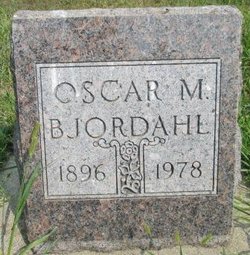
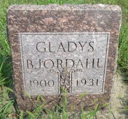
| Description | : | Rolland (Ronnie) LeRoy Bjordahl, a third-generation farmer, died on December 13, 2021, ten days before his 91st birthday. Rolland was born December 23, 1930, to Oscar and Gladys (Guse) Bjordahl, on a farm east of Erwin, SD. In 1931, his mother died, leaving his father to raise seven children. In 1935, the family moved to a farm four miles south of Erwin, which remains the family farm today. In 1945, his father married Hilda McKnight, adding two more children, James and Jean, to the family. After graduating from De Smet High School, Ronnie joined the National Guard in 1948.... Read More |
frequently asked questions (FAQ):
-
Where is Rolland LeRoy “Ronnie” Bjordahl's memorial?
Rolland LeRoy “Ronnie” Bjordahl's memorial is located at: De Smet Cemetery, De Smet, Kingsbury County, USA.
-
When did Rolland LeRoy “Ronnie” Bjordahl death?
Rolland LeRoy “Ronnie” Bjordahl death on 13 Dec 2021 in Milbank, Grant County, South Dakota, USA
-
Where are the coordinates of the Rolland LeRoy “Ronnie” Bjordahl's memorial?
Latitude: 44.3683014
Longitude: -97.5706024
Family Members:
Parent
Siblings

Flowers:


Nearby Cemetories:
1. De Smet Cemetery
De Smet, Kingsbury County, USA
Coordinate: 44.3683014, -97.5706024
2. Saint Thomas Catholic Cemetery
De Smet, Kingsbury County, USA
Coordinate: 44.3683300, -97.5689200
3. Saint Peter Cemetery
De Smet, Kingsbury County, USA
Coordinate: 44.3046000, -97.5313000
4. Manchester Cemetery
Manchester, Kingsbury County, USA
Coordinate: 44.3701930, -97.7125530
5. Dow Cemetery
Manchester, Kingsbury County, USA
Coordinate: 44.3112200, -97.6930700
6. Lake Preston Cemetery
Lake Preston, Kingsbury County, USA
Coordinate: 44.3630981, -97.4096985
7. Spirit Lake Cemetery
De Smet, Kingsbury County, USA
Coordinate: 44.4845900, -97.5327000
8. West Bethany Lutheran Church Cemetery
Erwin, Kingsbury County, USA
Coordinate: 44.4990770, -97.5117300
9. Spirit Lake Church Cemetery
De Smet, Kingsbury County, USA
Coordinate: 44.5130257, -97.6345255
10. Erwin Cemetery
Erwin, Kingsbury County, USA
Coordinate: 44.4989014, -97.4586029
11. Odden Cemetery
Kingsbury County, USA
Coordinate: 44.4197006, -97.3302994
12. Esmond Cemetery
Esmond, Kingsbury County, USA
Coordinate: 44.2578000, -97.7728000
13. Cloverleaf Colony Cemetery
Howard, Miner County, USA
Coordinate: 44.1858368, -97.5361023
14. LeSueur Cemetery
Bancroft, Kingsbury County, USA
Coordinate: 44.5064011, -97.7536011
15. Saint Pauls Catholic Cemetery
Iroquois, Kingsbury County, USA
Coordinate: 44.3679500, -97.8370300
16. Maplewood Cemetery
Iroquois, Kingsbury County, USA
Coordinate: 44.3679000, -97.8385100
17. Bethania Cemetery
Kingsbury County, USA
Coordinate: 44.4968987, -97.3688965
18. North Preston Lutheran Cemetery
Lake Preston, Kingsbury County, USA
Coordinate: 44.4407740, -97.3106400
19. Trinity Lutheran Cemetery
Oldham, Kingsbury County, USA
Coordinate: 44.2231500, -97.3714160
20. Clara Cemetery
Hartland Township, Kingsbury County, USA
Coordinate: 44.5404000, -97.4095000
21. Clara Lutheran Church Cemetery
Hartland Township, Kingsbury County, USA
Coordinate: 44.5286300, -97.3864100
22. Sacred Heart Cemetery
Carthage, Miner County, USA
Coordinate: 44.1824989, -97.7089005
23. Trinity Lutheran Cemetery New
Carthage, Miner County, USA
Coordinate: 44.1812172, -97.7092285
24. Hinderlie Cemetery
Kingsbury County, USA
Coordinate: 44.4488983, -97.2893982