| Birth | : | 21 Feb 1933 Anita, Cass County, Iowa, USA |
| Death | : | 1 Nov 2000 Council Bluffs, Pottawattamie County, Iowa, USA |
| Burial | : | Exira Cemetery, Exira, Audubon County, USA |
| Coordinate | : | 41.5953636, -94.8654785 |
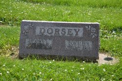
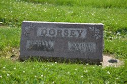
| Description | : | Ronald Wayne Dorsey, 67, died Wednesday, November 1, 2000 at the Jenny Edmondson Memorial Hospital in Council Bluffs. The son of Donald Heath and Hester LaVerne Hayter Dorsey, Ronald was born on February 21, 1933 north of Anita where he grew up and graduated from Anita high school in 1951. He was married to June M. Hackwell on January 19, 1952 in Anita. Following marriage they lived north of Anita until moving to the Atlantic area in the late 1950s. He farmed, sold Pete's feed and later sold insurance. On May 5, 1999 he was married to Patricia "Pat" Kincaid... Read More |
frequently asked questions (FAQ):
-
Where is Ronald Wayne Dorsey's memorial?
Ronald Wayne Dorsey's memorial is located at: Exira Cemetery, Exira, Audubon County, USA.
-
When did Ronald Wayne Dorsey death?
Ronald Wayne Dorsey death on 1 Nov 2000 in Council Bluffs, Pottawattamie County, Iowa, USA
-
Where are the coordinates of the Ronald Wayne Dorsey's memorial?
Latitude: 41.5953636
Longitude: -94.8654785
Family Members:
Parent
Spouse
Siblings
Nearby Cemetories:
1. Exira Cemetery
Exira, Audubon County, USA
Coordinate: 41.5953636, -94.8654785
2. Holy Trinity Cemetery
Exira, Audubon County, USA
Coordinate: 41.5905991, -94.8641968
3. Oakfield Cemetery
Oakfield, Audubon County, USA
Coordinate: 41.5362180, -94.9043460
4. Saint John's Cemetery
Exira, Audubon County, USA
Coordinate: 41.5914670, -94.9547750
5. Grove Cemetery
Oakfield, Audubon County, USA
Coordinate: 41.5462000, -94.7952000
6. Hamlin Lutheran Cemetery
Hamlin, Audubon County, USA
Coordinate: 41.6685000, -94.8995000
7. Adventist Cemetery
Exira, Audubon County, USA
Coordinate: 41.6164017, -94.9697037
8. Highland Cemetery
Audubon County, USA
Coordinate: 41.5113983, -94.8581009
9. Bowen Cemetery
Audubon, Audubon County, USA
Coordinate: 41.5113600, -94.8585700
10. Highland Cemetery
Cass County, USA
Coordinate: 41.4907990, -94.8352966
11. Oak Hill Cemetery
Brayton, Audubon County, USA
Coordinate: 41.5450000, -94.9930000
12. County Farm Cemetery
Audubon County, USA
Coordinate: 41.6953120, -94.9233120
13. Pleasant Hill Cemetery
Audubon County, USA
Coordinate: 41.5806007, -94.7210999
14. Oakfield Baptist Cemetery
Oakfield, Audubon County, USA
Coordinate: 41.5774994, -95.0168991
15. Saint Patricks Cemetery
Audubon, Audubon County, USA
Coordinate: 41.7033005, -94.9242020
16. North Branch Cemetery
Guthrie County, USA
Coordinate: 41.6460000, -94.7222000
17. Pleasant Hill Cemetery
North Branch, Guthrie County, USA
Coordinate: 41.6603012, -94.7236023
18. Saint Johns Cemetery
Brayton, Audubon County, USA
Coordinate: 41.5625000, -94.7019000
19. Saint Johns Lutheran Cemetery
Audubon, Audubon County, USA
Coordinate: 41.5625000, -94.7019000
20. Arlington Heights Cemetery
Audubon, Audubon County, USA
Coordinate: 41.7270000, -94.9240000
21. Maple Grove Cemetery
Audubon, Audubon County, USA
Coordinate: 41.7289100, -94.9242700
22. Elk Horn Cemetery
Elk Horn, Shelby County, USA
Coordinate: 41.5950000, -95.0590000
23. Bethany Lutheran Cemetery
Kimballton, Audubon County, USA
Coordinate: 41.6524410, -95.0530670
24. Melville Township Cemetery
Audubon County, USA
Coordinate: 41.7439003, -94.8013992


