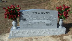
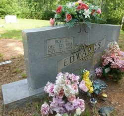
Ronnie Dale Edwards
| Birth | : | 8 Aug 1957 Forsyth County, North Carolina, USA |
| Death | : | 12 Sep 2009 Carroll County, Virginia, USA |
| Burial | : | Calvary Cemetery, Winchendon, Worcester County, USA |
| Coordinate | : | 42.6805992, -72.0318985 |
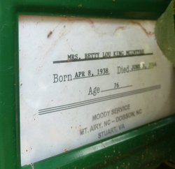
| Description | : | Ronnie Dale Edwards September 12, 2009 Mr. Ronnie Dale Edwards, 52, of Cana, passed away Saturday, September 12, 2009, at his home. Mr. Edwards was born August 8, 1957, in Forsyth County, to Betty King Edwards and the late Roy Ernest Edwards. He worked as the dye house computer room operator for Cross Creek Apparel and was a member of Paul's Creek Baptist Church. Mr. Edwards is survived by his wife, Marilyn King Edwards of the home; his mother and stepfather, Betty and Jack McIntyre of Cana, VA; brothers and sister-in-law, Jeffrey Edwards and Kevin Bradley and Amy Edwards, all of... Read More |
frequently asked questions (FAQ):
-
Where is Ronnie Dale Edwards's memorial?
Ronnie Dale Edwards's memorial is located at: Calvary Cemetery, Winchendon, Worcester County, USA.
-
When did Ronnie Dale Edwards death?
Ronnie Dale Edwards death on 12 Sep 2009 in Carroll County, Virginia, USA
-
Where are the coordinates of the Ronnie Dale Edwards's memorial?
Latitude: 42.6805992
Longitude: -72.0318985
Family Members:
Parent
Flowers:
Nearby Cemetories:
1. Riverside Cemetery
Winchendon, Worcester County, USA
Coordinate: 42.6805992, -72.0263977
2. Massachusetts Veterans Memorial Cemetery
Winchendon, Worcester County, USA
Coordinate: 42.6851300, -72.0185200
3. Old Centre Burial Ground
Winchendon, Worcester County, USA
Coordinate: 42.6617012, -72.0366974
4. Robbins Cemetery
Rindge, Cheshire County, USA
Coordinate: 42.7266670, -72.0638890
5. Robbins Burial Ground
Rindge, Cheshire County, USA
Coordinate: 42.7268982, -72.0658035
6. Rand Cemetery
Rindge, Cheshire County, USA
Coordinate: 42.7350006, -72.0582962
7. New Boston Cemetery
Winchendon, Worcester County, USA
Coordinate: 42.6306000, -72.0860977
8. Hillside Cemetery
Rindge, Cheshire County, USA
Coordinate: 42.7463000, -72.0063900
9. Meeting House Cemetery
Rindge, Cheshire County, USA
Coordinate: 42.7501200, -72.0096700
10. Wood Family Cemetery
Rindge, Cheshire County, USA
Coordinate: 42.7457040, -71.9859410
11. Greenlawn Cemetery
Templeton, Worcester County, USA
Coordinate: 42.6124992, -72.0708008
12. Saint Josephs Cemetery
Gardner, Worcester County, USA
Coordinate: 42.5922012, -72.0391998
13. Wilder Cemetery
Rindge, Cheshire County, USA
Coordinate: 42.7395400, -71.9404900
14. Wildwood Cemetery
Gardner, Worcester County, USA
Coordinate: 42.5896988, -72.0306015
15. Fairbanks Cemetery
Ashburnham, Worcester County, USA
Coordinate: 42.6355220, -71.9236710
16. Meetinghouse Hill Cemetery
Ashburnham, Worcester County, USA
Coordinate: 42.6436900, -71.9176100
17. Saint Johns Cemetery
Gardner, Worcester County, USA
Coordinate: 42.5875015, -72.0207977
18. Notre Dame Cemetery
Gardner, Worcester County, USA
Coordinate: 42.5849991, -72.0222015
19. Riverside Cemetery
Royalston, Worcester County, USA
Coordinate: 42.6302986, -72.1453018
20. Jonas Alliene Cemetery
Royalston, Worcester County, USA
Coordinate: 42.6748790, -72.1656520
21. Cathedral of the Pines Cemetery
Rindge, Cheshire County, USA
Coordinate: 42.7749900, -71.9901800
22. New Cemetery
Ashburnham, Worcester County, USA
Coordinate: 42.6318400, -71.9137400
23. Crystal Lake Cemetery
Gardner, Worcester County, USA
Coordinate: 42.5833015, -71.9957962
24. Lawrence Brook Cemetery
Royalston, Worcester County, USA
Coordinate: 42.6693993, -72.1707993


