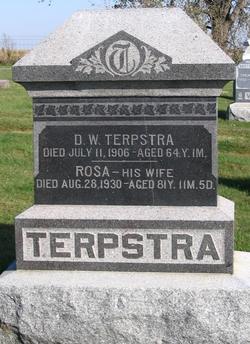
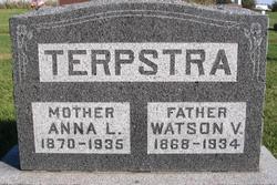
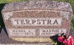
Rosa “Romkje” Napjus Terpstra
| Birth | : | 23 Sep 1848 Friesland, Netherlands |
| Death | : | 28 Aug 1930 Killduff, Jasper County, Iowa, USA |
| Burial | : | Wanbi Cemetery, Wanbi, District Council of Karoonda East Murray, Australia |
| Coordinate | : | -34.7634610, 140.2968910 |
| Inscription | : | Aged 81y 11m 5d |
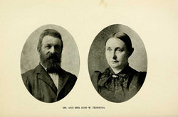
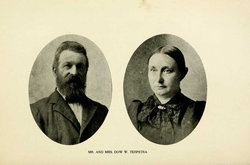
| Description | : | Rosa Napjus, was born 23 Sep 1848, in Friesland, The Netherlands, and she was eight years of age when she emigrated with her parents to the America in 1857, settling near Red Rock in Marion Co. Iowa. Rosa's Dutch name was Romkje, and she was their only child.(She had a sister who died on the trip to America. After one year the family moved into the town of Pella where her parents, Jan (aka John) A. and Rosa (Plantenga) Napjus, ran a general store. ----------------------------------------------- OBITUARY: Unknown newspaper article, found at Monroe Public Library. Mrs. Rosie Terpstra--Mrs. Rosie Terpstra,... Read More |
frequently asked questions (FAQ):
-
Where is Rosa “Romkje” Napjus Terpstra's memorial?
Rosa “Romkje” Napjus Terpstra's memorial is located at: Wanbi Cemetery, Wanbi, District Council of Karoonda East Murray, Australia.
-
When did Rosa “Romkje” Napjus Terpstra death?
Rosa “Romkje” Napjus Terpstra death on 28 Aug 1930 in Killduff, Jasper County, Iowa, USA
-
Where are the coordinates of the Rosa “Romkje” Napjus Terpstra's memorial?
Latitude: -34.7634610
Longitude: 140.2968910
Family Members:
Parent
Spouse
Children
Flowers:
Nearby Cemetories:
1. Wanbi Cemetery
Wanbi, District Council of Karoonda East Murray, Australia
Coordinate: -34.7634610, 140.2968910
2. Alawoona Cemetery
Alawoona, District Council of Loxton Waikerie, Australia
Coordinate: -34.7335890, 140.5090860
3. Galga Cemetery
Waikerie, District Council of Loxton Waikerie, Australia
Coordinate: -34.6889690, 140.0567010
4. Sandalwood Cemetery
Karoonda, District Council of Karoonda East Murray, Australia
Coordinate: -34.9348120, 140.1251510
5. Myrla Lutheran Cemetery
Wunkar, District Council of Loxton Waikerie, Australia
Coordinate: -34.4513750, 140.3225740
6. Taplan Saint John Lutheran Cemetery
Taplan, District Council of Loxton Waikerie, Australia
Coordinate: -34.5455690, 140.0000000
7. Borrika Cemetery
Borrika, District Council of Karoonda East Murray, Australia
Coordinate: -35.0288060, 140.0479410
8. Paruna Cemetery
District Council of Loxton Waikerie, Australia
Coordinate: -34.7251500, 140.7405500
9. Loxton Cemetery
Loxton, District Council of Loxton Waikerie, Australia
Coordinate: -34.4556160, 140.5714420
10. New Residence Trinity Lutheran Church Cemetery
Moorook, District Council of Loxton Waikerie, Australia
Coordinate: -34.3726190, 140.4054430
11. Marama Cemetery
Marama, District Council of Karoonda East Murray, Australia
Coordinate: -35.1763725, 140.1876090
12. Bakara Cemetery
Bakara, District Council of Karoonda East Murray, Australia
Coordinate: -34.6538500, 139.7838500
13. Loxton North Cemetery
Loxton, District Council of Loxton Waikerie, Australia
Coordinate: -34.3939900, 140.6017800
14. Perponda Cemetery
Perponda, District Council of Karoonda East Murray, Australia
Coordinate: -34.9860010, 139.8231380
15. Karoonda Cemetery
District Council of Karoonda East Murray, Australia
Coordinate: -35.0945320, 139.8952480
16. Meribah Cemetery
Meribah, District Council of Loxton Waikerie, Australia
Coordinate: -34.7060680, 140.8637590
17. Moorook Cemetery
Moorook, District Council of Loxton Waikerie, Australia
Coordinate: -34.2919660, 140.3523210
18. Bookpurnong Pilgrims of Zion Lutheran Cemetery
Berri, Berri Barmera Council, Australia
Coordinate: -34.3281160, 140.6062620
19. Barmera Cemetery
Barmera, Berri Barmera Council, Australia
Coordinate: -34.2642300, 140.4435640
20. Kingston on Murray
Kingston, District Council of Loxton Waikerie, Australia
Coordinate: -34.2330100, 140.3493100
21. Nildottie Cemetery
Nildottie, Mid Murray Council, Australia
Coordinate: -34.6780970, 139.6528670
22. Berri General Cemetery
Berri, Berri Barmera Council, Australia
Coordinate: -34.2764387, 140.5888914
23. Bow Hill Cemetery
Bow Hill, Mid Murray Council, Australia
Coordinate: -34.8916840, 139.6343770
24. Bugle Hut Lutheran Cemetery
Loxton, District Council of Loxton Waikerie, Australia
Coordinate: -34.3607730, 140.7801570

