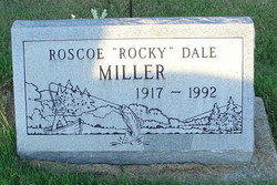
Roscoe Dale “Rocky” Miller
| Birth | : | 23 Dec 1917 Warren County, Indiana, USA |
| Death | : | 9 Sep 1992 Terre Haute, Vigo County, Indiana, USA |
| Burial | : | Mount Pleasant Cemetery, South Portland, Cumberland County, USA |
| Coordinate | : | 43.6356010, -70.2403030 |
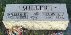
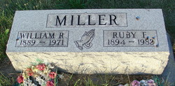
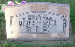
| Description | : | “Roscoe Dale “Rocky” Miller, 74, Terre Haute, died at 6 p.m. September 9, 1992, in a nursing facility at Terre Haute, after a three-year illness. He was born in Warren County, December 23, 1917, the son of William R. and Ruby Flo Cole Miller. He was first married in 1940 to Mildred C. Bowman. He was later married to Mary Morosa. She preceded in death in 1989. He lived at Mountain Home, Arkansas, for 15 years before moving to West Terre Haute in 1990. He was a conservational maintenance engineer for the Parks Department at Mountain... Read More |
frequently asked questions (FAQ):
-
Where is Roscoe Dale “Rocky” Miller's memorial?
Roscoe Dale “Rocky” Miller's memorial is located at: Mount Pleasant Cemetery, South Portland, Cumberland County, USA.
-
When did Roscoe Dale “Rocky” Miller death?
Roscoe Dale “Rocky” Miller death on 9 Sep 1992 in Terre Haute, Vigo County, Indiana, USA
-
Where are the coordinates of the Roscoe Dale “Rocky” Miller's memorial?
Latitude: 43.6356010
Longitude: -70.2403030
Family Members:
Parent
Spouse
Siblings
Children
Flowers:
Nearby Cemetories:
1. Mount Pleasant Cemetery
South Portland, Cumberland County, USA
Coordinate: 43.6356010, -70.2403030
2. Meeting House Hill
South Portland, Cumberland County, USA
Coordinate: 43.6354030, -70.2391200
3. Smith Street Cemetery
South Portland, Cumberland County, USA
Coordinate: 43.6414940, -70.2314440
4. Bay View Cemetery
South Portland Gardens, Cumberland County, USA
Coordinate: 43.6259960, -70.2477840
5. Old Settlers Cemetery
South Portland, Cumberland County, USA
Coordinate: 43.6457110, -70.2274690
6. Micah Dyer Plot
South Portland, Cumberland County, USA
Coordinate: 43.6196650, -70.2554380
7. Fort Scammel
Portland, Cumberland County, USA
Coordinate: 43.6492500, -70.2132800
8. Memorial Garden at Cathedral Church of Saint Luke
Portland, Cumberland County, USA
Coordinate: 43.6523222, -70.2648576
9. First Parish Church
Portland, Cumberland County, USA
Coordinate: 43.6583142, -70.2580524
10. Western Cemetery
Portland, Cumberland County, USA
Coordinate: 43.6450005, -70.2746964
11. Eastern Cemetery
Portland, Cumberland County, USA
Coordinate: 43.6624985, -70.2506027
12. Forest City Cemetery
South Portland, Cumberland County, USA
Coordinate: 43.6333008, -70.2799988
13. Brown's Hill Cemetery
South Portland, Cumberland County, USA
Coordinate: 43.6292114, -70.2839584
14. Brackett Cemetery
Peaks Island, Cumberland County, USA
Coordinate: 43.6523910, -70.2001320
15. Brackett Memorial Cemetery
Peaks Island, Cumberland County, USA
Coordinate: 43.6521930, -70.1998040
16. Highland Memorial Gardens
South Portland, Cumberland County, USA
Coordinate: 43.6166992, -70.2799988
17. 1812 Memorial
Portland, Cumberland County, USA
Coordinate: 43.6704930, -70.2466300
18. Calvary Cemetery
South Portland, Cumberland County, USA
Coordinate: 43.6323100, -70.2902700
19. Ye Olde Trott Burying Ground
Peaks Island, Cumberland County, USA
Coordinate: 43.6576890, -70.1932380
20. Pond Grove Cemetery
Peaks Island, Cumberland County, USA
Coordinate: 43.6585999, -70.1913986
21. Plante Cemetery
Peaks Island, Cumberland County, USA
Coordinate: 43.6563690, -70.1827030
22. Trefethen Cemetery
Peaks Island, Cumberland County, USA
Coordinate: 43.6676040, -70.1929430
23. Grand Trunk Cemetery
East Deering, Cumberland County, USA
Coordinate: 43.6844700, -70.2578790
24. Wescott Cemetery
South Portland, Cumberland County, USA
Coordinate: 43.6244389, -70.3093639

