
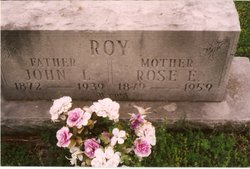
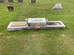
Rosetta “Rose" or "Rosettie” Stewart Roy
| Birth | : | 23 Mar 1879 Willow Springs, Howell County, Missouri, USA |
| Death | : | 3 May 1959 Couch, Oregon County, Missouri, USA |
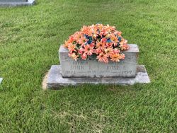
| Burial | : | Tippecanoe Memory Gardens, West Lafayette, Tippecanoe County, USA |
| Coordinate | : | 40.4686012, -86.9377975 |
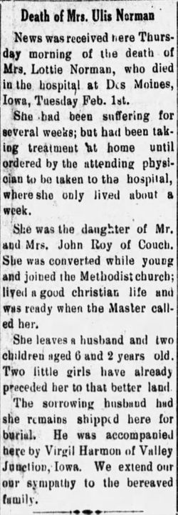
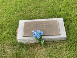
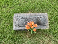
| Description | : | Daughter of Caroline Stewart. 1880 Howell County census has Caroline Stuart and daughter Rosety as boarders at the Wm. A. Stuart household. Married John L. Roy 20/Nov/1892 at Shannon Co., MO. Mother of Lottie, Joseph Thomas, Viola, Lucy M., Lee J., Albert, Amy Maude, Zella, Vena, Waltie Euna and a daughter that was stillborn. Per MO Death certificate #59-014276; burial 05/May/1959. NOTE: Her name is Rosetta Stewart on her husband's death certificate; Rosa Etta Thatcher in her daughter's obituary; her parents are given on her death certificate as Bill Thrasher and Caroline (Unknown). William Thrasher married Caroline Stewart in 1883; Wm Thrasher gave consent... Read More |
frequently asked questions (FAQ):
-
Where is Rosetta “Rose" or "Rosettie” Stewart Roy's memorial?
Rosetta “Rose" or "Rosettie” Stewart Roy's memorial is located at: Tippecanoe Memory Gardens, West Lafayette, Tippecanoe County, USA.
-
When did Rosetta “Rose" or "Rosettie” Stewart Roy death?
Rosetta “Rose" or "Rosettie” Stewart Roy death on 3 May 1959 in Couch, Oregon County, Missouri, USA
-
Where are the coordinates of the Rosetta “Rose" or "Rosettie” Stewart Roy's memorial?
Latitude: 40.4686012
Longitude: -86.9377975
Family Members:
Spouse

Children

Flowers:


Nearby Cemetories:
1. Tippecanoe Memory Gardens
West Lafayette, Tippecanoe County, USA
Coordinate: 40.4686012, -86.9377975
2. Burton Cemetery
Klondike, Tippecanoe County, USA
Coordinate: 40.4679985, -86.9616089
3. Hebron Cemetery
West Lafayette, Tippecanoe County, USA
Coordinate: 40.4893990, -86.9535980
4. Laurel Hill Cemetery
Tippecanoe County, USA
Coordinate: 40.4953499, -86.9200363
5. Indiana Soldiers Home Cemetery
Tippecanoe Township, Tippecanoe County, USA
Coordinate: 40.4720370, -86.8963890
6. County Farm Cemetery
Lafayette, Tippecanoe County, USA
Coordinate: 40.4920800, -86.9089000
7. Grand View Cemetery
West Lafayette, Tippecanoe County, USA
Coordinate: 40.4410310, -86.9095240
8. Pierce Cemetery
Tippecanoe County, USA
Coordinate: 40.4990900, -86.9114600
9. McCormick Cemetery
Wabash Township, Tippecanoe County, USA
Coordinate: 40.4311180, -86.9328620
10. First United Methodist Church Columbarium
West Lafayette, Tippecanoe County, USA
Coordinate: 40.4258940, -86.9377550
11. Purdue University Campus
West Lafayette, Tippecanoe County, USA
Coordinate: 40.4252625, -86.9146957
12. Davis-Higman Cemetery
Lafayette, Tippecanoe County, USA
Coordinate: 40.4587000, -86.8748900
13. Tippecanoe County Poor Farm Cemetery #2
Lafayette, Tippecanoe County, USA
Coordinate: 40.4369700, -86.8836600
14. Burnett Cemetery
Battle Ground, Tippecanoe County, USA
Coordinate: 40.5035706, -86.8866882
15. Greenbush Cemetery
Lafayette, Tippecanoe County, USA
Coordinate: 40.4315872, -86.8854294
16. Saint Joseph Cemetery
Lafayette, Tippecanoe County, USA
Coordinate: 40.4326744, -86.8797073
17. Saint Johns Episcopal Church Memorial Garden
Lafayette, Tippecanoe County, USA
Coordinate: 40.4202900, -86.8902520
18. Spring Vale Cemetery
Lafayette, Tippecanoe County, USA
Coordinate: 40.4486900, -86.8621400
19. Lafayette 1st Burial Ground
Lafayette, Tippecanoe County, USA
Coordinate: 40.4208600, -86.8869900
20. Saint Boniface Cemetery
Lafayette, Tippecanoe County, USA
Coordinate: 40.4459686, -86.8620529
21. Sand Ridge Cemetery
West Lafayette, Tippecanoe County, USA
Coordinate: 40.4081001, -86.9661026
22. Pet Haven Cemetery
Battle Ground, Tippecanoe County, USA
Coordinate: 40.5049350, -86.8681260
23. Tippecanoe County Historical Association Archives
Lafayette, Tippecanoe County, USA
Coordinate: 40.4170650, -86.8855860
24. Saint Mary Cathedral
Lafayette, Tippecanoe County, USA
Coordinate: 40.4177600, -86.8839700