
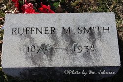
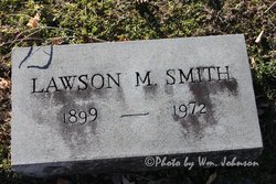
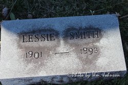
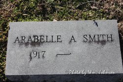
Ruffner Mankin “Ruff” Smith
| Birth | : | 24 Jun 1874 Carroll County, Virginia, USA |
| Death | : | 27 Aug 1938 Mount Airy, Surry County, North Carolina, USA |
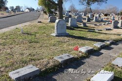
| Burial | : | Tivoli Cemetery, Eagle Lake, Blue Earth County, USA |
| Coordinate | : | 44.1310997, -93.8977966 |
| Description | : | Son of William and Jane (Beamer) Smith. |
frequently asked questions (FAQ):
-
Where is Ruffner Mankin “Ruff” Smith's memorial?
Ruffner Mankin “Ruff” Smith's memorial is located at: Tivoli Cemetery, Eagle Lake, Blue Earth County, USA.
-
When did Ruffner Mankin “Ruff” Smith death?
Ruffner Mankin “Ruff” Smith death on 27 Aug 1938 in Mount Airy, Surry County, North Carolina, USA
-
Where are the coordinates of the Ruffner Mankin “Ruff” Smith's memorial?
Latitude: 44.1310997
Longitude: -93.8977966
Family Members:
Parent

Spouse
Siblings
Children
Flowers:


Nearby Cemetories:
1. Tivoli Cemetery
Eagle Lake, Blue Earth County, USA
Coordinate: 44.1310997, -93.8977966
2. Burgess Cemetery
Eagle Lake, Blue Earth County, USA
Coordinate: 44.1525002, -93.8933029
3. Eagle Lake Cemetery
Eagle Lake, Blue Earth County, USA
Coordinate: 44.1664734, -93.8694916
4. McPherson Union Cemetery
Saint Clair, Blue Earth County, USA
Coordinate: 44.0881004, -93.8722000
5. Immaculate Conception Catholic Cemetery
Saint Clair, Blue Earth County, USA
Coordinate: 44.0797195, -93.8588867
6. Saint Johns Cemetery
Saint Clair, Blue Earth County, USA
Coordinate: 44.0764008, -93.8555984
7. Saint Johns Evangelical Lutheran Cemetery
Saint Clair, Blue Earth County, USA
Coordinate: 44.0782433, -93.8489456
8. Glenwood Cemetery
Mankato, Blue Earth County, USA
Coordinate: 44.1556015, -93.9816971
9. Mount Olivet Cemetery
Mankato, Blue Earth County, USA
Coordinate: 44.1561317, -93.9897385
10. Calvary Cemetery
Mankato, Blue Earth County, USA
Coordinate: 44.1758003, -93.9764023
11. Good Counsel Hill Cemetery
Mankato, Blue Earth County, USA
Coordinate: 44.1825562, -93.9739609
12. Pioneer Memorial Park Cemetery
Mankato, Blue Earth County, USA
Coordinate: 44.1768200, -93.9840000
13. Decoria Cemetery
Blue Earth County, USA
Coordinate: 44.0614014, -93.9589005
14. Dakota Sioux Memorial - 1862
Mankato, Blue Earth County, USA
Coordinate: 44.1677300, -94.0031000
15. Woodland Hills Memorial Park
Mankato, Blue Earth County, USA
Coordinate: 44.1460991, -94.0271988
16. Smiths Mill Cemetery
Smiths Mill, Waseca County, USA
Coordinate: 44.1327782, -93.7641678
17. Sugar Grove Cemetery
Blue Earth County, USA
Coordinate: 44.2289009, -93.8780975
18. Calvary Cemetery
Madison Lake, Blue Earth County, USA
Coordinate: 44.2038994, -93.7977982
19. Pilgrims Rest Cemetery
Mankato, Blue Earth County, USA
Coordinate: 44.2094002, -93.9942017
20. Rapidan Holberg Cemetery
Rapidan, Blue Earth County, USA
Coordinate: 44.1027985, -94.0391998
21. Boehland Family Cemetery
Blue Earth County, USA
Coordinate: 44.2326012, -93.9475021
22. Medo-McPherson Cemetery
Blue Earth County, USA
Coordinate: 44.0219002, -93.8602982
23. Stratton Family Cemetery
Blue Earth County, USA
Coordinate: 44.0503654, -94.0090027
24. Bunker Hill Cemetery
Blue Earth County, USA
Coordinate: 44.0513916, -93.7777786