
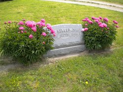
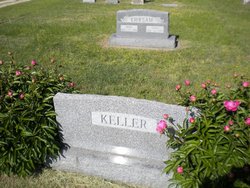
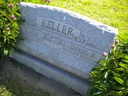
Ruth Anne Buhrer Keller
| Birth | : | 10 Jul 1893 Garfield, Dickinson County, Kansas, USA |
| Death | : | 11 Aug 1985 |
| Burial | : | Mount Hope Cemetery, Enterprise, Dickinson County, USA |
| Coordinate | : | 38.8869019, -97.1121979 |
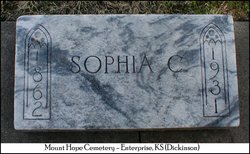
| Description | : | Was foster daughter of Jacob & Sophia Buhrer. ***** Natural parents are Henry Smith and Melissa Jan (Van Ness) Houdyshell. She was born near Garfield. (obit in Junction City Daily Union, Aug 12, 1985) |
frequently asked questions (FAQ):
-
Where is Ruth Anne Buhrer Keller's memorial?
Ruth Anne Buhrer Keller's memorial is located at: Mount Hope Cemetery, Enterprise, Dickinson County, USA.
-
When did Ruth Anne Buhrer Keller death?
Ruth Anne Buhrer Keller death on 11 Aug 1985 in
-
Where are the coordinates of the Ruth Anne Buhrer Keller's memorial?
Latitude: 38.8869019
Longitude: -97.1121979
Family Members:
Parent
Spouse

Siblings
Children
Flowers:


Nearby Cemetories:
1. Mount Hope Cemetery
Enterprise, Dickinson County, USA
Coordinate: 38.8869019, -97.1121979
2. Scheiller Cemetery
Enterprise, Dickinson County, USA
Coordinate: 38.8669014, -97.1106033
3. Pleasant Hill Cemetery
Enterprise, Dickinson County, USA
Coordinate: 38.8885150, -97.0749560
4. Lutheran Cemetery #17
Enterprise, Dickinson County, USA
Coordinate: 38.9009209, -97.0734787
5. Detroit Cemetery
Detroit, Dickinson County, USA
Coordinate: 38.9439300, -97.1255100
6. Farmington Cemetery
Abilene, Dickinson County, USA
Coordinate: 38.8707800, -97.1860200
7. Brown Memorial Cemetery
Abilene, Dickinson County, USA
Coordinate: 38.8755950, -97.1993410
8. Eisenhower Presidential Library and Museum Chapel
Abilene, Dickinson County, USA
Coordinate: 38.9118450, -97.2129410
9. Saint John's Episcopal Church Memorial Garden
Abilene, Dickinson County, USA
Coordinate: 38.9202700, -97.2137300
10. Dwight D. Eisenhower Municipal Building
Abilene, Dickinson County, USA
Coordinate: 38.9191100, -97.2155700
11. Navarre Cemetery
Navarre, Dickinson County, USA
Coordinate: 38.7957115, -97.1080627
12. Riffel Cemetery (Defunct)
Woodbine, Dickinson County, USA
Coordinate: 38.8177986, -97.0342026
13. Abilene Cemetery
Abilene, Dickinson County, USA
Coordinate: 38.9322014, -97.2217026
14. Belle Springs Cemetery
Hope, Dickinson County, USA
Coordinate: 38.7907982, -97.1481018
15. Mount Saint Joseph Cemetery
Abilene, Dickinson County, USA
Coordinate: 38.9442170, -97.2218690
16. Indian Hill Cemetery
Chapman, Dickinson County, USA
Coordinate: 38.9714012, -97.0327988
17. Bethel Cemetery
Moonlight, Dickinson County, USA
Coordinate: 39.0022011, -97.1110535
18. Rinehart Cemetery
Enterprise, Dickinson County, USA
Coordinate: 38.9021988, -96.9638977
19. Saint Patricks Cemetery
Chapman, Dickinson County, USA
Coordinate: 38.9803330, -97.0062850
20. Newbern Cemetery
Holland, Dickinson County, USA
Coordinate: 38.8133011, -97.2427979
21. Ebenezer Baptist Cemetery
Dickinson County, USA
Coordinate: 38.7659569, -97.1696701
22. Langhofer Cemetery
Woodbine, Dickinson County, USA
Coordinate: 38.7905530, -96.9921110
23. Langhofer-Riffel Cemetery
Woodbine, Dickinson County, USA
Coordinate: 38.7835530, -96.9874660
24. Mount Zion Cemetery
Junction City, Geary County, USA
Coordinate: 38.8762000, -96.9267080