Ruth B Wells Walton Hargrave
| Birth | : | 3 Nov 1912 Springville, Linn County, Iowa, USA |
| Death | : | 1981 Monticello, Jones County, Iowa, USA |
| Burial | : | Emmanuel Lutheran Brethren Cemetery, Carbury, Bottineau County, USA |
| Coordinate | : | 48.9441872, -100.5558243 |
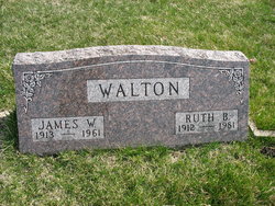
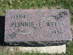
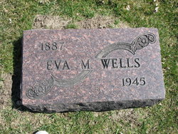
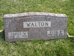
| Description | : | Ruth (Walton) Hargrave - Services for Ruth (Walton) Hargrave, 68, were held Saturday at 11 am in the Congregational Church in Monticello, where she died Wednesday at John McDonald Hospital following a lengthy illness. Interment was in the Springville Cemetery. Ruth Wells was born Nov 3, 1912, the daughter of Plinnie and Eva Wells, Springville. She was married Nov 3, 1930 to James Walton who preceded her in death Mar 31, 1961. She was then married to Glen Hargrave Jan 28, 1967. She was employed as a cook by the Anamosa School district at Martelle... Read More |
frequently asked questions (FAQ):
-
Where is Ruth B Wells Walton Hargrave's memorial?
Ruth B Wells Walton Hargrave's memorial is located at: Emmanuel Lutheran Brethren Cemetery, Carbury, Bottineau County, USA.
-
When did Ruth B Wells Walton Hargrave death?
Ruth B Wells Walton Hargrave death on 1981 in Monticello, Jones County, Iowa, USA
-
Where are the coordinates of the Ruth B Wells Walton Hargrave's memorial?
Latitude: 48.9441872
Longitude: -100.5558243
Family Members:
Parent
Spouse
Siblings
Children
Flowers:
Nearby Cemetories:
1. Emmanuel Lutheran Brethren Cemetery
Carbury, Bottineau County, USA
Coordinate: 48.9441872, -100.5558243
2. Turtle Mountain Lutheran Cemetery
Carbury, Bottineau County, USA
Coordinate: 48.9219017, -100.5730972
3. Bethesda Cemetery
Souris, Bottineau County, USA
Coordinate: 48.9648933, -100.6333923
4. Swedish Lutheran Cemetery
Souris, Bottineau County, USA
Coordinate: 48.9858055, -100.6212158
5. Inherred Lutheran Cemetery
Bottineau, Bottineau County, USA
Coordinate: 48.9209404, -100.4674301
6. Mountain View Cemetery
Souris, Bottineau County, USA
Coordinate: 48.9014015, -100.6750031
7. Manger Cemetery
Carbury, Bottineau County, USA
Coordinate: 48.9385986, -100.4113998
8. Mount Saint Mark Cemetery
Bottineau, Bottineau County, USA
Coordinate: 48.8347015, -100.4610977
9. Nordland Cemetery
Bottineau, Bottineau County, USA
Coordinate: 48.9307327, -100.3609695
10. Goodlands Cemetery
Goodlands, Southwestern Census Division, Canada
Coordinate: 49.0874500, -100.6014700
11. Oak Creek Cemetery
Bottineau, Bottineau County, USA
Coordinate: 48.8197296, -100.4362532
12. Saint Paul Roman Catholic Cemetery
Deloraine, Southwestern Census Division, Canada
Coordinate: 49.0866860, -100.4711380
13. Roth Grave Site
Roth, Bottineau County, USA
Coordinate: 48.9008369, -100.7966385
14. Vinje Cemetery
Bottineau, Bottineau County, USA
Coordinate: 48.8960000, -100.3040000
15. Fish Lake Cemetery
Bottineau, Bottineau County, USA
Coordinate: 48.9427986, -100.2919006
16. Lesje Cemetery
Roth, Bottineau County, USA
Coordinate: 48.9664688, -100.8221359
17. Turtle Mountain Adventist Cemetery
Bottineau, Bottineau County, USA
Coordinate: 48.9490000, -100.2756000
18. Salem Lutheran Cemetery
Bottineau, Bottineau County, USA
Coordinate: 48.9509315, -100.2387238
19. Waskada Cemetery
Waskada, Southwestern Census Division, Canada
Coordinate: 49.0947200, -100.7806100
20. Deloraine Pioneer Cemetery
Deloraine, Southwestern Census Division, Canada
Coordinate: 49.1316680, -100.4049660
21. Zion Cemetery
Landa, Bottineau County, USA
Coordinate: 48.9375000, -100.8942032
22. Tarsus Cemetery
Bottineau, Bottineau County, USA
Coordinate: 48.8036003, -100.2807999
23. Landa Cemetery
Landa, Bottineau County, USA
Coordinate: 48.9077988, -100.9067001
24. Del-Win Cemetery
Deloraine, Southwestern Census Division, Canada
Coordinate: 49.1778180, -100.4885750

