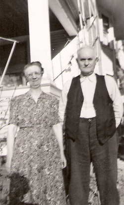
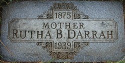
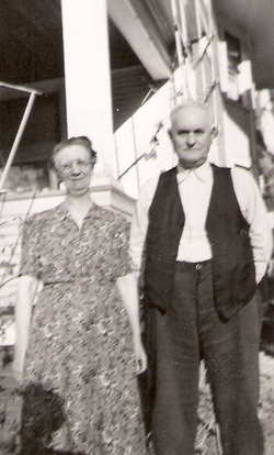
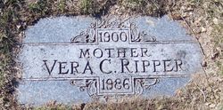
Ruth Bertha Belle Dooley Darrah
| Birth | : | 25 Sep 1875 |
| Death | : | 2 Jan 1939 Ravenna, Buffalo County, Nebraska, USA |
| Burial | : | Shiloh Cemetery, Worcester County, USA |
| Coordinate | : | 38.0974998, -75.4760971 |
| Description | : | Ruth Bertha Belle Dooley was the daughter of John Nelson Dooley and Elvira Catherine Harbold. She married James E. Darrah on November 12, 1895. They were the parents of Glen, Pearl, Vera Catherine, John L. (Roy), and Martha Evelyn. |
frequently asked questions (FAQ):
-
Where is Ruth Bertha Belle Dooley Darrah's memorial?
Ruth Bertha Belle Dooley Darrah's memorial is located at: Shiloh Cemetery, Worcester County, USA.
-
When did Ruth Bertha Belle Dooley Darrah death?
Ruth Bertha Belle Dooley Darrah death on 2 Jan 1939 in Ravenna, Buffalo County, Nebraska, USA
-
Where are the coordinates of the Ruth Bertha Belle Dooley Darrah's memorial?
Latitude: 38.0974998
Longitude: -75.4760971
Family Members:
Parent
Spouse
Siblings
Children
Flowers:
Nearby Cemetories:
1. Shiloh Cemetery
Worcester County, USA
Coordinate: 38.0974998, -75.4760971
2. Old Shiloh Cemetery
Pocomoke City, Worcester County, USA
Coordinate: 38.1044960, -75.4878110
3. Old Shiloh Cemetery
Worcester County, USA
Coordinate: 38.1044006, -75.4882965
4. Saint Lukes Cemetery
Worcester County, USA
Coordinate: 38.0960999, -75.4531021
5. Betheden Cemetery
Worcester County, USA
Coordinate: 38.1114006, -75.4608002
6. Beth Eden - Tilghman Hill Cemetery
Worcester County, USA
Coordinate: 38.1150017, -75.4621964
7. Hancock Cemetery
Worcester County, USA
Coordinate: 38.0783005, -75.4599991
8. Georgetown Baptist Church Cemetery
Snow Hill, Worcester County, USA
Coordinate: 38.0915580, -75.5160020
9. Goodwill Cemetery
Goodwill, Worcester County, USA
Coordinate: 38.0667000, -75.5000000
10. Saint Marks Cemetery
Worcester County, USA
Coordinate: 38.0430984, -75.4569016
11. Bratten Family Plot
Cokesbury, Somerset County, USA
Coordinate: 38.1051500, -75.5504100
12. Mount Zion United Methodist Church Cemetery
Pocomoke City, Worcester County, USA
Coordinate: 38.0762850, -75.5464160
13. First Baptist Cemetery
Pocomoke City, Worcester County, USA
Coordinate: 38.0774220, -75.5471510
14. Church Street Cemetery
Worcester County, USA
Coordinate: 38.0560989, -75.4169006
15. Church Street Cemetery
Stockton, Worcester County, USA
Coordinate: 38.0561904, -75.4164793
16. Home Beneficial Cemetery
Stockton, Worcester County, USA
Coordinate: 38.0542500, -75.4175827
17. Sandy Hill Cemetery
Stockton, Worcester County, USA
Coordinate: 38.0561660, -75.4151950
18. Spring Hill Cemetery
Worcester County, USA
Coordinate: 38.1044006, -75.3961029
19. Waters Cemetery
Mount Vernon, Somerset County, USA
Coordinate: 38.1600000, -75.4600000
20. Wesley Cemetery
Worcester County, USA
Coordinate: 38.0546989, -75.4135971
21. Gunby Presbyterian Church Cemetery
Stockton, Worcester County, USA
Coordinate: 38.0541992, -75.4085999
22. Coolspring United Methodist Church Cemetery
Girdletree, Worcester County, USA
Coordinate: 38.1124992, -75.3908005
23. Holy Name of Jesus Churchyard
Pocomoke City, Worcester County, USA
Coordinate: 38.0626898, -75.5521236
24. Nelson-Stevenson Cemetery
Snow Hill, Worcester County, USA
Coordinate: 38.1436510, -75.4074846

