
| Birth | : | 1 Mar 1911 Harvey County, Kansas, USA |
| Death | : | 11 Sep 2011 Memphis, Scotland County, Missouri, USA |
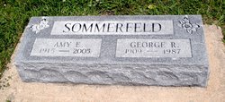
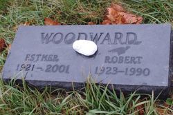
| Burial | : | Sunnyside Cemetery, Milton, Van Buren County, USA |
| Coordinate | : | 40.6690000, -92.1557000 |
| Description | : | Ruth Emily Martin, 100, of Memphis, Missouri, died Sunday morning, September 11, 2011 at Scotland County Hospital in Memphis. She was born March 1, 1911, in Harvey County, Kansas, to Alfred B. and Ethel Jane Boyd Woodward. Ruth was the oldest of eight children and last of her family. She grew up in Harvey County, Kansas and attended Liberty District School and graduated from Moundridge High School, Class 1929. She married Earl Martin, July 30, 1933 and to this union one son was born. Ruth was a homemaker and farm wife. She began taking piano lessons before she started school and played... Read More |
frequently asked questions (FAQ):
-
Where is Ruth Emily Woodward Martin's memorial?
Ruth Emily Woodward Martin's memorial is located at: Sunnyside Cemetery, Milton, Van Buren County, USA.
-
When did Ruth Emily Woodward Martin death?
Ruth Emily Woodward Martin death on 11 Sep 2011 in Memphis, Scotland County, Missouri, USA
-
Where are the coordinates of the Ruth Emily Woodward Martin's memorial?
Latitude: 40.6690000
Longitude: -92.1557000
Family Members:
Parent
Spouse

Siblings
Flowers:


Nearby Cemetories:
1. Sunnyside Cemetery
Milton, Van Buren County, USA
Coordinate: 40.6690000, -92.1557000
2. Stookesberry Cemetery
Milton, Van Buren County, USA
Coordinate: 40.6583607, -92.1668467
3. Oaks Cemetery
Milton, Van Buren County, USA
Coordinate: 40.6797000, -92.1694000
4. Plain View Amish Mennonite Cemetery
Pulaski, Davis County, USA
Coordinate: 40.6775860, -92.1875910
5. Egypt Cemetery
Van Buren County, USA
Coordinate: 40.6712646, -92.1176147
6. Kinnamon Family Cemetery
Milton, Van Buren County, USA
Coordinate: 40.7136180, -92.1968370
7. Oak Point Cemetery
Milton, Van Buren County, USA
Coordinate: 40.7277985, -92.1414032
8. South Prairie Cemetery
Van Buren County, USA
Coordinate: 40.6091995, -92.1493988
9. Pansy Hill Cemetery
Pulaski, Davis County, USA
Coordinate: 40.7214000, -92.2023000
10. Richardson Point Cemetery
Van Buren County, USA
Coordinate: 40.7377200, -92.1499400
11. Maple Grove Cemetery
Cantril, Van Buren County, USA
Coordinate: 40.6385994, -92.0681000
12. Price Cemetery
Cantril, Van Buren County, USA
Coordinate: 40.6028500, -92.1132000
13. Emerick Family Plot
Lebanon, Van Buren County, USA
Coordinate: 40.7305500, -92.1010000
14. Richardson Cemetery
Troy, Davis County, USA
Coordinate: 40.7308770, -92.2114810
15. Wheaton Cemetery
Pulaski, Davis County, USA
Coordinate: 40.7250240, -92.2251816
16. Billups Cemetery
Union Township, Scotland County, USA
Coordinate: 40.5908800, -92.1600800
17. Hubbard Cemetery
Davis County, USA
Coordinate: 40.6222000, -92.2410965
18. Koellner Cemetery
Cantril, Van Buren County, USA
Coordinate: 40.6205700, -92.0694900
19. Ten Eyck Cemetery
Pittsburg, Van Buren County, USA
Coordinate: 40.7282600, -92.0795000
20. Mount Olive Cemetery
Scotland County, USA
Coordinate: 40.5946999, -92.0922012
21. North Bethel Cemetery
Scotland County, USA
Coordinate: 40.5788994, -92.1583023
22. Lebanon Cemetery
Lebanon, Van Buren County, USA
Coordinate: 40.7261009, -92.0635986
23. Smith Cemetery
Bloomfield, Davis County, USA
Coordinate: 40.7263890, -92.2491670
24. Troy Cemetery
Troy, Davis County, USA
Coordinate: 40.7528000, -92.2058029