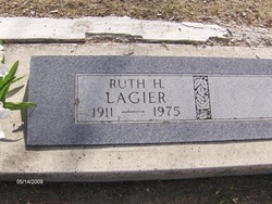
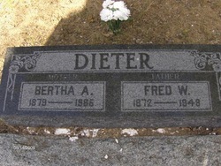
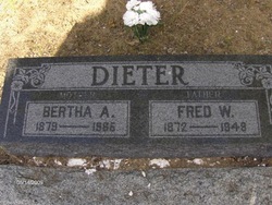
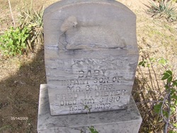
Ruth H. Dieter Lagier
| Birth | : | 15 Nov 1911 Lassen County, California, USA |
| Death | : | Apr 1975 Lassen County, California, USA |
| Burial | : | East Saugatuck Cemetery, Saugatuck, Allegan County, USA |
| Coordinate | : | 42.6818390, -86.0932312 |
frequently asked questions (FAQ):
-
Where is Ruth H. Dieter Lagier's memorial?
Ruth H. Dieter Lagier's memorial is located at: East Saugatuck Cemetery, Saugatuck, Allegan County, USA.
-
When did Ruth H. Dieter Lagier death?
Ruth H. Dieter Lagier death on Apr 1975 in Lassen County, California, USA
-
Where are the coordinates of the Ruth H. Dieter Lagier's memorial?
Latitude: 42.6818390
Longitude: -86.0932312
Family Members:
Parent
Siblings
Flowers:
Nearby Cemetories:
1. East Saugatuck Cemetery
Saugatuck, Allegan County, USA
Coordinate: 42.6818390, -86.0932312
2. Manlius Township Cemetery
Manlius Township, Allegan County, USA
Coordinate: 42.6352770, -86.0883330
3. Woodcock Cemetery
Manlius Township, Allegan County, USA
Coordinate: 42.6456700, -86.0355800
4. Riverside Cemetery
Hamilton, Allegan County, USA
Coordinate: 42.6813000, -86.0049900
5. Gibson Cemetery
Laketown Township, Allegan County, USA
Coordinate: 42.6962520, -86.1839640
6. Riverside Cemetery
Saugatuck, Allegan County, USA
Coordinate: 42.6686211, -86.1924210
7. Overisel Settlers Cemetery
Overisel, Allegan County, USA
Coordinate: 42.7287422, -86.0142589
8. Graafschap Christian Reformed Church Cemetery
Graafschap, Allegan County, USA
Coordinate: 42.7524310, -86.1328970
9. All Saints Memorial Gardens
Saugatuck, Allegan County, USA
Coordinate: 42.6562330, -86.2004740
10. Douglas Cemetery
Douglas, Allegan County, USA
Coordinate: 42.6367111, -86.1881866
11. Overisel Cemetery
Overisel, Allegan County, USA
Coordinate: 42.7318510, -86.0025290
12. Zion Lutheran Church Memorial Garden
Holland, Ottawa County, USA
Coordinate: 42.7692980, -86.1116280
13. Fennville Cemetery
Fennville, Allegan County, USA
Coordinate: 42.5956001, -86.1260986
14. First Presbyterian Church Memorial Gardens
Holland, Ottawa County, USA
Coordinate: 42.7728180, -86.1006290
15. East Holland Cemetery
Fillmore Township, Allegan County, USA
Coordinate: 42.7661018, -86.0436020
16. Hutchins Cemetery
Fennville, Allegan County, USA
Coordinate: 42.5936012, -86.1342010
17. Graafschap Cemetery
Holland, Ottawa County, USA
Coordinate: 42.7694016, -86.1369019
18. Grace Episcopal Church Gardens
Holland, Ottawa County, USA
Coordinate: 42.7763770, -86.1111190
19. Pilgrim Home Cemetery
Holland, Ottawa County, USA
Coordinate: 42.7825012, -86.0894012
20. Henry Clay Alexander Memorial Garden
Douglas, Allegan County, USA
Coordinate: 42.6359000, -86.2180640
21. Central Park Reformed Church Memorial Gardens
Holland, Ottawa County, USA
Coordinate: 42.7747600, -86.1575220
22. Oak Grove Cemetery
Fennville, Allegan County, USA
Coordinate: 42.5797220, -86.0555550
23. Hope Church Memorial Garden
Holland, Ottawa County, USA
Coordinate: 42.7874985, -86.1088867
24. Valley Township Cemetery
Fennville, Allegan County, USA
Coordinate: 42.5863808, -86.0158280

