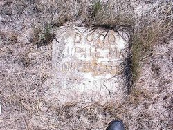
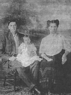
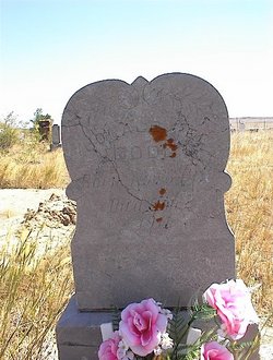
Ruth May Dodd
| Birth | : | 24 Sep 1910 Belle Fourche, Butte County, South Dakota, USA |
| Death | : | 15 Feb 1924 Deadwood, Lawrence County, South Dakota, USA |
| Burial | : | Alzada Cemetery, Alzada, Carter County, USA |
| Coordinate | : | 45.0341988, -104.4182968 |
| Description | : | From The Belle Fourche Bee - Thursday 21 Feb 1924: Ruth May, the 13 year old daughter of Mr and Mrs Charles Dodd of Belle Fourche, died Thursday of last week at the hospital at Deadwood, where she had been receiving treatment for the past few months. The body was taken to Alzada MT where funeral services were held Saturday. She had been suffering from an abcess of the ear for almost two years, and for the past three months her condition had been serious...She is survived by a father and mother, and one brother, Murel. ... Read More |
frequently asked questions (FAQ):
-
Where is Ruth May Dodd's memorial?
Ruth May Dodd's memorial is located at: Alzada Cemetery, Alzada, Carter County, USA.
-
When did Ruth May Dodd death?
Ruth May Dodd death on 15 Feb 1924 in Deadwood, Lawrence County, South Dakota, USA
-
Where are the coordinates of the Ruth May Dodd's memorial?
Latitude: 45.0341988
Longitude: -104.4182968
Family Members:
Parent
Siblings
Flowers:
Nearby Cemetories:
1. Alzada Cemetery
Alzada, Carter County, USA
Coordinate: 45.0341988, -104.4182968
2. Keith Massey Gravesite
Crook County, USA
Coordinate: 44.8269900, -104.4208900
3. Kimball Family Cemetery
Aladdin, Crook County, USA
Coordinate: 44.7177800, -104.2887700
4. Alva Cemetery
Alva, Crook County, USA
Coordinate: 44.6945480, -104.4453690
5. Hulett Cemetery
Hulett, Crook County, USA
Coordinate: 44.6955986, -104.5867004
6. Moore Hill Cemetery
Crook County, USA
Coordinate: 44.7235985, -104.6731033
7. Gustave Cemetery
Camp Crook, Harding County, USA
Coordinate: 45.2724991, -103.9550018
8. New Haven Cemetery
New Haven, Crook County, USA
Coordinate: 44.7256012, -104.8242035
9. Drane Cemetery
Ridge, Carter County, USA
Coordinate: 45.0493990, -105.0167710
10. Ridge Cemetery
Carter County, USA
Coordinate: 45.0261002, -105.0346985
11. Little Missouri Lutheran Cemetery
Carter County, USA
Coordinate: 45.4186000, -104.0820000
12. Ewalt Cemetery
Ridgeway, Carter County, USA
Coordinate: 45.4908333, -104.4786111
13. Capitol Cemetery
Capitol, Carter County, USA
Coordinate: 45.4294014, -104.0513992
14. Rockypoint Cemetery
Rockypoint, Campbell County, USA
Coordinate: 44.9153000, -105.0859000
15. Boyes Cemetery
Carter County, USA
Coordinate: 45.3069000, -105.0025024
16. Tower Cemetery
Devils Tower, Crook County, USA
Coordinate: 44.5651200, -104.6603400
17. Ranch Creek Cemetery
Powder River County, USA
Coordinate: 45.0466995, -105.1782990
18. Riverside Cemetery
Belle Fourche, Butte County, USA
Coordinate: 44.6631012, -103.8636017
19. Beulah Cemetery
Beulah, Crook County, USA
Coordinate: 44.5441550, -104.0754550
20. Saint Paul's Catholic Cemetery
Belle Fourche, Butte County, USA
Coordinate: 44.6461000, -103.8667000
21. Pine Slope Cemetery
Belle Fourche, Butte County, USA
Coordinate: 44.6460991, -103.8666992
22. Short Pines Cemetery
Harding, Harding County, USA
Coordinate: 45.4149720, -103.8088700
23. Minnesela Cemetery
Belle Fourche, Butte County, USA
Coordinate: 44.6549988, -103.8080978
24. Pioneer Cemetery
Carter County, USA
Coordinate: 45.5859560, -104.1484850


