
Ruth Sarah Packard
| Birth | : | 16 Jun 1915 Enterprise, Dickinson County, Kansas, USA |
| Death | : | 14 Apr 1916 Longford, Clay County, Kansas, USA |
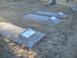
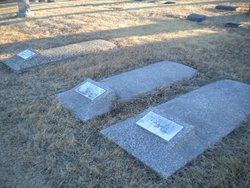
| Burial | : | Mount Hope Cemetery, Enterprise, Dickinson County, USA |
| Coordinate | : | 38.8869019, -97.1121979 |
| Plot | : | B-51 NO MARKER |
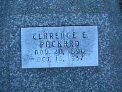
| Description | : | NO Marker ****** Journal 20 Apr 1916 born 16 June 1915 at Enterprise; daughter of Mr. & Mrs. Clarence Packard; died 14 April 1916 at Longford while visiting her grandmother Mrs. Ada Agnew; survived by parents and other relatives. ***** OBITUARY: Ruth Sarah Packard, daughter of Mr. and Mrs. C. E. Packard of Topeka, was born at Enterprise, Kansas, June 16, 1915, and died April 14, 1916, at the home of her grandma, Mrs. Ada Agnew, near Longford. Death was caused by pneumonia, after an illness of about two weeks. Funeral services were held at the home of her grandma Saturday at 12 o'clock and... Read More |
frequently asked questions (FAQ):
-
Where is Ruth Sarah Packard's memorial?
Ruth Sarah Packard's memorial is located at: Mount Hope Cemetery, Enterprise, Dickinson County, USA.
-
When did Ruth Sarah Packard death?
Ruth Sarah Packard death on 14 Apr 1916 in Longford, Clay County, Kansas, USA
-
Where are the coordinates of the Ruth Sarah Packard's memorial?
Latitude: 38.8869019
Longitude: -97.1121979
Family Members:
Parent
Flowers:


Nearby Cemetories:
1. Mount Hope Cemetery
Enterprise, Dickinson County, USA
Coordinate: 38.8869019, -97.1121979
2. Scheiller Cemetery
Enterprise, Dickinson County, USA
Coordinate: 38.8669014, -97.1106033
3. Pleasant Hill Cemetery
Enterprise, Dickinson County, USA
Coordinate: 38.8885150, -97.0749560
4. Lutheran Cemetery #17
Enterprise, Dickinson County, USA
Coordinate: 38.9009209, -97.0734787
5. Detroit Cemetery
Detroit, Dickinson County, USA
Coordinate: 38.9439300, -97.1255100
6. Farmington Cemetery
Abilene, Dickinson County, USA
Coordinate: 38.8707800, -97.1860200
7. Brown Memorial Cemetery
Abilene, Dickinson County, USA
Coordinate: 38.8755950, -97.1993410
8. Eisenhower Presidential Library and Museum Chapel
Abilene, Dickinson County, USA
Coordinate: 38.9118450, -97.2129410
9. Saint John's Episcopal Church Memorial Garden
Abilene, Dickinson County, USA
Coordinate: 38.9202700, -97.2137300
10. Dwight D. Eisenhower Municipal Building
Abilene, Dickinson County, USA
Coordinate: 38.9191100, -97.2155700
11. Navarre Cemetery
Navarre, Dickinson County, USA
Coordinate: 38.7957115, -97.1080627
12. Riffel Cemetery (Defunct)
Woodbine, Dickinson County, USA
Coordinate: 38.8177986, -97.0342026
13. Abilene Cemetery
Abilene, Dickinson County, USA
Coordinate: 38.9322014, -97.2217026
14. Belle Springs Cemetery
Hope, Dickinson County, USA
Coordinate: 38.7907982, -97.1481018
15. Mount Saint Joseph Cemetery
Abilene, Dickinson County, USA
Coordinate: 38.9442170, -97.2218690
16. Indian Hill Cemetery
Chapman, Dickinson County, USA
Coordinate: 38.9714012, -97.0327988
17. Bethel Cemetery
Moonlight, Dickinson County, USA
Coordinate: 39.0022011, -97.1110535
18. Rinehart Cemetery
Enterprise, Dickinson County, USA
Coordinate: 38.9021988, -96.9638977
19. Saint Patricks Cemetery
Chapman, Dickinson County, USA
Coordinate: 38.9803330, -97.0062850
20. Newbern Cemetery
Holland, Dickinson County, USA
Coordinate: 38.8133011, -97.2427979
21. Ebenezer Baptist Cemetery
Dickinson County, USA
Coordinate: 38.7659569, -97.1696701
22. Langhofer Cemetery
Woodbine, Dickinson County, USA
Coordinate: 38.7905530, -96.9921110
23. Langhofer-Riffel Cemetery
Woodbine, Dickinson County, USA
Coordinate: 38.7835530, -96.9874660
24. Mount Zion Cemetery
Junction City, Geary County, USA
Coordinate: 38.8762000, -96.9267080