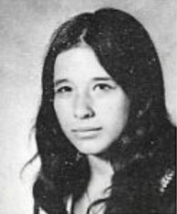
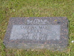
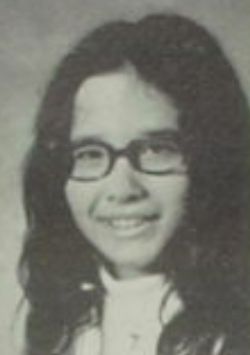
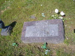
Sabrina Marie Curry
| Birth | : | 15 Oct 1956 Lynwood, Los Angeles County, California, USA |
| Death | : | 20 Jul 1974 Springdale, Washington County, Arkansas, USA |
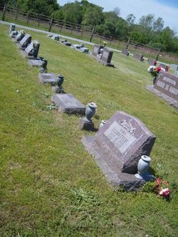
| Burial | : | Parade Cemetery, Deerfield, Rockingham County, USA |
| Coordinate | : | 43.1427536, -71.2268677 |
| Plot | : | Addition:1946;Section:2-G;Plot:3 |
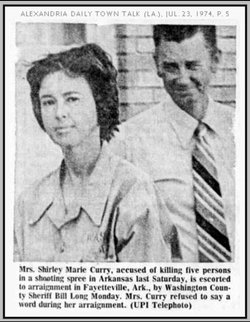
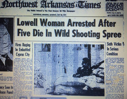
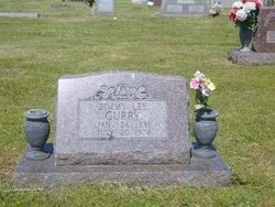
| Description | : | LOWELL WOMAN HELD IN SLAYING OF FIVE By Guy Barnes, News Staff Writer Five area residents were murdered and a sixth was seriously wounded in a series of shootings in Springdale and neighboring communities Friday night. A suspect is in custody. Police identified the dead as Jimmy Lee Curry, 43, and Sabrina Marie Curry, 17, both of 406 Michael St.; Springdale; Jo Ann Brophy, 31, 710 Young St., Springdale; Richard Allen Curry, 14, and Jesse Lee Curry, 10, both of Rt. 1, Lowell. The wounded man is James Robert Dotson, 46, Farmington. Shirley Marie Curry, 37, Rt. 1, Lowell, has been arrested in... Read More |
frequently asked questions (FAQ):
-
Where is Sabrina Marie Curry's memorial?
Sabrina Marie Curry's memorial is located at: Parade Cemetery, Deerfield, Rockingham County, USA.
-
When did Sabrina Marie Curry death?
Sabrina Marie Curry death on 20 Jul 1974 in Springdale, Washington County, Arkansas, USA
-
Where are the coordinates of the Sabrina Marie Curry's memorial?
Latitude: 43.1427536
Longitude: -71.2268677
Family Members:
Parent
Siblings
Flowers:
Nearby Cemetories:
1. Parade Cemetery
Deerfield, Rockingham County, USA
Coordinate: 43.1427536, -71.2268677
2. Morrison Cemetery
Deerfield, Rockingham County, USA
Coordinate: 43.1294790, -71.2366710
3. Old Center Cemetery
Deerfield, Rockingham County, USA
Coordinate: 43.1454580, -71.2505870
4. Hobbs Cemetery
Grafton County, USA
Coordinate: 43.1411110, -71.2016670
5. Tilton Cemetery
Deerfield, Rockingham County, USA
Coordinate: 43.1411830, -71.2011710
6. Freese Cemetery
Deerfield, Rockingham County, USA
Coordinate: 43.1614910, -71.2424310
7. Burbank Cemetery
Deerfield, Rockingham County, USA
Coordinate: 43.1458330, -71.1961110
8. White-Osgood Cemetery
Deerfield, Rockingham County, USA
Coordinate: 43.1654400, -71.2237800
9. Batchelder-Hoag Cemetery
Deerfield, Rockingham County, USA
Coordinate: 43.1652600, -71.2204100
10. Marston Cemetery
Deerfield, Rockingham County, USA
Coordinate: 43.1347220, -71.1963890
11. Cate Road Cemetery
Deerfield, Rockingham County, USA
Coordinate: 43.1391260, -71.1913680
12. Smith Family Cemetery
Deerfield, Rockingham County, USA
Coordinate: 43.1652520, -71.2456230
13. Eastman Cemetery
Deerfield, Rockingham County, USA
Coordinate: 43.1208330, -71.2050000
14. Cram Cemetery
Deerfield, Rockingham County, USA
Coordinate: 43.1280000, -71.2591670
15. Thompson Cemetery
Deerfield, Rockingham County, USA
Coordinate: 43.1669310, -71.2483550
16. Haynes Cemetery
Deerfield, Rockingham County, USA
Coordinate: 43.1411200, -71.2674300
17. Tilton Cemetery
Deerfield, Rockingham County, USA
Coordinate: 43.1541670, -71.1844440
18. Bartlett Cemetery
Nottingham, Rockingham County, USA
Coordinate: 43.1142319, -71.2000041
19. Currier Cemetery
Deerfield, Rockingham County, USA
Coordinate: 43.1311110, -71.2722220
20. Robinson Family Cemetery
Deerfield, Rockingham County, USA
Coordinate: 43.1089500, -71.2420400
21. Rand Cemetery
Deerfield, Rockingham County, USA
Coordinate: 43.1711110, -71.2583330
22. Noyes Cemetery
Deerfield, Rockingham County, USA
Coordinate: 43.1065680, -71.2179172
23. Philbrick Cemetery
Deerfield, Rockingham County, USA
Coordinate: 43.1067480, -71.2424110
24. Ladd Cemetery
Deerfield, Rockingham County, USA
Coordinate: 43.1056020, -71.2437240

