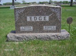
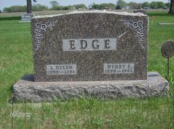
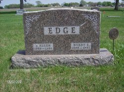
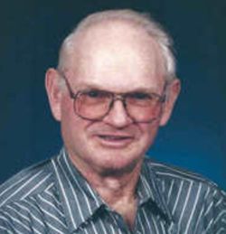
Sadie Helen Cornwell Edge
| Birth | : | 15 Dec 1909 Pocahontas County, Iowa, USA |
| Death | : | 14 Jan 1998 Laurens, Pocahontas County, Iowa, USA |
| Burial | : | Saint Bernard Cemetery, Tariffville, Hartford County, USA |
| Coordinate | : | 41.9084282, -72.7686005 |
| Description | : | Helen Edge, 88, Laurens, died Wednesday, January 14, 1998, at the Good Samaritan Center, Laurens. Services were held at 10:30 a.m. Saturday, at the Hope United Methodist Church, Havelock, with the Rev. Roger Kurtenbach officiating. Burial was at the Washington Cemetery, Havelock. Survivors include sons, Harlan and Robert, both of Havelock; and Richard, Martinsville, MO; and five grandchildren; seven great-grandchildren; and brother, Donald Cornwell, Cresco. She was preceded in death by her parents, Clarence and Estella Hersom Cornwell; husband, Henry in 1987; brother, Chester Cornwell; sister Daphane Ralph; and an infant granddaughter Kimberly Edge. |
frequently asked questions (FAQ):
-
Where is Sadie Helen Cornwell Edge's memorial?
Sadie Helen Cornwell Edge's memorial is located at: Saint Bernard Cemetery, Tariffville, Hartford County, USA.
-
When did Sadie Helen Cornwell Edge death?
Sadie Helen Cornwell Edge death on 14 Jan 1998 in Laurens, Pocahontas County, Iowa, USA
-
Where are the coordinates of the Sadie Helen Cornwell Edge's memorial?
Latitude: 41.9084282
Longitude: -72.7686005
Family Members:
Parent
Spouse
Siblings
Children
Flowers:
Nearby Cemetories:
1. Saint Bernard Cemetery
Tariffville, Hartford County, USA
Coordinate: 41.9084282, -72.7686005
2. Tariffville Cemetery
Tariffville, Hartford County, USA
Coordinate: 41.9079132, -72.7694473
3. Hartford Mutual Society Memorial Park
East Granby, Hartford County, USA
Coordinate: 41.9196815, -72.7742538
4. Beth Hillel Synagogue Memorial Park
East Granby, Hartford County, USA
Coordinate: 41.9218216, -72.7706451
5. Congregation Teferes Israel Memorial Park
East Granby, Hartford County, USA
Coordinate: 41.9217300, -72.7715912
6. Saint Andrew's Episcopal Church Cemetery
Bloomfield, Hartford County, USA
Coordinate: 41.8934593, -72.7584076
7. East Granby Smallpox Cemetery
East Granby, Hartford County, USA
Coordinate: 41.9245000, -72.7491000
8. Holcomb Cemetery
East Granby, Hartford County, USA
Coordinate: 41.9371223, -72.7716751
9. Simsbury United Methodist Church Memorial Garden
Simsbury, Hartford County, USA
Coordinate: 41.8760520, -72.8018120
10. Simsbury Cemetery
Simsbury, Hartford County, USA
Coordinate: 41.8749809, -72.8020782
11. Plank Hill Road Grave
Simsbury, Hartford County, USA
Coordinate: 41.8810640, -72.8134860
12. East Granby Cemetery
East Granby, Hartford County, USA
Coordinate: 41.9416008, -72.7261963
13. First Church of Christ Memorial Garden
Simsbury, Hartford County, USA
Coordinate: 41.8706790, -72.8059490
14. The First Church Memorial Garden
Granby, Hartford County, USA
Coordinate: 41.9538918, -72.7891693
15. East Granby Congregational Church Memorial Garden
East Granby, Hartford County, USA
Coordinate: 41.9434330, -72.7239120
16. Elmwood Cemetery
East Granby, Hartford County, USA
Coordinate: 41.9371986, -72.7146988
17. Granby Cemetery
Granby, Hartford County, USA
Coordinate: 41.9571991, -72.7913971
18. Old Newgate Prison Cemetery
East Granby, Hartford County, USA
Coordinate: 41.9630620, -72.7451570
19. Captain John Viets Cemetery
East Granby, Hartford County, USA
Coordinate: 41.9665909, -72.7455673
20. Saint Josephs Cemetery
Windsor, Hartford County, USA
Coordinate: 41.9136009, -72.6769028
21. Copper Hill Cemetery
East Granby, Hartford County, USA
Coordinate: 41.9766998, -72.7530975
22. West Granby Cemetery
Granby, Hartford County, USA
Coordinate: 41.9535522, -72.8400421
23. Pratt Cemetery
Granby, Hartford County, USA
Coordinate: 41.9710999, -72.8143997
24. Old Poquonock Burying Ground
Windsor, Hartford County, USA
Coordinate: 41.8895950, -72.6741714

