Salley Ann “Lolly” Huntley Baker
| Birth | : | 6 May 1825 Plattsburgh, Clinton County, New York, USA |
| Death | : | 31 Aug 1905 Albion, Boone County, Nebraska, USA |
| Burial | : | Rose Hill Cemetery, Albion, Boone County, USA |
| Coordinate | : | 41.6762000, -98.0003900 |
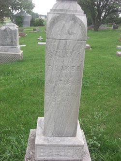
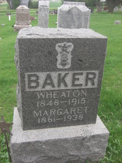
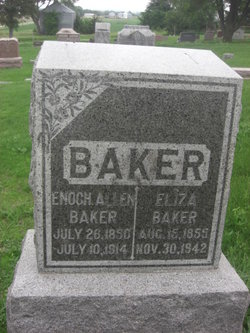
| Description | : | WIFE OF R. BAKER 80 YRS. 4 MS. 25 DS. Bio: Sally Ann Huntley Baker, called Lolly by her intimates was the daughter of the Reverend Joseph Warren Huntley and Deborah Bollis Huntley. Born in 1825 in Plattsburg, New York; she was the eldest of nine children. She married Reuben Baker about 1842. Their children included: Henry Baker (1844- ), Wheaton Baker (1848-1915), Enoch A Baker (1852-1914), Phebe M Baker (1854- ), Maria Baker (1867- ) Lolly lived with her sons Wheaton and Enoch in Albion, Nebraska during her later years. Thanks to contributor #47171394 |
frequently asked questions (FAQ):
-
Where is Salley Ann “Lolly” Huntley Baker's memorial?
Salley Ann “Lolly” Huntley Baker's memorial is located at: Rose Hill Cemetery, Albion, Boone County, USA.
-
When did Salley Ann “Lolly” Huntley Baker death?
Salley Ann “Lolly” Huntley Baker death on 31 Aug 1905 in Albion, Boone County, Nebraska, USA
-
Where are the coordinates of the Salley Ann “Lolly” Huntley Baker's memorial?
Latitude: 41.6762000
Longitude: -98.0003900
Family Members:
Flowers:
Nearby Cemetories:
1. Rose Hill Cemetery
Albion, Boone County, USA
Coordinate: 41.6762000, -98.0003900
2. Saint Michael's Cemetery
Albion, Boone County, USA
Coordinate: 41.6991997, -97.9764023
3. Boone Cemetery
Boone County, USA
Coordinate: 41.6272011, -97.9332962
4. Orford Pioneer Cemetery
Loretto, Boone County, USA
Coordinate: 41.7953000, -98.0864300
5. Dennison Cemetery
Albion, Boone County, USA
Coordinate: 41.7182999, -98.1753006
6. Sunrise Cemetery
Cedar Rapids, Boone County, USA
Coordinate: 41.5760994, -98.1278000
7. Salem Lutheran Cemetery
Woodville Township, Platte County, USA
Coordinate: 41.6525800, -97.8084000
8. Naomi Cemetery
Saint Edward, Boone County, USA
Coordinate: 41.5245200, -97.9907000
9. Saint Edward Catholic Cemetery
Saint Edward, Boone County, USA
Coordinate: 41.5684800, -97.8424800
10. Immanuel Zion South Branch Cemetery
Albion, Boone County, USA
Coordinate: 41.8135000, -97.8906000
11. Evergreen Cemetery
Saint Edward, Boone County, USA
Coordinate: 41.5677986, -97.8411026
12. Sunset Cemetery
Cedar Rapids, Boone County, USA
Coordinate: 41.5611000, -98.1605988
13. Saint Anthony Cemetery
Cedar Rapids, Boone County, USA
Coordinate: 41.5607986, -98.1616974
14. Trinity Cemetery
Newman Grove, Madison County, USA
Coordinate: 41.7574997, -97.8035965
15. Looking Glass Cemetery
Rosenborg, Platte County, USA
Coordinate: 41.6571000, -97.7617000
16. Hope Cemetery
Platte County, USA
Coordinate: 41.7383003, -97.7742004
17. Main Cemetery
Belgrade, Nance County, USA
Coordinate: 41.4947014, -98.0425034
18. Saint Ansgar Cemetery
Rosenborg, Platte County, USA
Coordinate: 41.6334000, -97.7539000
19. Dahlsborg Cemetery
Closter, Boone County, USA
Coordinate: 41.8212300, -97.8360000
20. Dublin Cemetery
Primrose, Boone County, USA
Coordinate: 41.6463000, -98.2529900
21. Saint Marys Catholic Cemetery
Primrose, Boone County, USA
Coordinate: 41.6465900, -98.2532600
22. Skeedee Cemetery
Nance County, USA
Coordinate: 41.5038986, -97.8850021
23. Mount Pleasant Cemetery
Petersburg, Boone County, USA
Coordinate: 41.8568993, -98.0924988
24. Saint Johns Cemetery
Petersburg, Boone County, USA
Coordinate: 41.8581009, -98.0939026


