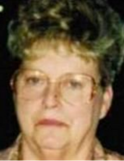
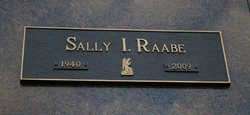
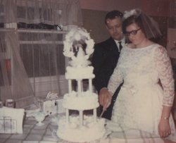
Sally I Mumaugh Raabe
| Birth | : | 4 Feb 1940 Flat Rock, Wayne County, Michigan, USA |
| Death | : | 30 Jun 2009 Lima, Allen County, Ohio, USA |
| Burial | : | Centre Hill Cemetery, Mossburn, Southland District, New Zealand |
| Coordinate | : | -45.6973670, 168.1959000 |
| Description | : | Sally I. Raabe, 69, died at 10:25 a.m. June 30, 2009, at St. Rita's Medical Center, Lima. She was born Feb. 14, 1940, in Lima to Alfred and Florella Groce Mummaugh, who preceded her in death. On April 11, 1959, in Lima she married Kenneth V. Raabe, who died Oct. 10, 2008. Mrs. Raabe worked at Lazarus Department Store for 18 years. She worked at Wal-Mart as CSM manager for eight years. She was a member of St. Charles Borromeo Catholic Church. She had 29 foster babies for a period of five years. Survivors include a son, K. Craig Raabe, of Lima; two... Read More |
frequently asked questions (FAQ):
-
Where is Sally I Mumaugh Raabe's memorial?
Sally I Mumaugh Raabe's memorial is located at: Centre Hill Cemetery, Mossburn, Southland District, New Zealand.
-
When did Sally I Mumaugh Raabe death?
Sally I Mumaugh Raabe death on 30 Jun 2009 in Lima, Allen County, Ohio, USA
-
Where are the coordinates of the Sally I Mumaugh Raabe's memorial?
Latitude: -45.6973670
Longitude: 168.1959000
Family Members:
Parent
Spouse
Siblings
Children
Flowers:
Nearby Cemetories:
1. Centre Hill Cemetery
Mossburn, Southland District, New Zealand
Coordinate: -45.6973670, 168.1959000
2. Lumsden Cemetery
Lumsden, Southland District, New Zealand
Coordinate: -45.7418320, 168.4534090
3. Dipton Cemetery
Dipton, Southland District, New Zealand
Coordinate: -45.8957730, 168.3508000
4. Jollies Graves
Eyre Creek, Southland District, New Zealand
Coordinate: -45.5790700, 168.4913300
5. Wairio Cemetery
Nightcaps, Southland District, New Zealand
Coordinate: -45.9617230, 168.0078750
6. Wreys Bush Cemetery
Wreys Bush, Southland District, New Zealand
Coordinate: -45.9941900, 168.0974500
7. Balfour Cemetery
Balfour, Southland District, New Zealand
Coordinate: -45.8391000, 168.5986640
8. Athol Cemetery
Athol, Southland District, New Zealand
Coordinate: -45.5088440, 168.5772790
9. Lynwood Cemetery
Te Anau, Southland District, New Zealand
Coordinate: -45.4845970, 167.8079240
10. Nokomai Southern Cemetery
Gore District, New Zealand
Coordinate: -45.5533090, 168.6607170
11. Eastern Bush Cemetery
Eastern Bush, Southland District, New Zealand
Coordinate: -45.9822530, 167.7751810
12. Garston Cemetery
Garston, Southland District, New Zealand
Coordinate: -45.4694520, 168.6840050
13. Riversdale Cemetery
Riversdale, Southland District, New Zealand
Coordinate: -45.9180100, 168.7263600
14. Winton Cemetery
Winton, Southland District, New Zealand
Coordinate: -46.1289300, 168.3250400
15. Otautau New Cemetery
Otautau, Southland District, New Zealand
Coordinate: -46.1307300, 168.0066400
16. East Winton Cemetery
Winton, Southland District, New Zealand
Coordinate: -46.1374640, 168.3557030
17. Waikaia Cemetery
Waikaia, Southland District, New Zealand
Coordinate: -45.7169300, 168.8490600
18. Otautau Old Cemetery
Otautau, Southland District, New Zealand
Coordinate: -46.1471300, 167.9940500
19. Calcium Cemetery
Isla Bank, Southland District, New Zealand
Coordinate: -46.2035710, 168.1279070
20. Kingston Cemetery
Kingston, Queenstown-Lakes District, New Zealand
Coordinate: -45.3376030, 168.7252250
21. Forest Hill Cemetery
Southland District, New Zealand
Coordinate: -46.2049720, 168.3969970
22. Tuatapere Cemetery
Tuatapere, Southland District, New Zealand
Coordinate: -46.1089340, 167.6910580
23. Ryal Bush
Ryal Bush, Southland District, New Zealand
Coordinate: -46.2836700, 168.3256000
24. Waikaka Cemetery
Waikaka, Gore District, New Zealand
Coordinate: -45.9312400, 169.0188900

