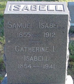
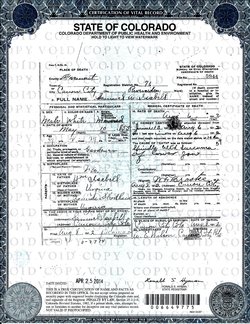
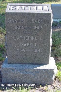
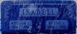
Samuel A Isabell
| Birth | : | May 1855 Boone County, Missouri, USA |
| Death | : | 6 Aug 1912 Canon City, Fremont County, Colorado, USA |
| Burial | : | Friedhof Biberist, Biberist, Bezirk Wasseramt, Switzerland |
| Coordinate | : | 47.1841058, 7.5591500 |
| Plot | : | section 011 block 000 lot 010 grave 00 |
| Description | : | The 1880 census gives his name as Samuel Isabelle, born circa 1856 in Missouri, with both his parents born in Virginia. He was unmarried at that time, a ranch hand in Wet Mountain Valley, Custer Co., Colorado. The 1860 census shows him as 2 years old, so By 1900 he and his wife Catherine had been married 19 years and lived at Canon City, Fremont County, Colorado. The 1900 census gives his name as Samuel A. Isabel, occupation "gardener," his father's birth place as Germany and his mother's as Kentucky. It also gives his wife "Katherine" Isabell's birth date as... Read More |
frequently asked questions (FAQ):
-
Where is Samuel A Isabell's memorial?
Samuel A Isabell's memorial is located at: Friedhof Biberist, Biberist, Bezirk Wasseramt, Switzerland.
-
When did Samuel A Isabell death?
Samuel A Isabell death on 6 Aug 1912 in Canon City, Fremont County, Colorado, USA
-
Where are the coordinates of the Samuel A Isabell's memorial?
Latitude: 47.1841058
Longitude: 7.5591500
Family Members:
Parent
Spouse
Siblings
Children
Flowers:
Nearby Cemetories:
1. Friedhof Biberist
Biberist, Bezirk Wasseramt, Switzerland
Coordinate: 47.1841058, 7.5591500
2. Friedhof Gerlafingen
Gerlafingen, Bezirk Wasseramt, Switzerland
Coordinate: 47.1721956, 7.5748746
3. Gemeindefriedhof Derendingen
Derendingen, Bezirk Wasseramt, Switzerland
Coordinate: 47.1963030, 7.5875510
4. Gemeindefriedhof Kriegstetten
Kriegstetten, Bezirk Wasseramt, Switzerland
Coordinate: 47.1764700, 7.5985800
5. Friedhof St. Katharinen in Solothurn
Solothurn, Bezirk Solothurn, Switzerland
Coordinate: 47.2187212, 7.5459221
6. Friedhof St.Niklaus
Feldbrunnen, Bezirk Lebern, Switzerland
Coordinate: 47.2209648, 7.5439568
7. Gemeindefriedhof Deitingen SO
Deitingen, Bezirk Wasseramt, Switzerland
Coordinate: 47.2107720, 7.6192680
8. Friedhof Selzach
Selzach, Bezirk Lebern, Switzerland
Coordinate: 47.2069805, 7.4578557
9. Friedhof Seeberg
Seeberg, Verwaltungskreis Oberaargau, Switzerland
Coordinate: 47.1587959, 7.6703613
10. Friedhof Wangen an der Aare
Wangen an der Aare, Verwaltungskreis Oberaargau, Switzerland
Coordinate: 47.2352419, 7.6585167
11. Friedhof Wiedlisbach
Wiedlisbach, Verwaltungskreis Oberaargau, Switzerland
Coordinate: 47.2488811, 7.6414128
12. Friedhof Welschenrohr
Welschenrohr, Bezirk Thal, Switzerland
Coordinate: 47.2826744, 7.5296148
13. Friedhof Herzogenbuchsee
Herzogenbuchsee, Verwaltungskreis Oberaargau, Switzerland
Coordinate: 47.1942000, 7.7102000
14. Friedhof Oberbipp
Oberbipp, Verwaltungskreis Oberaargau, Switzerland
Coordinate: 47.2633610, 7.6605863
15. Friedhof Wynigen
Wynigen, Verwaltungskreis Emmental, Switzerland
Coordinate: 47.1048300, 7.6666800
16. Friedhof Thörigen
Thörigen, Verwaltungskreis Oberaargau, Switzerland
Coordinate: 47.1701665, 7.7231642
17. Friedhof Oschwand
Oschwand, Verwaltungskreis Oberaargau, Switzerland
Coordinate: 47.1416000, 7.7134200
18. Friedhof Neuhaus und Oschwand
Ochlenberg, Verwaltungskreis Oberaargau, Switzerland
Coordinate: 47.1415500, 7.7135000
19. Friedhof Grenchen
Grenchen, Bezirk Lebern, Switzerland
Coordinate: 47.1919012, 7.3841961
20. Friedhof Niederbipp
Niederbipp, Verwaltungskreis Oberaargau, Switzerland
Coordinate: 47.2654200, 7.6918410
21. Friedhof Bannwil
Bannwil, Verwaltungskreis Oberaargau, Switzerland
Coordinate: 47.2372302, 7.7318282
22. Friedhof Thunstetten
Thunstetten, Verwaltungskreis Oberaargau, Switzerland
Coordinate: 47.2039799, 7.7527511
23. Friedhof Burgdorf
Burgdorf, Verwaltungskreis Emmental, Switzerland
Coordinate: 47.0550300, 7.6117800
24. Friedhof Bleienbach
Bleienbach, Verwaltungskreis Oberaargau, Switzerland
Coordinate: 47.1843989, 7.7594101


